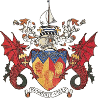
Preseli Pembrokeshire
Coordinates: 51°56′28″N 4°57′40″W / 51.941°N 4.961°W
| Preseli Pembrokeshire Welsh: Preseli Sir Benfro | |
|---|---|
 | |
| History | |
| • Created | 1974 |
| • Abolished | 1996 |
| • Succeeded by | Pembrokeshire |
| Status | District |
| • HQ | Haverfordwest |
 | |
Preseli Pembrokeshire (Welsh: Preseli Sir Benfro) was one of six local government districts of Dyfed in West Wales from 1974 to 1996. Until 1987 the name of the district was Preseli. The district took its name from the Preseli Hills.
It was formed by the Local Government Act 1972 on April 1, 1974 from the northern part of the administrative county of Pembrokeshire - specifically, the municipal borough of Haverfordwest, the urban districts of Fishguard and Goodwick, Milford Haven and Neyland, and the rural districts of Cemaes and Haverfordwest. In 1981, a further 11 communities were transferred from South Pembrokeshire district.
On April 1, 1996 the district was abolished by the Local Government (Wales) Act 1994 and merged into a reconstituted county of Pembrokeshire.
See also
- Preseli Hills
- Preseli Pembrokeshire (UK Parliament constituency)
- Preseli Pembrokeshire (National Assembly for Wales constituency)
- Preseli District Council election, 1983