Q'aysiri
| Q'aysiri | |
|---|---|
 Q'aysiri Location in Bolivia | |
| Highest point | |
| Elevation | 4,700 m (15,400 ft) [1] |
| Coordinates | 18°03′20″S 68°23′03″W / 18.05556°S 68.38417°WCoordinates: 18°03′20″S 68°23′03″W / 18.05556°S 68.38417°W |
| Geography | |
| Location | Bolivia, Oruro Department, Sajama Province |
| Parent range | Andes |
Q'aysiri (Aymara q'aysa a kind of potato,[2] -(i)ri a suffix, also spelled Caysiri) is a mountain in the Andes of Bolivia, about 4,700-metre (15,420 ft) high. It is situated in the Oruro Department, Sajama Province, at the border of the Curahuara de Carangas Municipality and the Turco Municipality. Q'aysiri lies north-east of the mountain Chilli Qhata.[1][3]
References
- 1 2 BIGM map 1:50,000 Estancia Marcarani 5939-IV
- ↑ "Diccionario Bilingüe, Castellano - Aymara, 2002". Félix Layme Pairumani. Retrieved November 10, 2014. (see: Papa, variedad alargada, de color blanco y morado y de tamaño regular)
- ↑ "Turco". Archived from the original on March 3, 2016. Retrieved November 10, 2014.
Capital: Oruro | ||
| Provinces | 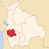 | |
| Municipalities (and seats) |
| |
This article is issued from Wikipedia - version of the 7/21/2016. The text is available under the Creative Commons Attribution/Share Alike but additional terms may apply for the media files.