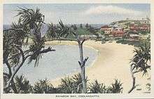
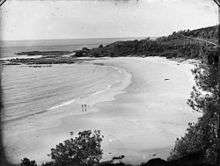
Rainbow Bay


Rainbow Bay is a bay, beach and locality at the southern end of Coolangatta within the City of Gold Coast, Queensland, Australia.[1][2][3]
History

The bay was originally but unofficially known as Shark/Sharks Bay. In 1925, the Point Danger Progress Association requested the Coolangatta Town Council to change the name to Rainbow Bay, which the council approved at its meeting on 31 May 1925. It is believed that this was the name originally given to the bay by Captain Henry John Rous, who surveyed the Point Danger area in 1828 in the HMS Rainbow, a sixth-rate frigate.[1][4][5] In August 1925, the council erected directional signs to Rainbow Bay.[6] Rainbow Bay is one of the most popular beaches on the Gold Coast. The beach attracts surfers going to nearby Snapper Rocks and Greenmount because of the spectacular waves, as the beach is included as part of the Superbank. The beach is also popular with families who flock to the sheltered beach because of the safety and lack of rips.
Amenities
Rainbow Bay is home to Rainbow Bay Surf Lifesaving Club near Snapper Rocks.
See also
References
- 1 2 "Rainbow Bay (entry 27920)". Queensland Place Names. Queensland Government. Retrieved 14 January 2014.
- ↑ "Rainbow Bay Beach (entry 47767)". Queensland Place Names. Queensland Government. Retrieved 14 January 2014.
- ↑ "Rainbow Bay (entry 27921)". Queensland Place Names. Queensland Government. Retrieved 14 January 2014.
- ↑ "COUNTRY NEW[?].". The Sydney Morning Herald. National Library of Australia. 23 May 1925. p. 16. Retrieved 14 January 2014.
- ↑ "COUNCIL MEETINGS.". The Brisbane Courier. National Library of Australia. 2 June 1925. p. 14. Retrieved 14 January 2014.
- ↑ "COOLANGATTA AND TWEED HEADS.". The Brisbane Courier. National Library of Australia. 13 August 1925. p. 12. Retrieved 14 January 2014.
External links
- "Rainbow Bay". Sophie Carter.
- "Rainbow Bay History". Travelpromote.com.au Pty Ltd.
Coordinates: 28°09′46″S 153°32′49″E / 28.1628°S 153.547°E