Reitwein
| Reitwein | |
|---|---|
 Reitwein | |
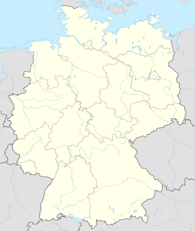
Location of Reitwein within Märkisch-Oderland district  | |
| Coordinates: 52°30′00″N 14°34′59″E / 52.50000°N 14.58306°ECoordinates: 52°30′00″N 14°34′59″E / 52.50000°N 14.58306°E | |
| Country | Germany |
| State | Brandenburg |
| District | Märkisch-Oderland |
| Municipal assoc. | Lebus |
| Government | |
| • Mayor | Karl Friedrich Tietz |
| Area | |
| • Total | 23.80 km2 (9.19 sq mi) |
| Population (2015-12-31)[1] | |
| • Total | 463 |
| • Density | 19/km2 (50/sq mi) |
| Time zone | CET/CEST (UTC+1/+2) |
| Postal codes | 15328 |
| Dialling codes | 033601 |
| Vehicle registration | MOL |
Reitwein is a municipality in the district Märkisch-Oderland, in Brandenburg, Germany.[2] It is located near the border with Poland.
Demography
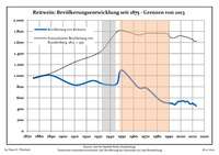
Development of population since 1875 within the current boundaries (Blue line: Population; Dotted line: Comparison to population development of Brandenburg state; Grey background: Time of Nazi rule; Red background: Time of communist rule)
|
|
|
|
References
- ↑ "Bevölkerung im Land Brandenburg nach amtsfreien Gemeinden, Ämtern und Gemeinden 31. Dezember 2015 (Fortgeschriebene amtliche Einwohnerzahlen auf Grundlage des Zensus 2011)". Amt für Statistik Berlin-Brandenburg (in German). 2016.
- ↑ Mapa Polski 1:500 000 Wojskowy Instytut Geograficzny Sztabu Generalnego W.P., Warszawa 1947
- ↑ Detailed data sources are to be found in the Wikimedia Commons.Population Projection Brandenburg at Wikimedia Commons
External links
![]() Media related to Reitwein at Wikimedia Commons
Media related to Reitwein at Wikimedia Commons
This article is issued from Wikipedia - version of the 7/17/2015. The text is available under the Creative Commons Attribution/Share Alike but additional terms may apply for the media files.