Ribble Link
| The Millennium Ribble Link | |
|---|---|
|
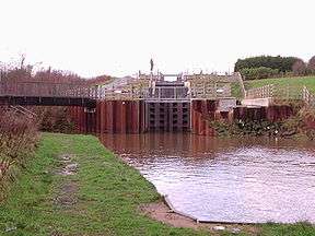
The 3-rise staircase locks | |
| Specifications | |
| Maximum boat length | 62 ft 0 in (18.90 m) |
| Maximum boat beam | 10 ft 6 in (3.20 m) |
| Locks |
8 (1 tidal gate) |
| Status | Navigable at certain times April–October |
| Navigation authority | Canal & River Trust |
| History | |
| Original owner | The Ribble Link Construction and Operation Limited/The Waterways Trust |
| Principal engineer | Gleeson |
| Other engineer(s) | Arup Water |
| Date completed | 2002 |
| Geography | |
| Start point | Lancaster Canal, Ingol, Preston |
| End point | River Ribble |
The Millennium Ribble Link is a Linear Water Park and new navigation which links the once-isolated Lancaster Canal in Lancashire, England to the River Ribble. It was opened in July 2002.
"The Recipient shall ensure that the participation of the (Millennium) Commission is publicised in all public statements or announcements, and in all promotional activity concerning the Project in accordance with guidelines prescribed by the Commission".[1]
History
The marshland of the River Ribble and the Savick Brook were natural obstacles preventing easy access north-west of Preston. Before the private toll road and modern roads A583/A584 were built crossing the marsh and the brook would have been much further inland, north-east of the present crossing and supportive evidence is this may have been at what is now the footbridge at Lea Golf Course. On the first 1840 Ordnance map this is called Wads Bridge but more importantly also shows a ford. This route also leads south to St Catherines Well on Lea Marsh, suggesting a route of pilgrimage and antiquity. The route north avoiding the marsh and toll road leads to the now much quieter lanes leading to the village of Clifton, which was at one time the main thoroughfare to Kirkham and the west.
Before canalisation the Savick Brook was a shallow meandering watercourse and transversing the brook was much easier in several places, formal by bridges and informal where it could simply be waded across. The Savick Brook with its fresh water and considerable fish population was an important local resource, in history and more recently into the 20th Century.
The Savick Brook, perhaps originally spelt Savock separated the local parish of Lea which after Domesday (1086) was separated as Norman or French Lea to the south while English Lea was to the north.
The Savick Brook has drained the hinterland for some considerable distance, being one of many brooks and streams that drains down from the foothills of the Pennines. Indeed a new private toll road across the marsh was built with the toll being paid at Lea Gate, hence its name.[2] This is now the Ribble Link bridge under the A583 Blackpool Road. No charge is now levied.
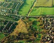
The Savick Brook by its very nature has altered course over every year and over millennia due to the structure of the land and flooded into the adjoining field systems, as a floodplain.
As part of the construction of the Ribble Link, an archeological evaluation took place to establish whether any important archeological sites would be disturbed by the new waterway.
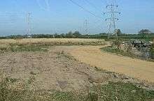
The evaluation found signs that there could have been an old mill at Lock 8 and evidence of a ridge and furrow field system and likely to be disturbed in part by the construction. Once gain local people refer to this field as 'the Mill Field'. This is what the evaluation said about the area:
The preliminary assessment of the archaeological potential along the line of the Ribble Link Navigation identified Mill Field as an area in which significant features, essentially a water mill, may have been located. The evaluation established that the field contained the abraded remains of a ridge and furrow field system. This feature partially survived as indistinct, but identifiable, earthworks covering the centre of the field. The remains of furrows found within the excavation trenches indicated that the field system originally covered a greater area. The evaluation indicated that the construction of the navigation should not conflict with the area in which the ridge and furrow survived as earthworks. However, the area where the field system was known to survive only as subsurface features would be affected by the excavations for the navigations. It may be possible to locate the eastern and western boundary ditches to the field system, if they exist, during the construction work.[3][4]
Severe flooding of the Millennium Ribble Link took place in 2003/2004 causing severe sedimentation to the channel and scour to by-wash weirs resulting in the Ribble Link becoming un-navigable. There was limited water supply due to major works on the Lancaster Canal. Ironically the site was subjected to severe flooding during remedial works. Remedial costs were £124,576.00.[5]
The Ribble Link was closed again in 2006 after £600,000 was spent on dredging and 'repairs'.[6]
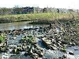
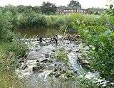
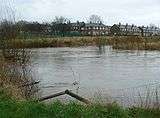
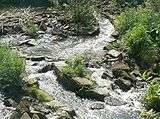
The Savick Brook was known to be tidal as far as Haslam Park, what is now the bottom of the 3 lock staircase.
As with all brooks entering the salt water sea, it was a breeding ground for flatfish. Other migratory fish are known to have used the Savick Brook to reach their spawning grounds.
The Millennium Ribble Link was built with locks and straightened leaving the original meanders of the Savick Brook, but only by constructing over-flow weirs at each lock allowing water to continue to flow through the Savick Brook. Fish passes were built into these weirs to allow fish passage.
Course
Ribble Link | |||||||||||||||||||||||||||||||||||||||||||||||||||||||||||||||||||||||||||||||||||||||||||||||||||||||||||||||||||||||||||||||||||||||||||||||||||||||||||||||||||||||||||||||||||
|---|---|---|---|---|---|---|---|---|---|---|---|---|---|---|---|---|---|---|---|---|---|---|---|---|---|---|---|---|---|---|---|---|---|---|---|---|---|---|---|---|---|---|---|---|---|---|---|---|---|---|---|---|---|---|---|---|---|---|---|---|---|---|---|---|---|---|---|---|---|---|---|---|---|---|---|---|---|---|---|---|---|---|---|---|---|---|---|---|---|---|---|---|---|---|---|---|---|---|---|---|---|---|---|---|---|---|---|---|---|---|---|---|---|---|---|---|---|---|---|---|---|---|---|---|---|---|---|---|---|---|---|---|---|---|---|---|---|---|---|---|---|---|---|---|---|---|---|---|---|---|---|---|---|---|---|---|---|---|---|---|---|---|---|---|---|---|---|---|---|---|---|---|---|---|---|---|---|---|---|
Legend
| |||||||||||||||||||||||||||||||||||||||||||||||||||||||||||||||||||||||||||||||||||||||||||||||||||||||||||||||||||||||||||||||||||||||||||||||||||||||||||||||||||||||||||||||||||
The Millennium Ribble Link includes what was Great Britain's first inland waterway to be constructed in nearly 100 years when it was opened in July 2002, and was the first to be built for leisure purposes only, not commercial use. It is a navigation – it is not a canal as boats can only travel in one direction on alternate days, The 4-mile (6.4 km) link connects the once-isolated Lancaster Canal to the River Ribble. From the Ribble it is possible to reach the main navigable system via the River Douglas and the Leeds and Liverpool Canal's Rufford Branch subject to tides and weather conditions.[7]
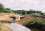
From the north; the Northern end of the Millennium Ribble Link is a holding basin adjacent and connected to the Lancaster Canal. This is the start of the sculpture trail. This is followed by a 3 lock staircase and a 'turning circle' at the bottom, the Savick Brook enters from the east. To the south of this is the fine Victorian Haslam Park and well worth a visit if travelling by foot. A pedestrian footpath and cycle path is clearly marked. The link itself turns west following the line of the original Savick Brook.
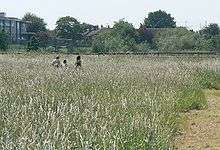
Passing under Tom Benson Way, and immediately under the local railway line bridge the Ribble Link comes to Lock 4 with a weir. The sculpture 'Fire' by Thompson Dagnall is found here. From Lock 4 to Lock 5, complete with weir, to the north is a quiet public park, again worth visiting on foot or bicycle. Between Locks 4 and 5, to the south is the 'hay meadow' part of the Ribble Link Development, identified as 'national significance'. Public access is approved and welcomed.
Lock 5 is separated from the meander of the Savick Brook by an island created by the line of the new canal and the Savick Brook joins again just after leaving Lock 5. The sculpture 'Air' by Thompson Dagnall is found above and to the south of Lock 5.
Passing under Lea Road the Ribble Link enters the flood plain of semi urban area with agricultural fields on either side. This leads to Lock 6, with weir and then under Tudor Avenue bridge. On the left is the local city soccer team's training ground, Preston North End Football Club. On the right is Ashton and Lea Golf Club. Then passing under a footbridge, possibly of ancient origin, Lock 7 and weir appears. Again separated from the meander of the Savick Brook the Ribble Link passes through agricultural fields, under Goodier Bridge to the Holding Basin at Lock 8. Floating pontoons are available for mooring.
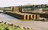
After Lock 8 the navigation becomes tidal. There is Savick Brook Pumping Station on the left[8] followed by a copse of semi-ancient woodland and a Biological Heritage Site reedbed at Savick Bridge, which is the main A583 road. The sculpture 'Rook' by Thompson Dagnall can be seen perched on the north bank. It is also visible if travelling by car along the A583.
Down to the rotating sealock at Lock 9 and into the River Ribble and turning west on to the River Douglas and beyond. From the south, reverse the description.
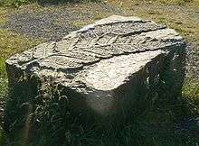
From the outset the project was to be far more than 'just a canal', it included the provision of a) community boat b) outdoor classroom c) visitor seating d) footbridge downstream of lock 7 & wetland scrape for birds e) public access and enjoyment f) natural habitat creation and enhancement and; Improve access to the canal and enhance the visitor experience[1] and provide an increase in economic benefits to the local community.[9] As a consequence the scheme includes a 'sculpture trail' along the length of the Millennium Ribble Link.
The Millennium Ribble Link is only open for approximately 90 days out of 365; approximately 200 boats a year have used the Ribble Link since its opening.[10]
Cost and funding
The Millennium Ribble Link was built to celebrate the Millennium (the year 2000), and cost £6.54 million, of which just over £3 million was a grant from the Millennium Commission.[11] The remaining £3.54 million was mainly from public funds.
Originally estimated at £3.7 million[12] the total construction costs increased on a regular basis to £5.6 million (£5,595,138 on 10 August 2000 to be precise)[13] and finally overspent by an additional £1.1 million (British Waterways contributed £510,000 towards that over spend).[14] Originally £850,000 was set aside, primarily from Lancashire Waste Services Limited landfill tax credits for 125 years of maintenance. All of The Waterways Trust maintenance budget was used to fund the original over-spend and the period of maintenance reduced to 40 years.
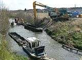
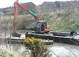
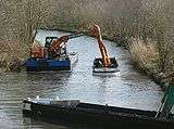
British Waterways have spent over £2.1million on maintenance and keeping the navigation open in the first five years of operation. Over £600,000 was spent on winter maintenance and dredging in 2006.[6]
Annual dredging is required to keep the Millennium Ribble Link navigable.
Following its success BW will be reapplying for further licences to carry out annual ‘cutter suction’ dredging to remove the build-up of silt that is brought into the Ribble Link throughout the course of a normal boating season.[6]
The Annual Report and Accounts of The Waterways Trust show a maintenance expenditure on the Ribble Link of £22,200 in 2005/6 from an income of £3,186,521 and £29,000 in 2006/7 from an income of £4,235,471.[15]
The Millennium Ribble Link is only open for approximately 90 days out of 365, therefore closed for 270 days. Approximately 200 boats a year have used the Ribble Link since its opening. It was closed in 2003/4 and 2006/7 for dredging, repairs and maintenance.
The cost of annual dredging, a well known problem, closed Preston Docks in October 1981.[16]
Background


The Savick Brook/Ribble Link is situated in an area subject to a high flood risk according to the Environment Agency. There is also a flood risk further upstream of the Savick Brook east of the A6 main road at Fulwood, Preston.[17] This appear to be supported as the Ribble Link was closed in 2003/4 and 2006/7 for 'maintenance and repairs' after flooding.[5][6]
Preston City Council has a specific policy on flooding which states "It is important that there must be no increase in rates of surface run-off to both the Savick Brook and Sharoe Brook catchments, because this could result in localised flooding further downstream. The Environment Agency has stressed the importance of ensuring that run-off from the industrial sites at Red Scar must not exceed levels to prevent the risk of flooding elsewhere" i.e. Savick Brook/Ribble Link indicative of the high flood risk to the Millennium Ribble Link.[18]
The Millennium Ribble Link is also subject to a number of local planning conditions and identified in the adopted local plan as a 'wildlife corridor'.[19]
Both the River Ribble and Savick Brook/Ribble Link are subject to outfall from a number of sources, one being the nuclear facility at Springfield nearby. The University of Portsmouth established the Ribble estuary has often failed its Environmental Quality Standards (EQS) values for a number of metals and certain organic and organo-metallic compounds (e.g. TBT). Presently, monitoring is conducted monthly by the Environment Agency.[20] A public version of 'Radiological Habits Survey 2006' supported by the Environment Agency, Food Standards Agency and Health and Executive is available which included 'recreational activities', i.e. The Millennium Ribble Link, in the vicinity of Springfield Fuels Limited, Westinghouse site near Preston Lancashire.[21]
When originally planned, the Lancaster Canal would have crossed the River Lune and the River Ribble on aqueducts, and it was intended that there should be a link to the Leeds and Liverpool Canal near Chorley. The Lune aqueduct was built, but the Ribble one was not, as the construction was well over budget by the time the canal reached Preston. The canal link was eventually replaced by a tramway link, crossing the Ribble on a timber bridge. The bridge outlasted the tramway, and it was not until the 1960s that it was demolished and replaced by a new pedestrian bridge, made of concrete beams but designed to look like the old timber structure. The Lancaster Canal remained isolated from the rest of the English Canal network.[22]
The idea of building a connecting link along the Savick Brook was first proposed in 1979 by John Whittaker of the Lancaster Canal Boat Club. The Ribble Link Trust was set up in 1984, in order to promote the idea, and a series of annual cruises were held, starting at Tarleton on the Leeds and Liverpool Rufford Branch, passing down the River Douglas, up the River Ribble and ending at Preston Dock. These cruises raised awareness of the proposed link, and also demonstrated that canal boats could navigate on this section of tidal water without difficulty.[22]
The original route for the scheme utilised the Sharoe Brook and Haslam Park, but there were considerable difficulties with land ownership and permissions. These remained a permanent problem. In 2007, five years after opening, the leases had still not been completed.[23] The junction with the Lancaster Canal required a flight of locks in a tight location, and it was originally intended to have one lock to the south of the Brook, which would then be crossed by an aqueduct leading to a 2-rise staircase. This configuration was replaced by a 3-rise staircase, with a turning basin to enable boats to negotiate the extremely sharp left hand turn at the bottom of the flight. Because of the tidal nature of the Savick Brook, it was decided at the early stages of planning that the link would be designed for one way operation.
There were constant delays and frustrations, while costs escalated. The project was further complicated as in 2000 "British Waterways are constrained by their statutory responsibilities from taking on additional liabilities or spending money on Waterways not within their current responsibilities. British Waterways must be able to satisfy the Department of Environment Transport and Regions that any involvement is within this principle. The Waterways Trust is a new organisation and currently doesn't have either the funds or track record to make absolute commitments".[24] There was considerable concern that the project would not proceed and the Millennium Commission Funding would be lost.[25] The original contractors were replaced under much angst and debate over fees.[26]
The contract for the construction was awarded to the civil engineers Gleeson in November 2000, with Arup Water responsible for the detailed design. A partnership between British Waterways, Lancashire County Council, the Ribble Link Trust and The Waterways Trust were responsible for the management of the scheme.[22] A separate company The Ribble Link Construction and Operation Limited was set up.
More than 'just a canal'[27]
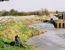
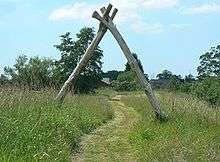
The Millennium Commission agreed to fund the Millennium Ribble Link as a community project for a Linear Water Park that included "such things as landscaping, artworks, heritage interpretation, foot and cycle paths, habitat creation and nature areas... something millennial and not just 5 miles of canal".[27]
Funding of £75,000 secured from the Millennium Commission for a community boat for the Millennium Ribble Link for use by the local community for educational purposes[29] enabled the purchase of a tip boat, which was taken to the Nantwich Canal Centre for refurbishment and to be made accessible for wheelchairs. She was renamed ‘Millennium Swiftsure’, a name derived from a 19th-century packet boat, part of the original passenger carrying service that ran on the Lancaster Canal for many years after the introduction of trains. The Millennium Swiftsure[30] was subsequently never used on the Millennium Ribble Link and moved to Lancaster to be used as a water taxi.[31][32]
Throughout the development 'Angling' was seen and promoted as a beneficiary of the scheme, as fishing had been a traditional pastime on the Savick Brook. The Millennium Ribble Link is one of the very few water courses in the UK where Fishing is not allowed. British Waterways do not allow angling on the Millennium Ribble Link.[28]
LWS Lancashire Environmental Fund – "the contribution (£250,000) is intended to support wider public amenity elements of the proposal, such as public access and enhanced natural habitats." ... "acknowledge the support of the Fund (using the full title "LWS Lancashire Environmental Fund' in any ... appropriate materials"[33]
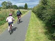
The Millennium Commission contributed £3,300 for Visitor Seating for enhancement and enjoyment, commissioned from recycled materials and installed in 2007.[34] Lancashire County Council contributed £80,000 to tarmac the cycle route along part of the Millennium Ribble Link, from Tudor Avenue to the Lancaster Canal and connect with the national cycle network.[35]

An important piece of land, a traditional hay meadow, adjoining the Savick Brook either side of Savick Way, between Locks 4 and 5, was identified as MG4 classification of 'national, county and local significance'.[36]
The Millennium Commission provided a £30,000[37] grant for public enjoyment and enhancement of the hay meadow.
"The (Millennium) Commission is to be satisfied in all respects regarding the operation and future maintenance of the hay meadow element of the Enhancement Project. A deed of dedication is to be provided by Preston Borough Council to the Commission's satisfaction prior to the release of any Enhancement Project Grant". .[37]
British Waterways used the £30,000 grant to replace the perimeter fencing with a new 'recycled material' fence.[38] Repairs, required where dredging vehicles access was required have been made using traditional wood.
A public Right of way, Footpath 70 from Lea Road, adjacent to the Ribble Link across the hay meadow and at one time under the railway line but was terminated west of the Railway Line when Tom Benson Way was constructed and the tunnel enclosed.[39]
Originally an outdoor school classroom was part of the development and located along the Millennium Ribble Link, incorporating the hay meadow. This was subsequently amended to be included inside the grounds of the local primary school by moving the perimeter fence. "The creation of the Link was not only for the sole purpose of the boating community, it was also created to add additional dimensions to meet the aspirations of the local community."
The outdoor classroom at Ashton Primary School features three carved wooden benches and an information board telling pupils about wildlife on the canal.
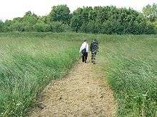
The hay meadow created nearby will provide a haven for wildflowers and insects.[40]
Visiting
The Ribble Millennium Link is underneath the flight path of Warton Aerodrome and one may see civilian and military aircraft passing overhead. It can be quite noisy at times.
The Banded Demoiselle, one of the largest and most colourful of the damselflies, has long been known from the Cuerden Valley Park. For many years this was thought to be its only Lancashire locality. However, during the late 1990s a considerable expansion of its range took place. The insect reached Savick Brook, west of Preston, in 1997 and, by 1999, was well established there. In 1998, it was recorded on the Lancaster Canal north of Preston and also on the Leeds-Liverpool canal at Withnell Fold.[41]
Annual dredging of the Ribble Link may affect these insects.
The Millennium Ribble Link has much to see and enjoy, including flora and fauna including many different butterflies.
Construction
Ground clearance began in February and March 2001, with the intention of constructing the lower end of the navigation first, but the outbreak of Foot-and-mouth disease in May 2001 resulted in all of the surrounding agricultural land being closed for access, and there was no option but to start at the top. Work began on lock 5 first, followed by lock 4. Both were built on dry ground between the sides of a meander. The design involved driving four rows of interlocking steel piles into the ground, using a vibrating pile driver to minimise the noise nuisance which is normally associated with hammer action pile driving. The inner two rows would form the lock walls, while the outer two were tied to them by steel tie rods to provide anchorage. Earth was then excavated from between the inner pair to form the lock chamber. Construction of the staircase began soon afterwards, which was the first staircase ever built by machine, and getting the profile of the piles correct required new skills which were developed on the project. The Foot-and-mouth restrictions were lifted in July 2001, and work on the lower section could start.[22]
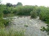
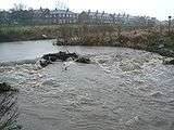
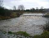
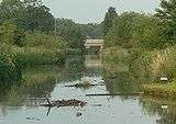
In August 2001, there was some concern about a number of tight bends, and trials with a 70-foot (21 m) measuring rod resulted in some of them having to be re-aligned. The navigation had been designed with massive weirs near all the locks, to cope with a 1 in 50 year flood level, but before they were constructed, prolonged heavy rain in late August resulted in extensive flooding, causing significant damage to the newly built banks, which were washed into the channel. A second flood occurred in mid-September, and a third on 8 October, all of which resulted in work having to be re-done. Lock 6 was the only lock which had to be built on the line of the Brook, and so the water had to be diverted around the site in pipes while the initial piling was completed.[22]
The lock gates were built at the Northwich works of British Waterways, and the first pair to be fitted were the upper gates of lock 5, in late October 2001. By the end of the year, the intermediate gates of the staircase had been fitted, as had those on lock 4, and work on a coffer dam around the site of the tidal gate had been started. In January, work started on the construction of an elevated pedestrian walkway through the railway bridge below the staircase, but on 28 January, much of the lower end of the site was flooded by an exceptional high tide, although little damage was caused. Access to the golf club required a new bridge to be installed, and a tube consisting of pre-shaped corrugated steel panels was built on the bank and then lowered by crane into the channel.
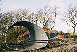
The technique had first been used at Moderna on the Rochdale Canal, although in this case the panels were made in Italy, as no British mills could produce such radiused panels.
The bridge to carry the Lancaster Canal towpath over the connection basin entrance at the top of the canal arrived on site from the Netherlands on 26 March, but the delivery lorry could not get close enough to the site, and so it was not fitted until 3 April. Further flooding of the lower section occurred on 29 April as a result of heavy rain and a high spring tide, again resulting in significant damage to the works.[22]
June 2002 saw the coffer dam removed from around the rotating sector gate, and also saw the first vessel on the waterway, when a British Waterways maintenance boat passed from the Lancaster Canal into the connection basin above the staircase locks. A number of boats traversed the navigation in July 2002, in order to assist with the commissioning of the locks and the methods of working. The boats were all owned by members of the Ribble Link Trust, who made their way from Preston Docks to the Lancaster Canal. Problems with the hydraulic swing bridge at the exit from the docks resulted in the boats leaving two hours later than expected, but a very high tide ensured that all the boats managed to pass through the sector gate before water levels dropped. The official opening took place on 20 September 2002, when the Rt. Hon. Margaret Beckett, who was at the time Secretary of State for the Environment, Food and Rural Affairs, declared the navigation open.[22]
The Ribble Link was closed during 2006 with British Waterways citing that the appearance of voids meant that the last section was too dangerous to operate for both their own staff and boaters.[42] After dredging and infilling behind lock chambers during the winter of 2006-7, the link was re-opened on 6 April 2007.
Operation
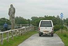
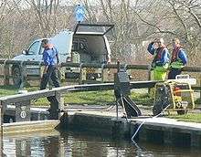
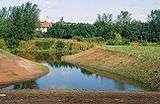
The Millennium Ribble Link runs at the north west of the city of Preston along a canalisation of the Savick Brook, which was tidal along its length to the 3 lock staircase but now limited to its lower reaches. The channel has been straightened and widened to allow navigation by boats with a maximum beam of 10.5 feet (3.2 m). One bank of the brook has been left with reed edges, to minimise the disturbance to wildlife, and artificial sand cliffs have been established where those used by nesting sand martins had to be removed as part of the engineering works. In addition to use by boats, a primary aim of the project was to create a feature which could be enjoyed and used by walkers, cyclists and fishermen*(See comment above, fishing is not allowed on the Millennium Ribble Link).[28] To add interest to such use, an arts sculpture trail has been created running the length of the development with a number of sculptures on view. Adjacent to the Lancaster Canal one which is entitled "Gauging the Ripple", commissioned from the artist Thompson Dagnall.[7] 'Gauging the Ripple' suffered structural integrity loss and had to be removed.
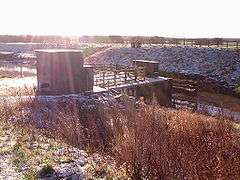
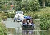
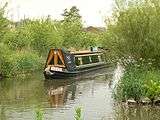
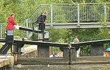
The link is seasonal for those boats wanting to travel its length, and is normally open between April and mid-October. Even then it is only available on limited days, approx 90 days in total during this period, subject to weather conditions. Passage along it must be booked in advance by contacting British Waterways, and it is operated in alternate directions on successive days. The sea lock at the Ribble end and the triple staircase at the Lancaster Canal end are manned by British Waterways staff, whereas the rest of the locks are unmanned and are operated by boat crews.[7]
There is no charge to use the Millennium Ribble Link if you have a full boat licence. Pleasure craft on hire are charged £60 per passage (each way). A Millennium Ribble Link Skippers Guide is available from British Waterways and is normally available on their web site.[43] Crossing of the River Ribble is not for the faint hearted and a pilot is available at Tarleton.[44] The Savick Brook canal to the River Ribble is only used by the more adventurous boat owners on major expeditions.[45]
Starting from the Lancaster Canal, the Ribble Link descends about 59 feet (18 m) by means of:
- a staircase of three locks
- four conventional locks
- one lock which is semi-tidal at its lower end
- a rotating sector gate (originally planned as a lock) only passable around high tide.
See also
References
- 1 2 Third Supplemental Agreement he Millennium Commission 22 December 2003
- ↑ "Archived copy". Archived from the original on November 8, 2009. Retrieved November 7, 2009.
- ↑ [Au(abr)] Archaeological periods represented: MO, UD. Archaeological Evaluation at Mill Field, Lee Gate Coxah, M Rugby: Environment Services, British Waterways, 2001, 5pp, figs, refs Work undertaken by: Environment Services, British Waterways
- ↑ "Archived copy" (PDF). Archived (PDF) from the original on 2013-06-18. Retrieved 2009-11-07.
- 1 2 "Archived copy" (PDF). Archived from the original (PDF) on July 17, 2011. Retrieved November 8, 2009.
- 1 2 3 4 "News and views | Canal & River Trust". Waterscape.com. Retrieved 2016-04-20.
- 1 2 3 Inland Waterways of Great Britain, 8th Ed., (2009), Jane Cumberlidge, Imray Laurie Norie and Wilson, ISBN 978-1-84623-010-3
- ↑
- ↑ "Archived copy". Archived from the original on June 16, 2011. Retrieved October 11, 2009.
- ↑ British Waterways
- ↑ Millennium Commission, The Millennium Ribble Link Archived June 16, 2011, at the Wayback Machine., accessed 2009-10-11
- ↑ Lancashire County Council Ribble Link Capital Costs and Funding Statement, 1999 Anticipated Total Construction Cost £3,752,947.14
- ↑ Ribble Link Capital Costs and Funding Statement
- ↑ Roger Hanbury, Chief Executive, The Waterways Trust
- ↑ "Register Home Page". Retrieved 20 April 2016.
- ↑ "Archived copy" (PDF). Archived (PDF) from the original on 2016-03-03. Retrieved 2009-11-05.
- ↑ "Environment Agency - What's in your backyard?". Maps.environment-agency.gov.uk. 2016-03-18. Retrieved 2016-04-20.
- ↑ "Archived copy". Archived from the original on August 9, 2009. Retrieved November 8, 2009.
- ↑ "Archived copy". Archived from the original on January 11, 2010. Retrieved November 8, 2009.
- ↑ "Archived copy" (PDF). Archived from the original (PDF) on October 9, 2011. Retrieved November 7, 2009.
- ↑ "Archived copy" (PDF). Archived from the original (PDF) on June 7, 2011. Retrieved November 7, 2009.
- 1 2 3 4 5 6 7 The Millenium Ribble Link, (2002), DVD, www.videoactive.co.uk
- ↑ Preston City Council and Land Agent
- ↑ G Clark, The Waterways Trust, 26 January 2000
- ↑ Mr D Weston, Director of Projects, Millennium Commission, 7 April 2000
- ↑ The Ribble link Trust, 12 April 2000
- 1 2 Steve Boxall, Project Manager, Millennium Commission
- 1 2 3 Ms D Lumb, BW North West General Manager 2007
- ↑ (Schedule 3A)
- ↑ 8.5.2 The name of the boat shall be subject to approval by the Millennium Commission. Third Supplemental Agreement the Millennium Commission 22 December 2003
- ↑ Hello (2003-11-03). "£150,000 flows in for city's Millennium Link - Lancashire Evening Post". Lep.co.uk. Retrieved 2016-04-20.
- ↑ "Archived copy". Archived from the original on July 23, 2011. Retrieved November 5, 2009.
- ↑ LWS Lancashire Environmental Fund, 21 August 2000, ref LWSLEF
- ↑ 8.5.2 Third Supplemental Agreement the Millennium Commission 22 December 2003
- ↑ "Archived copy". Archived from the original on 2016-03-03. Retrieved 2009-11-06.
- ↑ British Waterways landscape architect, LCC ecologist, Natural England
- 1 2 The Millennium Commission, The Fourth Supplemental Agreement, 6 October 2006
- ↑ "Bizrate | Find Deals, Compare Prices, Read Reviews & Save Money" (PDF). I-plas.co.uk. Retrieved 2016-04-20.
- ↑ Lancashire County Council Highways, Public Rights of Way.
- ↑ Hello (2007-08-23). "It's all systems crow for Link - Lancashire Evening Post". Lep.co.uk. Retrieved 2016-04-20.
- ↑ "Dragonflies". Lacfs.org.uk. 2004-01-01. Retrieved 2016-04-20.
- ↑ British Waterways notice posted at Johnson Hillock Locks, Whittle Springs 2006
- ↑ "Canal and river network | Canal & River Trust". Waterscape.com. Retrieved 2016-04-20.
- ↑ "Archived copy". Archived from the original on 2016-03-03. Retrieved 2009-11-05.
- ↑ http://fleetwood2007.co.uk/docs/fleetwood_plan100807_WEB.pdf[]
External links
- Map sources:
- grid reference SD509312 - junction with the Lancaster Canal
- SD481288 - the Savick Brook joining the Ribble
- Ribble Link Trust
- Canal & River Trust >> Canals & rivers >> Ribble Link
Coordinates: 53°45′55.19″N 2°47′19.49″W / 53.7653306°N 2.7887472°W
