Ruten (Hemne)
| Ruten | |
|---|---|
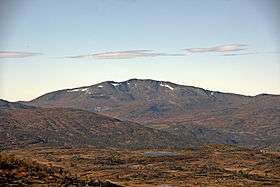
 Ruten seen from the mountain Vardfjellet | |
| Highest point | |
| Elevation | 1,040 m (3,410 ft) [1] |
| Prominence | 742 m (2,434 ft) [1] |
| Isolation | 23.91 km (14.86 mi) [1] |
| Coordinates | 63°10′23″N 09°08′37″E / 63.17306°N 9.14361°ECoordinates: 63°10′23″N 09°08′37″E / 63.17306°N 9.14361°E |
| Geography | |
 Ruten Location in Møre og Romsdal | |
| Location | Hemne, Rindal (Sør-Trøndelag, Møre og Romsdal), Norway |
Ruten (1,040 meters or 3,410 feet) is a mountain on the border between the municipality of Hemne in Sør-Trøndelag County and the municipality of Rindal in Møre og Romsdal County, Norway. The mountain stands southeast of the village of Vinjeøra and is the highest in Hemne.[2]
References
This article is issued from Wikipedia - version of the 8/27/2015. The text is available under the Creative Commons Attribution/Share Alike but additional terms may apply for the media files.