Sabana de la Mar
| Sabana de la Mar | |
|---|---|
 Sabana de la Mar | |
| Coordinates: 19°4′12″N 69°23′24″W / 19.07000°N 69.39000°WCoordinates: 19°4′12″N 69°23′24″W / 19.07000°N 69.39000°W | |
| Country |
|
| Province | Hato Mayor |
| Founded | 1760 |
| Area[1] | |
| • Total | 508.52 km2 (196.34 sq mi) |
| Elevation[2] | 3 m (10 ft) |
| Population (2012)[3] | |
| • Total | 10,582 |
| • Density | 21/km2 (54/sq mi) |
| • Demonym | Sabanalamarino(a) |
| Distance to – Hato Mayor |
36 km |
| Municipalities | 1 |
| Climate | Af |

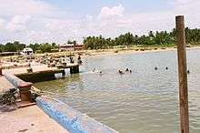
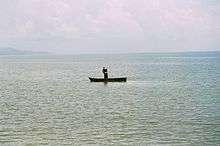
photo taken by Leonidas Bratini

Photo was taken by Leonidas Bratini
Sabana de la Mar, usually spelled in English as Savana de la Mar, is a town in the Hato Mayor province of the Dominican Republic.
Sabana de la mar is located in the eastern of Dominican Republic. Sabana de l a mar is an urban area with 508.52 km2. The economy of 10,582 inhabitants is based in agriculture and fishing, therefore this community is willing to improve its environmental issues. .
Climate
| Climate data for Sabana de la Mar | |||||||||||||
|---|---|---|---|---|---|---|---|---|---|---|---|---|---|
| Month | Jan | Feb | Mar | Apr | May | Jun | Jul | Aug | Sep | Oct | Nov | Dec | Year |
| Record high °C (°F) | 32.4 (90.3) |
33.4 (92.1) |
33.4 (92.1) |
35.0 (95) |
35.0 (95) |
34.6 (94.3) |
35.0 (95) |
35.0 (95) |
34.6 (94.3) |
35.0 (95) |
34.0 (93.2) |
33.0 (91.4) |
35.0 (95) |
| Average high °C (°F) | 27.8 (82) |
27.9 (82.2) |
28.4 (83.1) |
29.0 (84.2) |
29.7 (85.5) |
30.3 (86.5) |
30.4 (86.7) |
30.5 (86.9) |
30.7 (87.3) |
30.5 (86.9) |
29.4 (84.9) |
28.2 (82.8) |
29.4 (84.9) |
| Daily mean °C (°F) | 23.3 (73.9) |
23.3 (73.9) |
23.8 (74.8) |
24.6 (76.3) |
25.4 (77.7) |
26.0 (78.8) |
26.3 (79.3) |
26.3 (79.3) |
26.2 (79.2) |
25.9 (78.6) |
25.0 (77) |
23.9 (75) |
25.0 (77) |
| Average low °C (°F) | 18.8 (65.8) |
18.8 (65.8) |
19.3 (66.7) |
20.1 (68.2) |
21.2 (70.2) |
21.8 (71.2) |
22.3 (72.1) |
22.1 (71.8) |
21.8 (71.2) |
21.4 (70.5) |
20.7 (69.3) |
19.6 (67.3) |
20.7 (69.3) |
| Record low °C (°F) | 14.0 (57.2) |
13.5 (56.3) |
13.4 (56.1) |
14.0 (57.2) |
15.8 (60.4) |
17.0 (62.6) |
19.0 (66.2) |
19.3 (66.7) |
19.0 (66.2) |
18.5 (65.3) |
15.2 (59.4) |
14.0 (57.2) |
13.4 (56.1) |
| Average rainfall mm (inches) | 134.5 (5.295) |
107.0 (4.213) |
122.5 (4.823) |
162.1 (6.382) |
255.1 (10.043) |
200.1 (7.878) |
183.1 (7.209) |
232.4 (9.15) |
196.2 (7.724) |
218.5 (8.602) |
268.3 (10.563) |
183.1 (7.209) |
2,262.9 (89.091) |
| Average rainy days (≥ 1.0 mm) | 12.8 | 9.6 | 9.7 | 8.9 | 15.3 | 13.8 | 15.9 | 16.1 | 15.5 | 15.5 | 15.7 | 15.1 | 163.9 |
| Average relative humidity (%) | 83.6 | 82.0 | 80.8 | 80.1 | 83.2 | 83.7 | 83.5 | 84.2 | 84.6 | 85.0 | 84.8 | 84.1 | 83.3 |
| Source: NOAA[4] | |||||||||||||
Notable residents
- Luis Severino, baseball player[5]
References
- ↑ Superficies a nivel de municipios, Oficina Nacional de Estadistica
- ↑ De la Fuente, Santiago (1976). Geografía Dominicana (in Spanish). Santo Domingo, Dominican Republic: Editora Colegial Quisqueyana.
- ↑ Censo 2012 de Población y Vivienda, Oficina Nacional de Estadistica
- ↑ "Sabana de la Mar Climate Normals 1961–1990". National Oceanic and Atmospheric Administration. Retrieved March 23, 2015.
- ↑ "Novato Luis Severino ya se ve lanzando con los Yankees". 7dias.com.do (in Spanish). January 11, 2015. Retrieved August 2, 2015.
Sources
- World Gazeteer: Dominican Republic at Archive.is (archived 2012-12-04) – World-Gazetteer.com
This article is issued from Wikipedia - version of the 11/15/2016. The text is available under the Creative Commons Attribution/Share Alike but additional terms may apply for the media files.