Sansana
| Sansana | |
|---|---|
 | |
  Sansana | |
| Coordinates: 31°21′42.83″N 34°54′10.44″E / 31.3618972°N 34.9029000°ECoordinates: 31°21′42.83″N 34°54′10.44″E / 31.3618972°N 34.9029000°E | |
| District | Judea and Samaria Area |
| Council | Har Hevron |
| Region | West Bank |
| Affiliation | Amana |
| Founded | 1997 |
| Founded by | Nahal |
| Population (2015)[1] | 334 |
| Website | www.sansana.org |
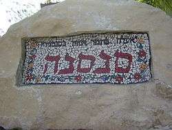
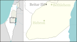
Sansana (Hebrew: סַנְסַנָּה, lit. Palm tree) is a religious communal settlement in the southern Judaean Mountains of the West Bank. Located to the south-west of Hebron and just over the Green Line, it falls under the jurisdiction of Har Hevron Regional Council. In 2015 it had a population of 334.
The international community considers Israeli settlements in the West Bank illegal under international law, but the Israeli government disputes this.[2]
History
The settlement was established in 1997 as a Nahal settlement,[3] the first kvutza arrived on 21 April 1999, and it was civilianised by members of the Or Movement in 2000. Its name is taken from the name of a Biblical village nearby (Joshua 15:31) and from Song of Songs 7:9;
I said: 'I will climb up into the palm-tree, I will take hold of the branches thereof; and let thy breasts be as clusters of the vine, and the smell of thy countenance like apples;
References
- ↑ "List of localities, in Alphabetical order" (PDF). Israel Central Bureau of Statistics. Retrieved 16 October 2016.
- ↑ "The Geneva Convention". BBC News. 10 December 2009. Retrieved 27 November 2010.
- ↑ Gabe Kahn, Israel's Junta – IDF Overrules Barak in Sansana. Arutz Sheva, 24 February 2012
External links
 |
Wikimedia Commons has media related to Sansana. |
- Sansana Negev Information Centre
This article is issued from Wikipedia - version of the 11/19/2016. The text is available under the Creative Commons Attribution/Share Alike but additional terms may apply for the media files.