Sétif Province
| Sétif Province ولاية سطيف | |
|---|---|
| Province | |
.jpg) | |
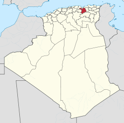
 Map of Algeria highlighting Sétif | |
| Coordinates: 36°11′N 5°24′E / 36.183°N 5.400°ECoordinates: 36°11′N 5°24′E / 36.183°N 5.400°E | |
| Country |
|
| Capital | Sétif |
| Government | |
| • PPA president | Naima Farhi (2007-2012) |
| Area | |
| • Total | 6,504 km2 (2,511 sq mi) |
| Population (2008)[1] | |
| • Total | 1,496,150 |
| • Density | 230/km2 (600/sq mi) |
| Time zone | CET (UTC+01) |
| Area Code | +213 (0) 36 |
| ISO 3166 code | DZ-19 |
| Districts | 20 |
| Municipalities | 60 |
| Website | www.wilayasetif.dz |
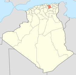
Sétif Province (Arabic: ولاية سطيف) is a province (wilaya) in north-eastern Algeria. Its capital and largest city is Sétif, the next largest city is El Eulma. There is also the World Heritage Site of Djémila there.
Administrative divisions
The province is divided into 20 districts (daïras), which are further divided into 60 communes or municipalities.
Districts
Communes
- Aïn Abessa
- Aïn Arnat
- Aïn Azel
- Aïn El Kébira
- Aïn Azel
- Aïn Lahdjar
- Aïn Legraj
- Aïn Oulmane
- Aïn Roua
- Aïn Sebt
- Ait Naoual Mezada
- Ait Tizi
- Amoucha
- Babor
- Bazer Sakhra
- Beidha Bordj
- Belaa
- Béni Aziz
- Beni Chebana
- Beni Fouda
- Beni Hocine
- Béni Ourtilane
- Bir El Arch
- Bir Haddada
- Bouandas
- Bougaâ
- Bousselam
- Boutaleb
- Dehamcha
- Djémila
- Draa Kebila
- El Eulma
- El Ouldja
- El Ouricia
- Guelal
- Guelta Zerka
- Guenzet
- Guidjel
- Hamma
- Hammam Guergour
- Harbil
- Ksar El Abtal
- Maaouia
- MAOKLANE
References
- ↑ Office National des Statistiques, Recensement General de la Population et de l’Habitat 2008 Preliminary results of the 2008 population census. Accessed on 2008-07-02.
This article is issued from Wikipedia - version of the 3/11/2016. The text is available under the Creative Commons Attribution/Share Alike but additional terms may apply for the media files.
