Shabla Municipality
| Shabla Municipality Община Шабла | |
|---|---|
| Municipality | |
 Shabla Municipality within Bulgaria and Dobrich Province. | |
| Coordinates: 43°36′N 28°31′E / 43.600°N 28.517°ECoordinates: 43°36′N 28°31′E / 43.600°N 28.517°E | |
| Country |
|
| Province (Oblast) | Dobrich |
| Admin. centre (Obshtinski tsentar) | Shabla |
| Area | |
| • Total | 329.64 km2 (127.27 sq mi) |
| Population (December 2009)[1] | |
| • Total | 5,580 |
| Time zone | EET (UTC+2) |
| • Summer (DST) | EEST (UTC+3) |
Shabla Municipality (Bulgarian: Община Шабла) is a municipality (obshtina) in Dobrich Province, Bulgaria, located in the north-easternmost part of the country on the Northern Bulgarian Black Sea Coast in Southern Dobruja geographical region, bounded by Romania to the north. It is named after its administrative centre - the town of Shabla.
The municipality embraces a territory of 329.64 km² with a population of 5,580 inhabitants, as of December 2009.[1]
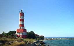
The area is best known with Cape Shabla - Bulgaria's easternmost point as well as the natural reserve of Durankulak Lake. The main road E87 crosses the municipality connecting the port of Varna with the Romanian port of Konstanza.
Settlements
.png)
Shabla Municipality includes the following 16 places (towns are shown in bold):
| Town/Village | Cyrillic | Population[2][3][4] (December 2009) |
|---|---|---|
| Shabla | Шабла | 3,586 |
| Bozhanovo | Божаново | 15 |
| Chernomortsi | Черноморци | 80 |
| Durankulak | Дуранкулак | 455 |
| Ezerets | Езерец | 183 |
| Gorichane | Горичане | 95 |
| Gorun | Горун | 105 |
| Granichar | Граничар | 163 |
| Krapets | Крапец | 378 |
| Prolez | Пролез | 56 |
| Smin | Смин | 78 |
| Staevtsi | Стаевци | 8 |
| Tvarditsa | Твърдица | 11 |
| Tyulenovo | Тюленово | 59 |
| Vaklino | Ваклино | 195 |
| Zahari Stoyanovo | Захари Стояново | 113 |
| Total | 5,580 |
Demography
The following table shows the change of the population during the last four decades.
| Shabla Municipality | ||||||||
|---|---|---|---|---|---|---|---|---|
| Year | 1975 | 1985 | 1992 | 2001 | 2005 | 2007 | 2009 | 2011 |
| Population | 9,261 | 8,375 | 7,508 | 6,380 | 5,959 | 5,759 | 5,580 | ... |
| Sources: Census 2001,[5] Census 2011,[6] „pop-stat.mashke.org“,[7] | ||||||||
See also
References
- 1 2 (English) Bulgarian National Statistical Institute - Bulgarian provinces and municipalities in 2009
- ↑ (English) Bulgarian National Statistical Institute - Bulgarian towns in 2009
- ↑ (English) Bulgarian National Statistical Institute - Bulgarian villages under 1000 inhabitants - December 2009
- ↑ (English) Bulgarian National Statistical Institute - Bulgarian Settlements 1000-5000 inhabitants - December 2009
- ↑ National Statistical Institute - Census 2001
- ↑ „pop-stat.mashke.org“
- ↑ "Population of Bulgarian divisions". Pop-stat.mashke.org. 2011-02-01. Retrieved 2012-03-28.
External links
- Official website (Bulgarian)
