Shepman Run
| Shepman Run | |
|---|---|
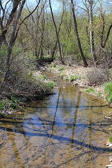
 Shepman Run looking downstream | |
| Other name(s) | Shepmans Run |
| Basin | |
| Main source |
valley in Moreland Township, Lycoming County, Pennsylvania 944 ft (288 m) |
| River mouth |
Little Muncy Creek in Moreland Township, Lycoming County, Pennsylvania near Clarketown 594 ft (181 m) 41°11′26″N 76°41′14″W / 41.19055°N 76.68719°WCoordinates: 41°11′26″N 76°41′14″W / 41.19055°N 76.68719°W |
| Progression | Little Muncy Creek → Muncy Creek → West Branch Susquehanna River → Susquehanna River → Chesapeake Bay |
| Basin size | 1.59 sq mi (4.1 km2) |
| Physical characteristics | |
| Length | 2.6 mi (4.2 km) |
| Features | |
| Tributaries |
|
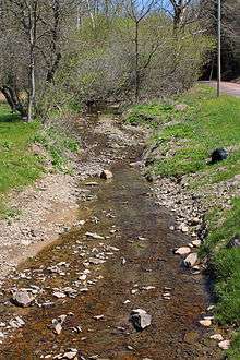
Shepman Run (also known as Shepmans Run) is a tributary of Little Muncy Creek in Lycoming County, Pennsylvania, in the United States. It is approximately 2.6 miles (4.2 km) long and flows through Moreland Township.[1] The watershed of the stream has an area of 1.59 square miles (4.1 km2). A covered bridge crosses the stream. Shepman Run is classified as a Coldwater Fishery and a Migratory Fishery.
Course

Shepman Run begins in a valley in Moreland Township. It flows east for a few tenths of a mile before turning south for several tenths of a mile. In this reach, the stream receives an unnamed tributary from the left and passes through a small pond. The stream then turns south-southwest for several tenths of a mile before reaching the end of its valley. Shortly afterwards, it turns east for a short distance before reaching its confluence with Little Muncy Creek.[1]
Shepman Run joins Little Muncy Creek 5.86 miles (9.43 km) upstream of its mouth.[2]
Tributaries
Shepman Run has no named tributaries. However, it does have one unnamed tributary, which is 0.5 miles (0.80 km) long.[1]
Geography and geology

The elevation near the mouth of Shepman Run is 594 feet (181 m) above sea level.[3] The elevation of the stream's source is 944 feet (288 m) above sea level. The stream flows through a valley known as Tommy Hollow.[1]
A bridge known as the Eichenlaub bridge crosses Shepman Run in Moreland Township, off Tom Hill Hollow Road (on the road's west side). The bridge has a length of 16 feet (4.9 m).[4]
Watershed and biology
The watershed of Shepman Run has an area of 1.59 square miles (4.1 km2).[2] The stream is entirely within the United States Geological Survey quadrangle of Hughesville.[3] Its mouth is located near Clarketown.[3]
Shepman Run is in the Lower West Branch Susquehanna sub-basin.[5]
Shepman Run is classified as a Coldwater Fishery and a Migratory Fishery, as are all of the other tributaries of Little Muncy Creek.[6]
History
Shepman Run was entered into the Geographic Names Information System on August 2, 1979. Its identifier in the Geographic Names Information System is 1187470. The stream is also known as Shepmans Run.[3] This variant name appears in The Geology of Lycoming County, which was written by Andrew Sherwood and Franklin Platt and published in 1880.[7]
See also
- Cox Run, next tributary of Little Muncy Creek going downstream
- List of rivers of Pennsylvania
References
- 1 2 3 4 United States Geological Survey, The National Map Viewer, retrieved January 23, 2015
- 1 2 Pennsylvania Gazetteer of Streams (PDF), November 2, 2001, p. 128, retrieved January 27, 2016
- 1 2 3 4 Geographic Names Information System, Feature Detail Report for: Shepman Run, retrieved January 27, 2016
- ↑ 38041e, retrieved January 27, 2016
- ↑ Water Supply Commission of Pennsylvania (1921), Water Resources Inventory Report ..., Parts 1-5, pp. 55, 57, retrieved January 27, 2016
- ↑ Lycoming College Clean Water Institute (Fall 2003), Summary Report-Muncy Creek (PDF), Lycoming College, pp. 3–4, retrieved January 27, 2016
- ↑ Geographic Names Information System, Variant Citation, retrieved January 27, 2016