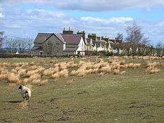
Sunniside, Weardale
Coordinates: 54°44′31″N 1°47′06″W / 54.742°N 1.785°W
Sunniside is a small rural village to the east of Tow Law and north of Crook in County Durham, England.
Sunniside has two pubs, and a former post office. There is a collection of newly built homes in the west of the village, called The Paddock. There are five streets, Gladstone Terrace, Flag Terrace, Front Street (the main street) Garden Terrace, and a little offshoot along a back road to Roddymoor, called Grahams Cottages.
Sunniside is one of the highest villages within the County of Durham, at 1,000 feet (300 m) above sea level.
References
External links
![]() Media related to Sunniside, Weardale at Wikimedia Commons
Media related to Sunniside, Weardale at Wikimedia Commons
This article is issued from Wikipedia - version of the 1/23/2016. The text is available under the Creative Commons Attribution/Share Alike but additional terms may apply for the media files.

