Taboiaki
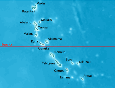
 Map of Nonouti | |||||
 | |||||
| Geography | |||||
|---|---|---|---|---|---|
| Location | Pacific Ocean | ||||
| Coordinates | 0°40′S 174°20′E / 0.667°S 174.333°E | ||||
| Archipelago | Gilbert Islands | ||||
| Area | 21.02 km2 (8.12 sq mi) | ||||
| Highest elevation | 3 m (10 ft) | ||||
| Administration | |||||
| Demographics | |||||
| Population | 2,683 (2010 Census) | ||||
| Pop. density | 135 /km2 (350 /sq mi) | ||||
| Ethnic groups | I-Kiribati 99.7% | ||||
| Additional information | |||||
| |||||
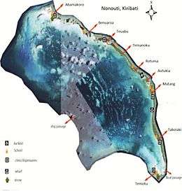
Taboiaki is a settlement in Kiribati.[1] It is located on the atoll of Nonouti; It is the largest village with 662 residents in the 2010 census (26% of the population of Nonouti).[1] Matang is the administrative centre with 536 residents (20% of the island's population in 2010).[1]
References
- 1 2 3 "11. Nonouti" (PDF). Office of Te Beretitent - Republic of Kiribati Island Report Series. 2012. Retrieved 28 April 2015.
This article is issued from Wikipedia - version of the 11/17/2016. The text is available under the Creative Commons Attribution/Share Alike but additional terms may apply for the media files.