Tarakeshwar
For other uses, see Tarakeshwara (disambiguation).
| Tarakeshwar Municipality तारकेश्वर नगरपालिका | |
|---|---|
| Municipality | |
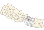
  Tarakeshwar Municipality Location in Nepal | |
| Coordinates: 27°47′12″N 85°18′11″E / 27.78667°N 85.30306°ECoordinates: 27°47′12″N 85°18′11″E / 27.78667°N 85.30306°E | |
| Country |
 Nepal Nepal |
| Region | Central |
| Zone | Bagmati Zone |
| District | Kathmandu District |
| Established | December 2014 |
| Area | |
| • Total | 34.9 km2 (13.5 sq mi) |
| Population (2011 Nepal census) | |
| • Total | 81,443 |
| • Density | 2,300/km2 (6,000/sq mi) |
| • Ethnicities | Newar, Bahun, Chhetri, Tamang, Magar |
| Time zone | NST (UTC+5:45) |
| Website |
www |
Tarakeshwar is a municipality in the Central development region of Kathmandu District in the Bagmati Zone of Nepal. The new municipality was formed by merging seven existing Village development committees — Dharmasthali, Futung, Goldhunga, Jitpurphedi, Kabhresthali, Manmaiju and Sangla — on 02 Dec 2014.[1][2] The office of the municipality is that of the former Dharmasthali village development committee.
Population
Tarakeshwar municipality has a total population of 81,443 according to 2011 Nepal census.[3]
References
- ↑ "Govt announces 61 municipalities". The Kathmandu Post. 3 December 2014. Retrieved 2 December 2014.
- ↑ "Govt creates 61 new municipalities". República. 3 Dec 2014. Retrieved 2 Dec 2014.
- ↑ "2011 Nepal census (Ward Level)" (PDF). Central Bureau of Statistics. November 2012. Retrieved November 2012. Check date values in:
|access-date=(help)
External links
See also
Headquarter: Kathmandu | |||
 |  | ||
This article is issued from Wikipedia - version of the 7/27/2016. The text is available under the Creative Commons Attribution/Share Alike but additional terms may apply for the media files.