Taypi Qullu (Mejillones)
This article is about the mountain in the La Rivera Municipality, Mejillones Province, Oruro Department, Bolivia. For other uses, see Taypi Qullu.
| Taypi Qullu | |
|---|---|
 Taypi Qullu Location in Bolivia | |
| Highest point | |
| Elevation | 5,062 m (16,608 ft) [1] |
| Coordinates | 18°54′58″S 68°49′33″W / 18.91611°S 68.82583°WCoordinates: 18°54′58″S 68°49′33″W / 18.91611°S 68.82583°W |
| Geography | |
| Location | Bolivia, Oruro Department, Mejillones Province |
| Parent range | Andes, Cordillera Occidental |
Taypi Qullu (Aymara taypi center, middle, qullu mountain,[2] "center mountain", hispanicized spelling Taypi Kkollu) is a 5,062-metre (16,608 ft) high mountain in the Cordillera Occidental in the Andes of Bolivia. It lies in the Oruro Department, Mejillones Province, La Rivera Municipality. Taypi Qullu is situated south of the mountain Chullumpiri, south-west of Laram Pukara and north-west of Janq'u Qullu. The river Ch'iyar Qullu Jawira ("black mountain river", also spelled Chiar Kkollu Jahuira) flows along its slopes and then to the south-west.[3]
References
- ↑ BIGM map 1:50,000 Cerro Capitan Hoja 5837-III
- ↑ Radio San Gabriel, "Instituto Radiofonico de Promoción Aymara" (IRPA) 1993, Republicado por Instituto de las Lenguas y Literaturas Andinas-Amazónicas (ILLLA-A) 2011, Transcripción del Vocabulario de la Lengua Aymara, P. Ludovico Bertonio 1612 (Spanish-Aymara-Aymara-Spanish dictionary)
- ↑ "La Rivera". Retrieved September 12, 2014. (unnamed, south of Chullumpiri)
Capital: Oruro | ||
| Provinces | 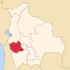 | |
| Municipalities (and seats) |
| |
This article is issued from Wikipedia - version of the 2/20/2016. The text is available under the Creative Commons Attribution/Share Alike but additional terms may apply for the media files.