Tepeapulco
| Tepeapulco | ||
|---|---|---|
| Municipality | ||
| ||
  Tepeapulco Location in Mexico | ||
| Coordinates: 19°47′08″N 98°33′06″W / 19.78556°N 98.55167°WCoordinates: 19°47′08″N 98°33′06″W / 19.78556°N 98.55167°W | ||
| Country |
 Mexico Mexico | |
| State |
 Hidalgo Hidalgo | |
| Town | 1527 | |
| Municipality | 1824 | |
| Municipal seat | City of Tepeapulco | |
| Government | ||
| • Body | Honorably City Hall of Tepeapulco | |
| • Mayor or municipal president | Alberto Franco (Institutional Revolutionary Party) | |
| Area | ||
| • Total | 239 km2 (92 sq mi) | |
| Population (2005) | ||
| • Total | 49,850 | |
| Postal code (C.P.) | 43978 | |
| Area code(s) | 791 | |
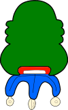
Tepeapulco is a town and one of the 84 municipalities of Hidalgo, in central-eastern Mexico.The municipality covers an area of 239 km².
As of 2005, the municipality had a total population of 49,850.[1]
During the Spanish colonial period it was part of the domain of the alcaldia mayor of Apa y Tepeapulco.[2] The parish of San Francisco Tepeapulco was established in 1527.
References
- ↑ "Tepeapulco". Enciclopedia de los Municipios de México. Instituto Nacional para el Federalismo y el Desarrollo Municipal. Retrieved December 27, 2008.
- ↑ Peter Gerhard, Guide to the Historical Geography of New Spain (Cambridge: Cambridge University Press, 1972) p. 53

This article is issued from Wikipedia - version of the 4/9/2013. The text is available under the Creative Commons Attribution/Share Alike but additional terms may apply for the media files.