Ternate City
| Ternate Kota Ternate | ||
|---|---|---|
| City | ||
|
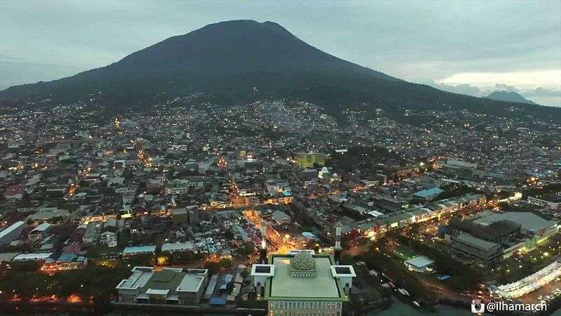
Skyline of Ternate, 2010 | ||
| ||
| Motto: Maku Gawene | ||
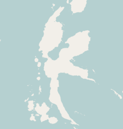
 Ternate Location off Halmahera | ||
| Coordinates: 0°41′N 127°24′E / 0.683°N 127.400°E | ||
| Country | Indonesia | |
| Province | North Maluku | |
| Island | Halmahera | |
| Government | ||
| • Mayor | Drs. H. Burhan Abdurrahman | |
| Area | ||
| • Total | 249,75 km2 (9,643 sq mi) | |
| Population (2011) | ||
| • Total | 207,295 | |
| • Density | 1,860.98/km2 (4,819.9/sq mi) | |
| Time zone | WIT (UTC+9) | |
| Area code(s) | +62 921 | |
| Website | www.ternatekota.go.id/ | |
Ternate City (Indonesian: Kota Ternate) is the largest town in the province of North Maluku in Indonesia. It is located on the islands of Ternate in the Maluku Islands. Sofifi City, the new provincial capital consisting of the former mainland portion, was split off.
Ternate was the seat of the Sultanate of Ternate. Today the Sultanate still exists, although it no longer holds any political power.
Greater Ternate City spreads 10 kilometres from the airport to Bastiong port. The commercial centre stretches 2 kilometres from the bus terminal near Fort Oranye to Ahmad Yani Port where Pelni ships arrive.[1] The current Sultan's Palace, built in 1796, is now partly a museum. The large Fort Oranye, built by the Dutch in 1607, was the home of the Dutch East Indies Company until it moved to Batavia (Jakarta) around 1619. According to a news report by the Huffington Post, the U.S. Geological Survey said that a 6.6-magnitude shallow, strong earthquake (12 miles under the Molucca Sea) struck off Ternate on Monday, November 14, 2011, but an official of the Indonesian meteorological and geophysics agency said there was little risk of a tsunami.[2]
Transport
Sultan Babullah Airport is the main gateway to the city, serving several flights to other cities in Indonesia such as Jakarta, Makassar and Surabaya. Recently the airport has been upgraded to meet the increase of demand.
The Ahmad Yani seaport is the main seaport of Ternate, which served different type of ships from different parts of the archipelago. Ships operated by Pelni connects Ternate with other cities such as Ambon and Manado.
Administration
Ternate city (which includes various minor islands as well as the main island of Ternate) is divided into 4 districts as follows:
| District (kecamatan) | Area km²[3] | Population 2007 Census[4] |
|---|---|---|
| Pulau Ternate | 174,13 | 19.133 |
| Moti | 24,60 | 4.797 |
| Ternate Selatan | 28,96 | 78.989 |
| Ternate Utara | 22,06 | 73.919 |
| Ternate | 249,75 | 176.838 |
Tourism
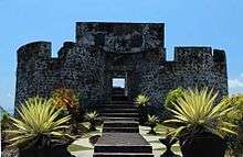
There are numerous old forts that was built by different empires during the colonial era scattered around the city. Examples of fort built by the Portuguese are Fort Kalamata and Fort Tolukko. Fort Oranje, which was built by the Dutch, is the largest fort in the island. It was the headquarter of the Dutch East India Company until it was moved to Batavia (Jakarta) in 1619. Some forts no longer exists, only leaving only some ruins, such as Fort Kastela, which was built by the Spanish.
The palace of the Sultan of Ternate still exists. It is now converted into a museum. The museum displayed some old artifacts from the Sultanate of Ternate at its maximum extent, such as weapons, armors and traditional Ternatean clothes.
There are several beach in the island that offers spectacular views, such as the Tobololo beach and Sulamadaha beach. There are also some beautiful lakes in the island, such as the Laguna Lake and Tolire Lake[5]

See Also
Gallery

 Palace of the Sultan of Ternate
 Tolire Lake
 View of Ternate, 2010
References
- ↑ Witton, Patrick (2003). Indonesia (7th edition). Melbourne: Lonely Planet. p. 166. ISBN 1-74059-154-2.
- ↑ "Strong, Shallow Earthquake Hits Eastern Indonesia". Huffington Post. November 13, 2011.
- ↑
- ↑
- ↑ 7 Tempat Wisata di Ternate Yang Bisa Dikunjungi
Coordinates: 0°47′N 127°22′E / 0.783°N 127.367°E
%2C_Indonesia_(2010).jpg)
