Texas State Highway 199
| |||||||
|---|---|---|---|---|---|---|---|
 | |||||||
| Route information | |||||||
| Maintained by TxDOT | |||||||
| Length: | 53.25 mi[1] (85.70 km) | ||||||
| Existed: | by 1935 – present | ||||||
| Major junctions | |||||||
| West end: |
    US 281 / US 380 / SH 59 / SH 114 at Jacksboro US 281 / US 380 / SH 59 / SH 114 at Jacksboro | ||||||
 I-820 at Fort Worth I-820 at Fort Worth | |||||||
| East end: |
 I-30 at Fort Worth I-30 at Fort Worth | ||||||
| Highway system | |||||||
| |||||||


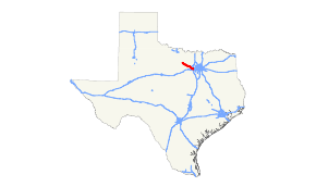
State Highway 199 is a northwest-to-southeast state route that runs from Interstate 30 in downtown Fort Worth, Texas to State Highway 59 in Jacksboro, Texas.
Names
- The part of the highway located within the city limits of Fort Worth is known as "Jacksboro Highway", as the route's other end is in Jacksboro.
- In Lake Worth, the highway is known as "Lake Worth Boulevard".
- In Azle, the highway is named "Southwest Parkway Street".
- In Downtown Fort Worth, the highway is known as "Henderson Street."
Major intersections
| County | Location | mi | km | Destinations | Notes |
|---|---|---|---|---|---|
| Jack | Jacksboro | US 281 north / US 380 west / SH 59 north / SH 114 west – Olney | west end of US 281 / US 380 / SH 114 overlap | ||
 PR 61 – Fort Richardson State Park PR 61 – Fort Richardson State Park | |||||
| | US 380 east / SH 114 east – Runaway Bay, Bridgeport, Dallas | east end of US 380 / SH 114 overlap | |||
| |  FM 3324 south FM 3324 south | ||||
| | US 281 south – Mineral Wells | east end of US 281 overlap | |||
| Joplin |  FM 1156 north – Vineyard, Wizard Wells FM 1156 north – Vineyard, Wizard Wells | ||||
| |  FM 2210 – Gibtown FM 2210 – Gibtown | ||||
| Wise | |  FM 920 north – Bridgeport FM 920 north – Bridgeport | west end of FM 920 overlap | ||
| | FM 920 south – Weatherford | east end of FM 920 overlap | |||
| Parker | Springtown |  Loop 182 Loop 182 | |||
 FM 51 – Decatur, Weatherford FM 51 – Decatur, Weatherford | |||||
| |  FM 2257 north (Jay Bird Lane) FM 2257 north (Jay Bird Lane) | ||||
| La Junta |  FM 1542 north – Reno FM 1542 north – Reno | ||||
| Azle |   Loop 344 east / FM 730 south Loop 344 east / FM 730 south | interchange; west end of freeway; no direct westbound exit (FM 730 north exit serves both directions) | |||
| Tarrant | FM 730 north – Boyd | ||||
| Loop 344 (Main Street) / Stewart Street | |||||
| Denver Trail | no direct westbound exit (signed at Wells-Burnett Road) | ||||
| Normandy Avenue / Wells-Burnett Road | interchange; east end of freeway | ||||
| Fort Worth |  FM 1886 (Confederate Park Road) FM 1886 (Confederate Park Road) | Interchange | |||
| Lake Worth | I-820 | I-820 exit 10A | |||
| Fort Worth |  SH 183 (Ephriham Avenue / River Oaks Boulevard) – NAS Fort Worth JRB, FMC Carswell, River Oaks SH 183 (Ephriham Avenue / River Oaks Boulevard) – NAS Fort Worth JRB, FMC Carswell, River Oaks | ||||
 I-30 / US 377 I-30 / US 377 | I-30 exit 13B | ||||
| 1.000 mi = 1.609 km; 1.000 km = 0.621 mi | |||||
References
This article is issued from Wikipedia - version of the 7/31/2016. The text is available under the Creative Commons Attribution/Share Alike but additional terms may apply for the media files.