Turner Island (Antarctica)
Turner Island
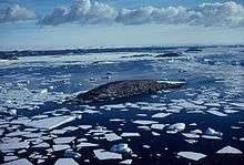
Turner Island (68°33′S 77°53′E / 68.550°S 77.883°ECoordinates: 68°33′S 77°53′E / 68.550°S 77.883°E) is an island lying 0.5 nautical miles (0.9 km) northwest of Bluff Island and 2.5 nautical miles (4.6 km) west of Breidnes Peninsula, Vestfold Hills, in Prydz Bay. Mapped by Norwegian cartographers from air photos taken by the Lars Christensen Expedition, 1936-37. Remapped by ANARE (Australian National Antarctic Research Expeditions) (1957–58) and named for P.B. Turner, radio officer at Davis Station in 1958.
See also
![]() This article incorporates public domain material from the United States Geological Survey document "Turner Island (Antarctica)" (content from the Geographic Names Information System).
This article incorporates public domain material from the United States Geological Survey document "Turner Island (Antarctica)" (content from the Geographic Names Information System).
This article is issued from Wikipedia - version of the 11/21/2015. The text is available under the Creative Commons Attribution/Share Alike but additional terms may apply for the media files.