U.S. Route 82 in Arkansas
| ||||
|---|---|---|---|---|
_map.svg.png) | ||||
| Route information | ||||
| Maintained by AHTD | ||||
| Existed: | 1932 – present | |||
| Major junctions | ||||
| West end: |
| |||
| East end: |
| |||
| Location | ||||
| Counties: | ||||
| Highway system | ||||
| ||||
.svg.png)
U.S. Highway 82 in Arkansas is a major east–west artery which runs across the state's lowest tier of counties. It enters Arkansas from Texas, concurrent with US Highway 67, at a junction with US Highway 71 on the border between Texarkana, Texas and Texarkana, Arkansas. The route leaves Arkansas on the Lake Village Bridge over the Mississippi River near Lake Village, crossing into Mississippi.
Route description
Highway 82 runs across the southern tier of counties in Arkansas, serving three cities of regional importance: Texarkana, Magnolia, and El Dorado in the Arkansas Timberlands. The eastern half of the route runs through the Lower Arkansas Delta, serving small towns and agricultural areas.
US 82 enters the state from Texarkana, TX concurrent with US 67 as a pair of one-way streets. Running east as 7th Street (the westbound half of the couplet is Dr. Martin Luther King Jr. Blvd), the road enters Arkansas at an intersection with State Line Avenue. The junction provides US 67/ US 82 with access northward to US 59/US 71 via US 71Y (unsigned). At Hazel Street, US 67/US 82 intersects US 59/US 71, beginning a brief concurrency east to Hickory St, when US 59/US 71 turns south toward Shreveport, LA. The intersection is near the J.K. Wadley House, listed on the National Register of Historic Places.[1] The two one-way streets combine at Hickory St and run east as 9th Street to Broad Street, where US 67 turns northeast.[2] Continuing east, US 82 intersects Interstate 49 (I-49) with a diamond interchange, the only junction with an Interstate highway in Arkansas. In east Texarkana, US 82 intersects Highway 237 south of the Texarkana Regional Airport.
East of Texarkana, US 82 runs to the east side of Miller County near the Lafayette County line and Red River. The route intersects Highway 296 before turning south toward Garland, where it intersects Highway 134. US 82 turns east and crosses the Red River to enter Lafayette County. US 82 runs east to Lewisville, the county seat of Lafayettte County, where it intersects Highway 29 just south of downtown Lewisville. The route continues east to Stamps, where a concurrency begins with Highway 53 to Buckner, where Highway 53 turns north. The highway crosses into Columbia County, with the county line following Dorcheat Bayou.[3]
It crosses the Red River at Garland City on a new bridge, then passes through the towns of Lewisville and Magnolia. At Magnolia the route joins US 79 for approximately two miles before continuing eastward. The route passes through the cities of El Dorado and Strong before crossing the Ouachita River just north of Lake Jack Lee, then continues through Crossett and Hamburg to Lake Village. The route continues from there across the Mississippi River to Greenville, MS.
History
The route was designated in 1932. In Arkansas, it replaced State Road 2.
Major intersections
| County | Location | mi[4] | km | Exit[4] | Destinations | Notes |
|---|---|---|---|---|---|---|
| Bowie | Texarkana | Continuation into Texas | ||||
| 0.00 | 0.00 | Texas–Arkansas state line | ||||
| Miller | Texarkana | 0.00 | 0.00 | |||
| 0.10 | 0.16 | Begin US 59/US 71 overlap | ||||
| 0.46 | 0.74 | End US 59/US 71 overlap | ||||
| 0.95 | 1.53 | End US 67 overlap | ||||
| 2.32 | 3.73 | |||||
| 3.85 | 6.20 | |||||
| | 17.72 | 28.52 | AR 296 eastern terminus | |||
| Garland | 21.22 | 34.15 | AR 134 eastern terminus | |||
| Miller–Lafayette county line | | 22.24– 22.56 | 35.79– 36.31 | Bridge over Red River | ||
| Lafayette | Lewisville | 29.89 | 48.10 | |||
| Stamps | 34.23 | 55.09 | Begin AR 53 overlap | |||
| Buckner | 38.34 | 61.70 | End AR 53 overlap | |||
| Lafayette–Columbia county line | | 39.51– 39.59 | 63.59– 63.71 | Bridge over Dorcheat Bayou | ||
| Columbia | | 41.46 | 66.72 | AR 344 western terminus | ||
| | 43.71 | 70.34 | AR 98 western terminus | |||
| Magnolia | 50.48 | 81.24 | ||||
| 51.32 | 82.59 | AR 355 northern terminus | ||||
| 52.68 | 84.78 | Begin US 79 overlap | ||||
| End US 79 overlap, US 82B eastern terminus | ||||||
| Village Junction | ||||||
| Union | Marysville | AR 57 southern terminus | ||||
| Cairo | AR 172 eastern terminus | |||||
| | ||||||
| El Dorado | 17 | US 82B western terminus | ||||
| 18 | AR 15 northern terminus | |||||
| 22 | ||||||
| US 82B eastern terminus | ||||||
| Strong | AR 129 northern terminus | |||||
| Ashley | Felsenthal NWR | US 82S northern terminus | ||||
| Crossett | ||||||
| AR 133T northern terminus | ||||||
| | Begin US 425/AR 52 concurrency | |||||
| | End AR 52 concurrency | |||||
| Hamburg | Begin AR 189 concurrency | |||||
| Begin AR 8 concurrency | ||||||
| End AR 189 concurrency | ||||||
| End US 425/AR 8 concurrency | ||||||
| Thebes | AR 160 western terminus | |||||
| Montrose | US 82B western terminus | |||||
| US 82B eastern terminus | ||||||
| Chicot | | AR 293 southern terminus | ||||
| Lake Village | Begin US 65/US 278 overlap, AR 144 western terminus | |||||
| Fairview | End US 65 overlap | |||||
| Shives | AR 142 western terminus | |||||
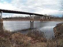
| Mississippi River | Lake Village Bridge | |||||
| Washington | | Continuation into Mississippi | ||||
1.000 mi = 1.609 km; 1.000 km = 0.621 mi
| ||||||
See also
References
- ↑ National Park Service (2010-07-09). "National Register Information System". National Register of Historic Places. National Park Service.
- ↑ Arkansas State Highway and Transportation Department (February 17, 2015). General Highway Map, Miller County, Arkansas (PDF) (Map). 1:62500. Arkansas State Highway and Transportation Department. Retrieved November 24, 2016.
- ↑ Arkansas State Highway and Transportation Department (September 27, 2007). General Highway Map, Lafayette County, Arkansas (PDF) (Map). 1:62500. Arkansas State Highway and Transportation Department. Retrieved November 25, 2016.
- 1 2
| Previous state: Texas |
Arkansas | Next state: Mississippi |
External links
-
 Media related to U.S. Route 82 in Arkansas at Wikimedia Commons