U.S. Route 68
| |
|---|---|
 | |
| Route information | |
| Length: | 560 mi[1] (901 km) |
| Existed: | 1926[1] – present |
| Major junctions | |
| West end: |
 US 62 at Reidland, KY US 62 at Reidland, KY |
| |
| North end: |
 I-75 in Findlay, OH I-75 in Findlay, OH |
| Location | |
| States: | Kentucky, Ohio |
| Highway system | |

U.S. Route 68 (US 68) is an east–west United States highway that runs for 560 miles (900 km) from northwest Ohio to Western Kentucky. The highway's western terminus is at US 62 in Reidland, Kentucky. Its northern terminus is at Interstate 75 in Findlay, Ohio. It is signed east–west in Kentucky and north–south in Ohio.
Route description
Kentucky

U.S. Route 68 is designated as a "Scenic Highway" throughout Kentucky. The majority of the route winds through forested, hilly terrain. US 68 is Broadway Street through downtown Lexington, and it is Harrodsburg Road before it leaves Lexington. US 68 goes near or through Maysville, Paris, Lexington, Wilmore, Harrodsburg, Lebanon, Campbellsville, Edmonton, Glasgow, Bowling Green, Auburn, Russellville, Elkton, Hopkinsville, Cadiz, and Reidland.
The route passes several Civil War battle sites. The Battle of Tebbs Bend Historic Civil War Site is located near Campbellsville and the Perryville Battlefield State Historic Site is outside Perryville. In addition, the Jefferson Davis State Historic Site is along the highway about 9 miles (14 km) east of Hopkinsville at the small town of Fairview.
There is an annual 400-mile (640 km) yard sale held along the highway for 4 days in early summer.[2]
The sections of the highway through Campbellsville and Lebanon are slated for expansion to begin in 2008. The long-term goal is to widen and make safer the entire US 68 corridor through Kentucky as part of the Heartland Parkway project.[3][4]
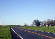

Sections in Kentucky have been improved in recent years. The Paris Pike which was completed in 2003. Work is currently in progress to make US 68 four lanes through Land Between the Lakes.
Two spans of the US 68/KY 80 Eggner Ferry Bridge over Kentucky Lake collapsed after being struck by a cargo ship on January 26, 2012.[5] The bridge reopened to traffic on May 25, 2012.[6]
| Browse numbered routes | ||||
|---|---|---|---|---|
←  KY 67 KY 67 | list | KY 69  → → | ||
Ohio
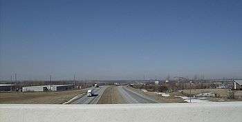
US 68 takes a south-north route throughout Ohio, roughly paralleling Interstate 75 but covering counties one tier to the east of those counties covered by I-75. US 68 begins at the William H. Harsha Bridge over the Ohio River and duplexes with U.S. Route 52 for 5.6 miles while travelling on the north bank of the river. The highways separate at Ripley, at which point US 68 heads north as a generally rural two-lane highway, passing through or bypassing communities such as Georgetown, Mount Orab, Fayetteville, Wilmington, Xenia, and Yellow Springs. Shortly before reaching Interstate 70, it becomes a four-lane expressway, bypassing Springfield before transitioning back to a rural two-lane road as it approaches Urbana. As it continues north, US 68 passes through West Liberty, Bellefontaine, Kenton, Dunkirk, and Arlington on its way north to its terminus at an interchange with Interstate 75 outside Findlay.
In total, US 68 traverses 179.1 miles within Ohio.
| Browse numbered routes | ||||
|---|---|---|---|---|
←  SR 67 SR 67 | OH | SR 68 .svg.png) → → | ||
History
From 1926 until the late 1940s, in terms of the routing between Bowling Green and Perryville, US 68 went westward through Springfield to Bardstown, and followed U.S. Route 31E southward to near Horse Cave. US 68 then followed the current KY 218 (Charlie Moran Highway) westward into Horse Cave, and then joined U.S. Route 31W from there through Cave City to Bowling Green.[7] US 68 moved to its current routing from Bowling Green to Perryville around 1948-49.
US 68 previously ran to Toledo, Ohio, terminating at the west approach to the High Level Bridge south of downtown, but the Toledo-Findlay segment was decommissioned in the 1950s.[8] It also passed through Springfield, Ohio prior to its realignment onto a four-lane bypass of that city.
Future
In Clark County, Ohio, there is an almost full-access interchange between controlled-access US 68 and US 40/SR 4, which is itself a controlled-access highway until approximately 0.3 mile west of the US 68 interchange. One exit ramp from US 68 ends on Upper Valley Pike, rather than on US 40/SR 4; another entrance ramp includes two-way traffic and an at-grade entrance to a retirement community. On US 40/SR 4 between the controlled-access portion and US 68, there are an at-grade intersection at Upper Valley Pike, other street and driveway breaks in access control and a steep grade on the eastbound approach toward Upper Valley Pike. In September 2013, the Clark County-Springfield Transportation Coordinating Committee (TCC) ranked the US 40/SR 4/Upper Valley Pike intersection as the most hazardous in the county, based on 2010-2012 crash data.[9][10] Because the road design over the years had played a significant factor in the high number of crashes in the area, the TCC conducted a study; in February 2006 it recommended reconfiguring the US 68 interchange and altering nearby traffic patterns. The Ohio Department of Transportation (ODOT) the same year approved $5 million to fund the project. However, the TCC soon rejected ODOT's money, concluding that even its recommended fix would not be enough to solve the area road network's underlying problems.[9][11] Instead, the TCC is making small changes, such as improving traffic signal timing and adding signs. ODOT, for its part, is working on reducing the number of driveways near the US 40/SR 4/Upper Valley Pike intersection and on upgrading traffic signals.[9]
Major intersections
| State | County | Location | mi[12] | km | Destinations | Notes | |
|---|---|---|---|---|---|---|---|
| Kentucky | McCracken | Reidland | 0.000 | 0.000 | US 62 – Paducah, Kentucky Dam | ||
| | 0.988 | 1.590 |  I-24 – Kentucky Dam, Nashville, St. Louis I-24 – Kentucky Dam, Nashville, St. Louis | I-24 exit 16 | |||
| | 1.342 | 2.160 |  KY 284 west – Reidland, Symsonia KY 284 west – Reidland, Symsonia | ||||
| | 2.177 | 3.504 |  KY 787 KY 787 | ||||
| Marshall | | 3.841 | 6.181 |  KY 1042 north KY 1042 north | |||
| Sharpe | 4.273 | 6.877 |  KY 795 south KY 795 south | west end of KY 795 overlap | |||
| 4.348 | 6.997 | KY 795 north | east end of KY 795 overlap | ||||
| |  KY 1610 north KY 1610 north | ||||||
| |  KY 1396 south KY 1396 south | ||||||
| Coy |  KY 1712 south KY 1712 south | ||||||
| |  KY 1413 north KY 1413 north | ||||||
| Palma |  KY 3456 north KY 3456 north | ||||||
 KY 1422 east KY 1422 east | |||||||
| |  KY 95 north – Calvert City KY 95 north – Calvert City | ||||||
| |  KY 782 west KY 782 west | ||||||
| | 12.092 | 19.460 |  Purchase Parkway – Mayfield, Calvert City Purchase Parkway – Mayfield, Calvert City | Purchase Parkway exit 47 | |||
| | 12.339 | 19.858 |  US 641 north – Kentucky Dam Village State Resort Park US 641 north – Kentucky Dam Village State Resort Park | west end of US 641 overlap | |||
| Draffenville | 12.755 | 20.527 | US 641 south | east end of US 641 overlap | |||
| Briensburg | 14.509 | 23.350 |  KY 58 west KY 58 west | ||||
| | Moors Camp Highway | former KY 963 | |||||
| |  KY 1462 west KY 1462 west | ||||||
| | Big Bear Highway | former KY 58 east | |||||
| |  KY 408 west – Benton, Mayfield KY 408 west – Benton, Mayfield | ||||||
| Fairdealing | Barge Island Road | former KY 962 north | |||||
 KY 962 south KY 962 south | |||||||
| |  KY 1364 south KY 1364 south | ||||||
| |  KY 1484 north KY 1484 north | ||||||
| Aurora | 28.49 | 45.85 |  KY 402 west – Mayfield KY 402 west – Mayfield | ||||
| | 30.658 | 49.339 |  KY 80 west – Murray KY 80 west – Murray | west end of KY 80 overlap | |||
| see KY 80 | |||||||
| Metcalfe | Edmonton | 189.786 | 305.431 | KY 80 east | east end of KY 80 overlap | ||
| |  KY 3524 KY 3524 | ||||||
| |  KY 1243 KY 1243 | ||||||
| |  KY 2399 KY 2399 | ||||||
| |  KY 544 KY 544 | ||||||
| |  KY 543 KY 543 | ||||||
| | 198.619 | 319.646 |  KY 70 west – Cave City KY 70 west – Cave City | west end of KY 70 overlap | |||
| |  KY 745 KY 745 | ||||||
| Green | |  KY 729 KY 729 | |||||
| |  KY 487 – Exie KY 487 – Exie | ||||||
| |  KY 218 west – Horse Cave KY 218 west – Horse Cave | ||||||
| | 212.754 | 342.394 |  KY 61 south – Columbia KY 61 south – Columbia | west end of KY 61 overlap | |||
| Greensburg |  KY 417 (East Columbia Avenue) KY 417 (East Columbia Avenue) | ||||||
| 215.087 | 346.149 | KY 61 north / Industrial Park Road (KY 3535 east) – Hodgenville | east end of KY 61 overlap | ||||
| |  KY 793 KY 793 | ||||||
| Taylor | |  KY 2764 (Miller Road) KY 2764 (Miller Road) | |||||
| |  KY 883 (Shiloh Road) KY 883 (Shiloh Road) | ||||||
| Campbellsville |  KY 323 KY 323 | ||||||
| 224.081 | 360.623 |   KY 55 south / KY 210 west – Hodgenville, Columbia, Green River Reservoir State Park, Jacob Hiestand Museum KY 55 south / KY 210 west – Hodgenville, Columbia, Green River Reservoir State Park, Jacob Hiestand Museum | west end of KY 55 overlap | ||||
| KY 323 south (Columbia Avenue) – Campbellsville University | |||||||
| 225.018 | 362.131 |  KY 70 east / KY 527 north (North Central Avenue) KY 70 east / KY 527 north (North Central Avenue) | east end of KY 70 overlap | ||||
 KY 289 north (Lebanon Avenue) – Business District KY 289 north (Lebanon Avenue) – Business District | |||||||
 KY 658 east (Roberts Road) KY 658 east (Roberts Road) | |||||||
  KY 1799 east – Airport KY 1799 east – Airport | |||||||
| Arista |  KY 3211 west (Palestine Road) KY 3211 west (Palestine Road) | ||||||
| |  KY 1834 east (Sportsman Lake Road) KY 1834 east (Sportsman Lake Road) | ||||||
| |   KY 208 north / KY 744 – Calvary KY 208 north / KY 744 – Calvary | ||||||
| Marion | |  KY 412 west KY 412 west | west end of KY 412 overlap | ||||
| | KY 412 east | east end of KY 412 overlap | |||||
| | KY 289 south | ||||||
| |  KY 2741 west KY 2741 west | ||||||
| |  KY 426 west KY 426 west | ||||||
| |  KY 2154 KY 2154 | ||||||
| Lebanon | Cemetery Road | former KY 208 south | |||||
| 243.432 | 391.766 | KY 55 north – Airport | east end of KY 55 overlap | ||||
  KY 49 / KY 52 west (Proctor Knott Avenue) – Liberty KY 49 / KY 52 west (Proctor Knott Avenue) – Liberty | west end of KY 52 overlap | ||||||
| To KY 55 / Spalding Avenue (KY 55S north) | |||||||
| KY 2154 west (Corporate Drive) to KY 55 north | |||||||
 KY 1404 north KY 1404 north | |||||||
| |  KY 1195 north KY 1195 north | ||||||
| |  KY 243 south – Gravel Switch, Bradfordsville KY 243 south – Gravel Switch, Bradfordsville | ||||||
| Boyle | North Fork |  KY 34 east KY 34 east | |||||
| |  KY 1894 south (Brumfield Road) KY 1894 south (Brumfield Road) | ||||||
| Perryville | 262.935 | 423.153 |  US 150 west (2nd Street West) – Perryville Battlefield State Historic Site US 150 west (2nd Street West) – Perryville Battlefield State Historic Site | west end of US 150 overlap | |||
| 263.044 | 423.328 |  US 150 east / KY 52 east (2nd Street East) / KY 1856 south (Bragg Street South) US 150 east / KY 52 east (2nd Street East) / KY 1856 south (Bragg Street South) | east end of US 150 / KY 52 overlap | ||||
| |  KY 1941 north KY 1941 north | ||||||
| Mercer | Nevada |  KY 1822 south KY 1822 south | |||||
| |  KY 1915 south (Dry Branch Road) KY 1915 south (Dry Branch Road) | ||||||
| Harrodsburg |  KY 152 west (Mooreland Avenue) – Springfield KY 152 west (Mooreland Avenue) – Springfield | west end of KY 152 overlap | |||||
| 273.127 | 439.555 |  US 127 south (South College Street) – Danville US 127 south (South College Street) – Danville | west end of US 127 overlap | ||||
| 273.406 | 440.004 | US 127 north (North College Street) – Lawrenceburg | east end of US 127 overlap | ||||
| KY 152 east (Cane Run Street) – Burgin, Herrington Lake | east end of KY 152 overlap | ||||||
| Stringtown | 274.766 | 442.193 |   US 127 Byp. US 127 Byp. | ||||
| |  KY 1343 north (Curry Pike) KY 1343 north (Curry Pike) | ||||||
| Pleasant Hill | 280.827 | 451.947 |  KY 33 south – Burgin, Herrington Lake, Danville, Shaker Village KY 33 south – Burgin, Herrington Lake, Danville, Shaker Village | west end of KY 33 overlap | |||
| | Shaker Ferry Road | former KY 29 north | |||||
| Kentucky River | Brooklyn Bridge | ||||||
| Jessamine | | 287.941 | 463.396 | KY 33 north – Versailles | east end of KY 33 overlap | ||
| |  KY 1268 south – Wilmore KY 1268 south – Wilmore | ||||||
| | 290.874 | 468.116 |  KY 29 south – Wilmore, Asbury University KY 29 south – Wilmore, Asbury University | west end of KY 29 overlap | |||
| | 291.519 | 469.154 | KY 29 north – Nicholasville | east end of KY 29 overlap | |||
| |  KY 169 KY 169 | ||||||
| |  KY 3375 (Catnip Hill Road) KY 3375 (Catnip Hill Road) | ||||||
| |  KY 1980 east (Brannon Road) KY 1980 east (Brannon Road) | ||||||
| Fayette | Lexington |  KY 1267 south (Military Pike) KY 1267 south (Military Pike) | |||||
| Man o' War Boulevard | |||||||
| 301.588 | 485.359 |  KY 4 (New Circle Road) KY 4 (New Circle Road) | KY 4 exit 2 | ||||
| 304.645 | 490.279 |  US 27 south (Bolivar Street) US 27 south (Bolivar Street) | west end of US 27 overlap | ||||
 US 60 west (West High Street) US 60 west (West High Street) | west end of US 60 overlap | ||||||
| 305.114 | 491.033 |   US 25 south / US 60 east / US 421 south (West Vine Street) US 25 south / US 60 east / US 421 south (West Vine Street) | east end of US 60 overlap; no left turn westbound (left-turning traffic turns right at West Main Street) | ||||
| 305.176 | 491.133 | US 25 north / US 421 north (West Main Street) | |||||
| KY 4 (West New Circle Road) | |||||||
| 308.186 | 495.977 |  I-75 / I-64 – Cincinnati, Louisville, Knoxville, Ashland I-75 / I-64 – Cincinnati, Louisville, Knoxville, Ashland | I-75 exit 113 | ||||
 KY 3367 south (Johnston Road) KY 3367 south (Johnston Road) | |||||||
 KY 1973 north (Iron Works Pike) KY 1973 north (Iron Works Pike) | west end of KY 1973 overlap | ||||||
| KY 1973 south (Muir Station Road) | east end of KY 1973 overlap | ||||||
| Bourbon | Piper |  KY 1939 north KY 1939 north | |||||
| Paris | KY 1939 (Hume Bedford Road / Bethlehem Road) | ||||||
  US 68 Bus. east (Lexington Road) US 68 Bus. east (Lexington Road) | |||||||
 US 460 – Georgetown, Paris US 460 – Georgetown, Paris | |||||||
| US 27 north – Cynthiana | east end of US 27 overlap | ||||||
 US 68 Bus. west (East Main Street) to US 460 east – Paris US 68 Bus. west (East Main Street) to US 460 east – Paris | |||||||
 KY 1940 north KY 1940 north | |||||||
| |  KY 1893 west KY 1893 west | ||||||
| Millersburg |  KY 1879 north KY 1879 north | ||||||
| Nicholas | |  KY 386 KY 386 | |||||
| |  KY 648 KY 648 | ||||||
| |  KY 36 east – Carlisle KY 36 east – Carlisle | west end of KY 32 overlap | |||||
| |  KY 32 west / KY 36 west – Cynthiana KY 32 west / KY 36 west – Cynthiana | east end of KY 36 overlap; west end of KY 32 overlap | |||||
| |  KY 1244 KY 1244 | ||||||
| | KY 32 east – Carlisle | east end of KY 32 overlap | |||||
| |  KY 1455 south – Carlisle KY 1455 south – Carlisle | west end of KY 1455 overlap | |||||
| | KY 1455 north | east end of KY 1455 overlap | |||||
| Ellisville |  KY 606 KY 606 | ||||||
| | KY 1244 | ||||||
| Robertson | |  KY 165 north – Mount Olivet KY 165 north – Mount Olivet | west end of KY 165 overlap | ||||
| Fleming | |  KY 2505 (Mount Pleasant Road) KY 2505 (Mount Pleasant Road) | |||||
| Fairview | KY 165 south – Flemingsburg | east end of KY 165 overlap | |||||
| Mason | Peed |  KY 560 (Nepton Road) KY 560 (Nepton Road) | |||||
| |  KY 2517 – Mays Lick KY 2517 – Mays Lick | ||||||
| |  KY 324 – Mayslick, Sardis, Wedonia, Mayslick Historic District KY 324 – Mayslick, Sardis, Wedonia, Mayslick Historic District | ||||||
| | KY 2517 – Mays Lick | ||||||
| |  KY 2514 KY 2514 | ||||||
| | KY 2514 | ||||||
| Maysville | US 68 Bus. east – Washington | ||||||
| 314.197 | 505.651 |    KY 9 (AA Hwy.) / KY 10 – Brooksville, Maysville KY 9 (AA Hwy.) / KY 10 – Brooksville, Maysville | interchange | ||||
 KY 3056 KY 3056 | |||||||
 KY 8 – Augusta, Maysville KY 8 – Augusta, Maysville | interchange | ||||||
| Ohio River | 361.968– 362.38 | 582.531– 583.19 | William H. Harsha Bridge | ||||
| Ohio | Brown | Aberdeen |  US 52 east / US 62 west – Aberdeen US 52 east / US 62 west – Aberdeen | south end of US 52 / US 62 overlap | |||
| Ripley | US 52 west | north end of US 52 overlap | |||||
| Redoak | US 62 east – Russellville | north end of US 62 overlap | |||||
| |  SR 125 east – Russellville SR 125 east – Russellville | south end of SR 125 overlap | |||||
| | SR 125 west – Georgetown Business District | north end of SR 125 overlap | |||||
| Georgetown | Mount Orab Pike (C-30A) - Georgetown Business District | ||||||
| Mount Orab |  SR 774 west SR 774 west | ||||||
 SR 32 – Cincinnati, Jackson SR 32 – Cincinnati, Jackson | interchange | ||||||
| Fivemile |  SR 286 SR 286 | ||||||
| Chasetown |  SR 131 SR 131 | ||||||
| Fayetteville |  US 50 US 50 | ||||||
| |  SR 123 – Blanchester SR 123 – Blanchester | ||||||
| Clinton | |  SR 251 south – St. Martin, Chatfield College SR 251 south – St. Martin, Chatfield College | |||||
| |  SR 28 – Blanchester, New Vienna, Martinsville SR 28 – Blanchester, New Vienna, Martinsville | ||||||
| |  SR 350 – Clarksville, Cuba SR 350 – Clarksville, Cuba | interchange | |||||
| Wilmington |  SR 134 south / to Airborne Road – Martinsville, Lynchburg SR 134 south / to Airborne Road – Martinsville, Lynchburg | south end of SR 134 overlap | |||||
 SR 730 south (West Truesdell Street) SR 730 south (West Truesdell Street) | |||||||
   US 22 east / SR 3 east (East Main Street) to SR 73 east – Wilmington College US 22 east / SR 3 east (East Main Street) to SR 73 east – Wilmington College | |||||||
 US 22 west / SR 3 west (West Locust Street) to SR 73 west / I-71 south US 22 west / SR 3 west (West Locust Street) to SR 73 west / I-71 south | |||||||
| SR 134 north (Lorish Avenue) | north end of SR 134 overlap | ||||||
| | SR 73 to I-71 – Waynesville, Hillsboro | interchange | |||||
| | I-71 – Cincinnati, Columbus | I-71 exit 50 | |||||
| Greene | Xenia |  US 35 – Dayton, Washington CH US 35 – Dayton, Washington CH | interchange | ||||
 SR 380 south (South Detroit Street) SR 380 south (South Detroit Street) | south end of SR 380 overlap | ||||||
 US 42 / US 35 Bus. (Main Street) US 42 / US 35 Bus. (Main Street) | north end of SR 380 overlap | ||||||
| |  SR 235 north – Fairborn, WPAFB SR 235 north – Fairborn, WPAFB | ||||||
| Yellow Springs |  SR 343 east – Clifton, John Bryan State Park SR 343 east – Clifton, John Bryan State Park | ||||||
| Clark | |  SR 794 east – Springfield Airport SR 794 east – Springfield Airport | |||||
| | Fairfield Pike | at-grade intersection; south end of freeway | |||||
| |  I-70 – Dayton, Columbus I-70 – Dayton, Columbus | I-70 exit 52 | |||||
| Sugar Grove |   US 40 / SR 4 – Dayton, Springfield US 40 / SR 4 – Dayton, Springfield | ||||||
| |  SR 41 – Troy, Springfield SR 41 – Troy, Springfield | ||||||
| |  SR 334 east / River Road – Springfield SR 334 east / River Road – Springfield | ||||||
| Clark–Champaign county line | Bowlusville | County Line Road | |||||
| Champaign | | Springfield-Urbana Pike | at-grade intersection; north end of freeway | ||||
| Urbana |  SR 55 west SR 55 west | ||||||
  US 36 / SR 29 (Miami Street / Scioto Street) US 36 / SR 29 (Miami Street / Scioto Street) | traffic circle | ||||||
| |  SR 296 SR 296 | ||||||
| |  SR 507 east – Ohio Caverns SR 507 east – Ohio Caverns | ||||||
| Logan | West Liberty |  SR 245 – Ohio Caverns SR 245 – Ohio Caverns | |||||
| |  SR 508 west – DeGraff SR 508 west – DeGraff | ||||||
| Bellefontaine |   SR 47 east (North Madriver Street) / SR 540 east (Sandusky Avenue) SR 47 east (North Madriver Street) / SR 540 east (Sandusky Avenue) | ||||||
| SR 47 west (Sandusky Avenue) | south end of SR 47 west overlap (southbound only) | ||||||
| To SR 47 east / Rush Avenue | north end of SR 47 west overlap (southbound only) | ||||||
 US 33 – Huntsville, Russells Point, Marysville US 33 – Huntsville, Russells Point, Marysville | interchange | ||||||
| |  SR 638 north – Belle Center SR 638 north – Belle Center | ||||||
| |  SR 274 – Huntsville, Rushsylvania SR 274 – Huntsville, Rushsylvania | ||||||
| |  SR 273 – Belle Center, Mount Victory SR 273 – Belle Center, Mount Victory | ||||||
| Hardin | Kenton |  SR 53 north / SR 67 west (West Espy Street) SR 53 north / SR 67 west (West Espy Street) | south end of SR 67 overlap | ||||
 SR 309 (West Franklin Street) SR 309 (West Franklin Street) | |||||||
| SR 67 east (West Columbus Street) | north end of SR 67 overlap | ||||||
 SR 31 south (West Carrol Street) SR 31 south (West Carrol Street) | |||||||
| |  SR 701 west – Blanchard SR 701 west – Blanchard | ||||||
| Dunkirk |  SR 81 SR 81 | ||||||
| Hancock | |  US 30 – Fort Wayne, Mansfield US 30 – Fort Wayne, Mansfield | interchange | ||||
| Arlington |  SR 103 (Main Cross Street) SR 103 (Main Cross Street) | ||||||
| |  SR 15 east / South Main Street – Findlay, Carey SR 15 east / South Main Street – Findlay, Carey | south end of SR 15 overlap | |||||
| Findlay | Lima Avenue - Findlay, Airport | interchange; former US 25 | |||||
| I-75 / SR 15 west – Dayton, Toledo | north end of SR 15 overlap; I-75 exit 156 | ||||||
1.000 mi = 1.609 km; 1.000 km = 0.621 mi
| |||||||
Related routes
References
- 1 2 Droz, Robert V. U.S. Highways : From US 1 to (US 830). URL accessed 02:55, 4 July 2006 (UTC).
- ↑ "400 mile sale across Kentucky's scenic byway historic highway 68". Retrieved 2010-05-05.
- ↑ "US 68". KentuckyRoads.com. 2012-02-29. Retrieved 2012-03-21.
- ↑ "Heartland Parkway Project". Retrieved 2013-08-13.
- ↑ "US 68/Ky 80 Eggner's Ferry Bridge sections collapse after cargo ship strike". WPSD. Retrieved February 13, 2012.
- ↑ "US 68/KY 80 Kentucky Lake Bridge Reopens". KentuckyRoads.com. 2012-05-31. Retrieved 2013-01-27.
- ↑ "H.B.'s Fun Facts About Kentucky Highways". Archived from the original August 27, 2002. Retrieved July 12, 2016.
- ↑ U. S. G. S. Topographic Maps, Toledo 7.5 ' Quadrangles edited 1934 and 1951 and Dept. of Highways Map of Ohio, 1959.
- 1 2 3 Heffner, Jessica (September 20, 2013). "Money to fix road rejected". Dayton Daily News. Retrieved October 26, 2013.
- ↑ "High Hazard Location List for Clark County" (PDF). Clark County-Springfield Transportation Coordinating Committee. September 2013. Retrieved October 26, 2013.
- ↑ "US 40/Upper Valley Pike Study". Clark County-Springfield Transportation Coordinating Committee. February 2006. Retrieved October 26, 2013.
- ↑ Division of Planning. "Official Milepoint Route Log Extract". Highway Information System. Kentucky Transportation Cabinet. Retrieved April 7, 2015.
Routes in italics are no longer a part of the system. Highlighted routes are considered main routes of the system. |
