Uur Caleed
| Uur Caleed اورعليد Ur Aled | |
|---|---|
| Sub Region | |
 | |
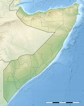 Uur Caleed Location in Somalia. | |
| Coordinates: 10°34′16.3″N 49°42′32.8″E / 10.571194°N 49.709111°ECoordinates: 10°34′16.3″N 49°42′32.8″E / 10.571194°N 49.709111°E | |
| Country |
|
| Regional State |
|
| Region | Bari |
| Sub Region | Uur Caleed |
| Founded | 14th century |
| Time zone | EAT (UTC+3) |
Uur Caleed is an area in Somalia, situated between Kalabayr and Iskushuban, and covers 2/3 of the bari region in Somalia.
Geographical location[1]
- Location: Somalia, East Africa, Africa
- Latitude: 10° 34' 16.3" (10.5712°) north
- Longitude: 49° 42' 32.8" (49.7091°) east
- Average elevation: 433 meters (1,421 feet)
Major Towns In Uur Caleed
- Ufeyn – The Capital
- Kobdhexaad
- Jeedaal
- Tisjiic
- Geesaqabad
- Moqor
- Tuula Mirood
- Dawacaley
- Kalabayr
- Xinka
- And Many Others
Education In Uur Caleed
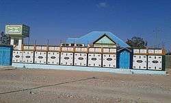
- SH. Abdalla Ibrahim Secondary School.[2]
- Thirteen (13) Primary And Intermediate Schools Include (Godane, Kobdhexaad, Daalrul-Cilmi, Jeedaal, Tisjiic, Moqor And Etc.)[3]
- Institute Of Language Studies
- Vocational Schools
- Computer Training Institutions
- Institute Of Health Science
- Islamic Studies Institution
Water Supply In Uur Caleed
Two water pipelines have been rehabilitated to serve 25,000 residents of Ufeyn District in Bari Region, water access points such as boreholes, shallow wells, and hand taps are being constructed. Water sources include (ufeyn hoose, ufeyn sare, dibir, jidmoxor, and so on)
Sites
Sites in Uur Caleed:
 farms in ufeyn
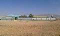 sh. abdalla ibrahim secondary
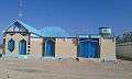 sites in ufeyn
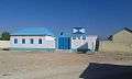 MCH in ufeyn
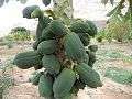 uurcaleed sites
References
- ↑ Uur caleed, Somalia
- ↑ "Puntland - Secondary schools". Ministry of Education of Puntland. Retrieved 26 May 2013.
- ↑ "Puntland - Primary schools". Ministry of Education of Puntland. Retrieved 26 May 2013.
This article is issued from Wikipedia - version of the 8/10/2016. The text is available under the Creative Commons Attribution/Share Alike but additional terms may apply for the media files.