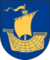
Västervik Municipality
| Västervik Municipality Västerviks kommun | ||
|---|---|---|
| Municipality | ||
| ||
 | ||
| Country | Sweden | |
| County | Kalmar County | |
| Seat | Västervik | |
| Area[1] | ||
| • Total | 3,596.85 km2 (1,388.75 sq mi) | |
| • Land | 1,874.43 km2 (723.72 sq mi) | |
| • Water | 1,722.42 km2 (665.03 sq mi) | |
| Area as of January 1, 2014. | ||
| Population (June 30, 2016)[2] | ||
| • Total | 36,274 | |
| • Density | 10/km2 (26/sq mi) | |
| Time zone | CET (UTC+1) | |
| • Summer (DST) | CEST (UTC+2) | |
| ISO 3166 code | SE | |
| Province | Småland | |
| Municipal code | 0883 | |
| Website | www.vastervik.se | |

Västervik Municipality (Swedish: Västerviks kommun) is a municipality in Kalmar County, south-eastern Sweden, with its seat in the city of Västervik.
The present municipality was created in 1971, when the former City of Västervik was amalgamated with eight surrounding rural municipalities.
Localities
There are 11 urban areas (also called localities, Swedish: tätorter) in Västervik Municipality.
In the table the localities are listed according to the size of the population as of December 31, 2005. The municipal seat is in bold characters.
| # | Locality | Population |
|---|---|---|
| 1 | Västervik | 20,694 |
| 2 | Gamleby | 2,805 |
| 3 | Ankarsrum | 1,337 |
| 4 | Överum | 1,270 |
| 5 | Gunnebo | 989 |
| 6 | Piperskärr | 462 |
| 7 | Loftahammar | 432 |
| 8 | Hjorted | 338 |
| 9 | Edsbruk | 311 |
| 10 | Totebo | 256 |
| 11 | Almvik | 202 |
Government and politics
Distribution of the 57 seats in the municipal council after the 2010 election:
- Moderate Party 21
- Social Democratic Party 21
- Centre Party 4
- Green Party 2
- Liberal People's Party 2
- Left Party 2
- Sweden Democrats 2
- Socialisterna 1
- Kommunpartiet VDM 1
- Christian Democrats 1
Results of the Swedish general election, 2010 in Västervik:
- Social Democratic Party 39.9%
- Moderate Party 25.8%
- Centre Party 7.3%
- Liberal People's Party 5.5%
- Green Party 5.4%
- Sweden Democrats 5.2%
- Left Party 5.1%
- Christian Democrats 4.7%
International relations
Twin towns — Sister cities
The municipality is twinned with:[3]
References
- ↑ "Statistiska centralbyrån, Kommunarealer den 1 januari 2014" (Microsoft Excel) (in Swedish). Statistics Sweden. Retrieved 2014-04-18.
- ↑ "Folkmängd i riket, län och kommuner 30 juni 2016" (in Swedish). Statistics Sweden. August 17, 2016. Retrieved August 17, 2016.
- ↑ http://www.vastervik.se/templates/VVKommun_Page.aspx?id=2350
External links
- Västervik Municipality - Official site
- Västervik Tourism Official site - In Swedish, English and German
- (Swedish) Article Västervik in Nordisk Familjebok
- Coat of arms
Coordinates: 57°45′N 16°38′E / 57.750°N 16.633°E
