Veselí nad Lužnicí
| Veselí nad Lužnicí | |||
| Town | |||
|
|||
| Country | Czech Republic | ||
|---|---|---|---|
| Region | South Bohemian | ||
| District | Tábor | ||
| Little District | Soběslav | ||
| Rivers | Lužnice, Nežárka | ||
| Elevation | 407 m (1,335 ft) | ||
| Coordinates | CZ 49°11′12″N 14°41′56″E / 49.18667°N 14.69889°ECoordinates: CZ 49°11′12″N 14°41′56″E / 49.18667°N 14.69889°E | ||
| Area | 29.56 km2 (11.41 sq mi) | ||
| Population | 6,598 (2007-12-31) | ||
| Density | 223/km2 (578/sq mi) | ||
| First mentioned | 1259 | ||
| Mayor | Jaromír Novák | ||
| Timezone | CET (UTC+1) | ||
| - summer (DST) | CEST (UTC+2) | ||
| Postal code | 391 81 | ||
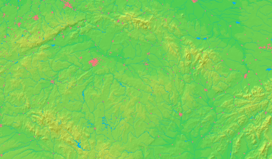
  Location in the Czech Republic | |||
| Wikimedia Commons: Veselí nad Lužnicí | |||
| Website: www.veseli.cz | |||
Veselí nad Lužnicí (Czech pronunciation: [ˈvɛsɛliː ˈnadluʒɲɪtsiː]; German: Wesseli an der Lainsitz) is a town in South Bohemia, Czech Republic and has population of 6,600. It lies on the confluence of the Lužnice and Nežárka rivers.
The town is situated on the northern edge of the Třeboň basin (407 meters above sea level), and is known for its fish ponds and pine forests. Since the late 19th century, it has been an important railway junction between České Budějovice, Tábor, Třeboň and Jindřichův Hradec. The railway station remains one of the biggest local employers. The sand, concrete and food industries are also long-established in the town.
History
The town was first mentioned in 1259 as a hamlet and a redoubt on the salt road from Austria to Prague. Emperor Charles IV gave it the status of a town in 1362. In the 15th century, the town saw many fires and was looted by the Hussites. It was Petr Vok from the House of Rosenberg, a famous fish pond founder and supporter, who let the town grow again a hundred years later. The Thirty Years' War (1618-1648) damaged the town badly again - with only about 50 people remaining. New development came with the Švamberk dynasty in the second half of the 17th century. Veselí stayed in their possession until the end of the First World War in 1918.
It was originally two separate towns - Veselí nad Lužnicí and Mezimostí nad Nežárkou (a town since 1908). They were joined in 1943 to make one town under the present name.
Sights
The Church of Exaltation of the Holy Cross (kostel Povýšení svatého Kříže), the oldest monument from the 13th century, dominates the town. The renaissance Old Town Hall is the main building on the square and together with the Museum forms an architectonic unit. Chapel of St. Mark (1754) and the Little Church of St. Florian in Mezimostí (1718) are other notable buildings.
Veselí nad Lužnicí is a popular summer resort, especially for canoers and hikers. Another attraction are the man-made lakes south of the town; these were created in the 1970s and 1980s when huge amounts of sand were quarried. A nature trail runs around them. Horusický rybník, the second largest fish pond in the Czech Republic (415 ha) lies southwest of the town. The recreational area is part of the protected area of Třeboňsko, which was declared a UNESCO biosphere reserve.
Notable residents, past and present
- Karel Červinka, poet and prose writer
- Karel Traxler, chess master
- Saša Večtomov, cellist
- Vladimír Večtomov, guitarist
- Gustav Vránek, violinist and composer
- Karel Weis, composer, collector of folk songs and folklorist
External links
| Wikimedia Commons has media related to Veselí nad Lužnicí. |

