Wepener
| Wepener | |
|---|---|
|
Wepener | |
 Wepener  Wepener  Wepener
| |
| Coordinates: 29°44′S 27°02′E / 29.733°S 27.033°ECoordinates: 29°44′S 27°02′E / 29.733°S 27.033°E | |
| Country | South Africa |
| Province | Free State |
| District | Xhariep |
| Municipality | Naledi |
| Established | 1875[1] |
| Government | |
| • Type | Municipality |
| • Mayor | Rose Mompati [2] (ANC) |
| Area[3] | |
| • Total | 38.6 km2 (14.9 sq mi) |
| Population (2011)[3] | |
| • Total | 9,553 |
| • Density | 250/km2 (640/sq mi) |
| Racial makeup (2011)[3] | |
| • Black African | 94.0% |
| • Coloured | 3.1% |
| • Indian/Asian | 0.9% |
| • White | 1.8% |
| • Other | 0.2% |
| First languages (2011)[3] | |
| • Sotho | 84.6% |
| • Afrikaans | 7.0% |
| • English | 3.0% |
| • Xhosa | 2.6% |
| • Other | 2.8% |
| Postal code (street) | 9944 |
| PO box | 9944 |
| Area code | 051 |
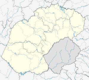
Wepener is a village in the Free State, South Africa, located near the border with Lesotho.
History
The town is named after Louw Wepener, the leader of the Boers in their war with the Basotho chief Moshoeshoe I in 1865. It was founded in 1867 on the banks of Jammersbergspruit, a tributary of the Caledon River. The Jammerberg (Mountain of Sorrow) towers over the village. Louw Wepener was killed in 1865 while trying to storm Moshoeshoe's stronghold of Thaba Bosiu.One of the local schools is also named after him.
Wepener was the southernmost of several settlements founded by the Free Staters in the "conquered territories" to prevent the Basotho from resettling the land taken from them during the war of 1865. The Dutch Reformed parish was established in 1870 and the town was granted its first management board in 1875. The beautiful sandstone Dutch Reformed church was designed by a Welsh architect. The design of the church reflected his heritage - the Prince of Wales's feathers adorn the steeple.
During the Anglo-Boer War, a British garrison of 2000 men under Colonel E. H. Dalgety was besieged by the Boer commandos under the command of General Christiaan de Wet at Jammersdrift on the Caledon River. The siege lasted 17 days, until reinforcements arrived on April 25, 1900 to end the battle in favour of the British.
The district of Wepener was the scene of many battles, raids and skirmishes during the 19th century. Many graves, mostly without identification, still exist as reminders of the events in the valley of Jammerbergspruit during this stormy period.
Present
Today the town is a commercial center for a 1,725 square km district where mixed farming is practised. Farming activities include cattle and sheep ranching, dairy farming and the cultivation of wheat and maize.
There are two hotels in Wepener, The Wepener Hotel and the Lord Fraser's Guest House. Lord Fraser's was the summer residence of Lord Ian Fraser of Lonsdale. He was the chairman of the board of the once powerful retail business, Frasers, in Lesotho. The Fleetwood Country Inn is situated about 5 miles outside the town.There are leisure facilities at the nearby Knelpoort and Welbedacht dams.
Other facilities in the village include various general stores, builders merchant, sports club, furniture stores, butchery, 2 banks, doctors surgeries, post office, fuel stations, police station and Magistrate's Court.
References
- ↑ "Chronological order of town establishment in South Africa based on Floyd (1960:20-26)" (PDF). pp. xlv–lii.
- ↑ Free State Tourism.org
- 1 2 3 4 Sum of the Main Places Wepener and Qibing from Census 2011.
 This article incorporates text from a publication now in the public domain: Chisholm, Hugh, ed. (1911). "Wepener". Encyclopædia Britannica. 28 (11th ed.). Cambridge University Press.
External links
 |
Bloemfontein Dewetsdorp | Maseru |  | |
| Reddersburg | |
Lesotho | ||
| ||||
| | ||||
| Smithfield | Zastron | Mafeteng |

.svg.png)