Wila Qullu (Sabaya)
This article is about the mountain in the Sabaya Municipality, Oruro Department, Bolivia. For other uses, see Wila Qullu.
| Wila Qullu | |
|---|---|
 Wila Qullu Location in Bolivia | |
| Highest point | |
| Elevation | 4,600 m (15,100 ft) |
| Coordinates | 18°47′05″S 68°50′42″W / 18.78472°S 68.84500°WCoordinates: 18°47′05″S 68°50′42″W / 18.78472°S 68.84500°W |
| Geography | |
| Location | Bolivia, Oruro Department, Sabaya Province |
| Parent range | Andes, Cordillera Occidental |
Wila Qullu (Aymara wila red, blood, qullu mountain,[1][2] "red mountain", hispanicized spelling Wila Khollu, Wila Kkollu) is a mountain in the Bolivian Andes, about 4,600 metres (15,092 ft) high. It situated in the Cordillera Occidental near the border with Chile. It is located in the Oruro Department, Sabaya Province, Sabaya Municipality, Julo Canton. Wila Qullu lies south-east of the volcano Pukintika and north-west of the mountain Phaq'u Q'awa.[3][4]
See also
References
- ↑ "Diccionario Quechua - Aymara al español". katari.org. Retrieved August 13, 2014.
- ↑ Radio San Gabriel, "Instituto Radiofonico de Promoción Aymara" (IRPA) 1993, Republicado por Instituto de las Lenguas y Literaturas Andinas-Amazónicas (ILLLA-A) 2011, Transcripción del Vocabulario de la Lengua Aymara, P. Ludovico Bertonio 1612 (Spanish-Aymara-Aymara-Spanish dictionary)
- ↑ Bolivian IGM map 1:250,000 Corque SE-19-11
- ↑ "Sabaya". Retrieved August 13, 2014. Sabaya Municipality: population data and map showing "Wila Kkollu"
Capital: Oruro | ||
| Provinces | 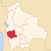 | |
| Municipalities (and seats) |
| |
This article is issued from Wikipedia - version of the 12/7/2015. The text is available under the Creative Commons Attribution/Share Alike but additional terms may apply for the media files.