Zemer
Zemer
| |
|---|---|
| Hebrew transcription(s) | |
| • ISO 259 | Zemr |
 | |
  Zemer | |
| Coordinates: 32°22′1.28″N 35°2′7.05″E / 32.3670222°N 35.0352917°ECoordinates: 32°22′1.28″N 35°2′7.05″E / 32.3670222°N 35.0352917°E | |
| Grid position | 154/197 PAL |
| District | Central |
| Founded | 1988 (merger) |
| Government | |
| • Type | Local council (from 1988) |
| Area | |
| • Total | 8,203 dunams (8.203 km2 or 3.167 sq mi) |
| Population (2015)[1] | |
| • Total | 6,486 |
| Name meaning | Khurbet Ibthan; meaning "Ruin of gardens, or of soft soil"[2] |
Zemer (Hebrew: זמר; Arabic: زيمر) is an Arab local council in the Central District of Israel. It is located in the Arab Triangle area, between Baqa al-Gharbiyye and Bat Hefer on Road 574. Zemer is the result of a merger of four villages – Bir al-Sika, Ibtan, Marja and Yama, - in 1988
History
Potsherds dating from the Hellenistic, Roman and Byzantine era have been found at Ibtan.[3]
Ottoman era
Yama and Ibtan appeared in Ottoman tax registers compiled in 1596, in the Nahiyas of Qaqun and Jabal Sami, respectively, of the Nablus Liwa. Yama had a population of 18 Muslim households and 5 bachelors, while Ibtan was indicated as empty even though it paid taxes.[4]
In 1882, in the Palestine Exploration Fund's Survey of Western Palestine, only Khurbet Ibthan was noted, with "traces of ruins and a well."[5]
British Mandate era
In the 1922 census of Palestine conducted by the British Mandate authorities, Bir al-Sikka had a population of 36, Ibthan 56 and Yamma 48, all Muslims.[6]
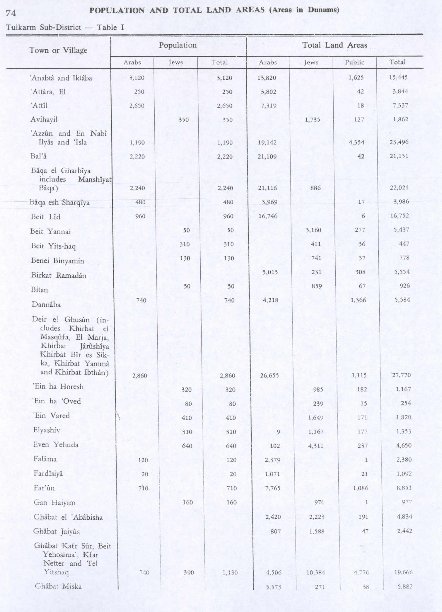
Prior to 1948, all four villages were administratively related to modern-day Palestinian town of Deir al-Ghusun.[7][8]
Post-1948
Zemer's population at the end of 2009 was 5,700,[9] and its jurisdiction is 8,203 dunams.[10] The population increased to 6,375 in 2014.[11]
References
- ↑ "List of localities, in Alphabetical order" (PDF). Israel Central Bureau of Statistics. Retrieved 16 October 2016.
- ↑ Palmer, 1881, p. 185
- ↑ Abu Fana, 2006, Ibthan
- ↑ Hütteroth and Abdulfattah, 1977, p. 127, p. 138.
- ↑ Conder and Kitchener, 1882, SWP II, p. 196
- ↑ Barron, 1923, Table IX, Sub-district of Tulkarem, p. 28
- ↑ Department of Statistics, 1945, p. 20
- ↑ Government of Palestine, Department of Statistics. Village Statistics, April, 1945. Quoted in Hadawi, 1970, p. 74
- ↑ "Table 3 - Population of Localities Numbering Above 2,000 Residents and Other Rural Population" (PDF). Israel Central Bureau of Statistics. 2010-06-30. Retrieved 2011-05-30.
- ↑ "Local Authorities in Israel 2005, Publication #1295 - Municipality Profiles - Zemer" (PDF) (in Hebrew). Israel Central Bureau of Statistics. Retrieved 2008-06-09.
- ↑ "לוח 3.- אוכלוסייה( 1), ביישובים שמנו מעל 2,000 תושבים( 2) ושאר אוכלוסייה כפרית Population (1) of localities numbering above 2,000 Residents (2) and other rural population". Archived from the original on 3 October 2015. Retrieved 2 October 2015.
Bibliography
 |
Wikimedia Commons has media related to Zemer. |
- Abu Fana, Mohammed (2006-01-23). "Ibthan Final Report" (118). Hadashot Arkheologiyot – Excavations and Surveys in Israel.
- Barron, J. B., ed. (1923). Palestine: Report and General Abstracts of the Census of 1922. Government of Palestine.
- Conder, Claude Reignier; Kitchener, Herbert H. (1882). The Survey of Western Palestine: Memoirs of the Topography, Orography, Hydrography, and Archaeology. 2. London: Committee of the Palestine Exploration Fund.
- Department of Statistics (1945). Village Statistics, April, 1945. Government of Palestine.
- Hadawi, Sami (1970). Village Statistics of 1945: A Classification of Land and Area ownership in Palestine. Palestine Liberation Organization Research Centre.
- Hütteroth, Wolf-Dieter; Abdulfattah, Kamal (1977). Historical Geography of Palestine, Transjordan and Southern Syria in the Late 16th Century. Erlanger Geographische Arbeiten, Sonderband 5. Erlangen, Germany: Vorstand der Fränkischen Geographischen Gesellschaft. ISBN 3-920405-41-2.
- Masarwa, Durar (2011-08-10). "Ibthan (North) Final Report" (123). Hadashot Arkheologiyot – Excavations and Surveys in Israel.
- Masarwa, Durar (2011-09-07). "Ibthan (North) Final Report" (123). Hadashot Arkheologiyot – Excavations and Surveys in Israel.
- Masarwa, Durar (2011-11-29). "Ibthan Final Report" (123). Hadashot Arkheologiyot – Excavations and Surveys in Israel.
- Masarwa, Durar (2012-12-06). "Ibthan Final Report" (124). Hadashot Arkheologiyot – Excavations and Surveys in Israel.
- Masarwa, Durar (2015-03-09). "Ibthan Final Report" (127). Hadashot Arkheologiyot – Excavations and Surveys in Israel.
- Masarwa, Durar (2016-03-31). "Ibthan Final Report" (128). Hadashot Arkheologiyot – Excavations and Surveys in Israel.
- Palmer, E. H. (1881). The Survey of Western Palestine: Arabic and English Name Lists Collected During the Survey by Lieutenants Conder and Kitchener, R. E. Transliterated and Explained by E.H. Palmer. Committee of the Palestine Exploration Fund.
- Toueg, Ron (2010-09-05). "Ibthan Final Report" (122). Hadashot Arkheologiyot – Excavations and Surveys in Israel.
External links
- Welcome To Bir al-Sikka
- Welcome To Kh. Ibthan
- Welcome To al-Marja
- Welcome To Khirbat Yamma
- Survey of Western Palestine, Map 11: IAA, Wikimedia commons