Bambey Department
| Bambey | |
|---|---|
| Department | |
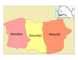 Location in the Diourbel Region | |
| Country |
|
| Region | Diourbel Region |
| Capital | Bambey |
| Area | |
| • Total | 1,351 km2 (522 sq mi) |
| Population (2013 census) | |
| • Total | 299,476 |
| • Density | 220/km2 (570/sq mi) |
| Time zone | GMT (UTC+0) |
Bambey Department is one of the 45 departments of Senegal, one of the three making up the Diourbel Region.
Its capital and the only commune in the department is Bambey.
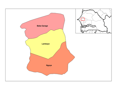
The rural districts (communautés rurales) are:
- Baba Garage Arrondissement:
- Baba-Garage
- Dinguiraye
- Keur Samba Kane
- Lambaye Arrondissement:
- Gawane
- Lambaye
- N'Gogom
- Refane
- Ngoye Arrondissement:
- Dangalma
- N'Dondol
- N'Goye
- Thiakar
- Historic sites [1]
- Tumulus of Lambaye (sites of the teignes (moths?))
- Tène-Mbambey, battlefield at Mbambey Sérère
- Gouye Ndeung, baobab tree on the site of the Battle of Sanghay at Lambaye
- Battlefield at Sanghay-Mbol
- Site of battle of Ndiarème, near Sindiane
- Mausoleum of Cheikh Anta Diop at Thieytou, Dinguiraye
- Tumulus of Pouniar, Lambaye Arrondissement
- Tumulus of Gallo Peye, Ndangalma
- Tumulus of Peul Lamassas, Ndangalma
References
- ↑ Historic sites ]
Coordinates: 14°43′12″N 16°36′41″W / 14.72000°N 16.61139°W
This article is issued from Wikipedia - version of the 11/22/2016. The text is available under the Creative Commons Attribution/Share Alike but additional terms may apply for the media files.