Bottoms Bridge, Virginia
Chickahominy River and Rte. 60
Coordinates: 37°30′39″N 77°11′34″W / 37.51083°N 77.19278°W
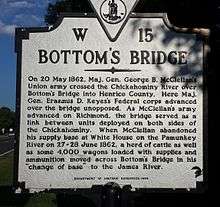
Bottoms Bridge is a small unincorporated community in New Kent County, Virginia, United States. Located on U.S. Route 60 and State Route 33 in modern times, it was named for a crossing of the Chickahominy River between New Kent and Henrico County.

This article is issued from Wikipedia - version of the 9/4/2016. The text is available under the Creative Commons Attribution/Share Alike but additional terms may apply for the media files.