Cedar, Iowa
Coordinates: 41°12′45″N 92°31′25″W / 41.2125°N 92.5235°W
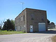
Cedar Hall
Cedar is an unincorporated community in southeastern Mahaska County, Iowa, United States. It lies along Iowa Highway 23 southeast of the city of Oskaloosa, the county seat of Mahaska County.[1] Its elevation is 814 feet (248 m), and it is located at 41°12′45″N 92°31′25″W / 41.21250°N 92.52361°W (41.2125,-92.5235).[2] Although Cedar is unincorporated, it has a post office with the ZIP code of 52543,[3] which opened on 19 June 1874.[4] Cedar also has a Methodist church and a grain elevator. Manard serves as the self-appointed mayor of the community.
References
- ↑ Rand McNally. The Road Atlas '08. Chicago: Rand McNally, 2008, p. 39.
- ↑ U.S. Geological Survey Geographic Names Information System: Cedar, Iowa
- ↑ Zip Code Lookup
- ↑ U.S. Geological Survey Geographic Names Information System: Cedar Post Office
Municipalities and communities of Mahaska County, Iowa, United States | ||
|---|---|---|
| Cities | ||
| Unincorporated communities | ||
| Footnotes | ‡This populated place also has portions in an adjacent county or counties | |
This article is issued from Wikipedia - version of the 9/7/2016. The text is available under the Creative Commons Attribution/Share Alike but additional terms may apply for the media files.