Ciénaga Grande de Santa Marta
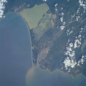
In this satellite image, the Ciénaga Grande de Santa Marta is the greenish area at top, bordered by the Caribbean Sea on the left.
The Ciénaga Grande de Santa Marta (Spanish for Large Marsh of Saint Martha) is the largest of the swampy marshes located in Colombia between the Magdalena River and the Sierra Nevada de Santa Marta. It has an area of 4280 km2 and belongs to the outer delta system of the Madgalena River [1] and is separated from the Caribbean Sea by a narrow, sandy artificial spit built in the 1950s[2] on which is situated coastal route 90 from Barranquilla to Santa Marta. The marsh's large lagoon is connected to the Caribbean Sea via a narrow strait (the La Barra channel) located between the town of Pueblo Viejo and the city of Ciénaga.
|
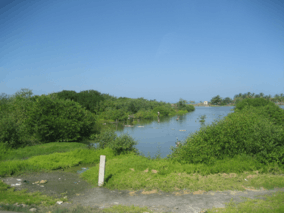

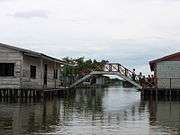

Panorama of Ciénaga Grande de Santa Marta from 2006-10-12
References
External links
- UNESCO Biosphere Reserve information
- (Spanish) Colombia National Park system website
- At Coastal Wiki
Coordinates: 10°52′N 74°25′W / 10.867°N 74.417°W
Treasures of Colombia | |||||||||||||||||||||||||||||||||||||||||||||||||||||
|---|---|---|---|---|---|---|---|---|---|---|---|---|---|---|---|---|---|---|---|---|---|---|---|---|---|---|---|---|---|---|---|---|---|---|---|---|---|---|---|---|---|---|---|---|---|---|---|---|---|---|---|---|---|
Archaeological sites · Colombia magia salvaje · National monuments · National parks · World Heritage sites | |||||||||||||||||||||||||||||||||||||||||||||||||||||
| |||||||||||||||||||||||||||||||||||||||||||||||||||||
| |||||||||||||||||||||||||||||||||||||||||||||||||||||
| |||||||||||||||||||||||||||||||||||||||||||||||||||||
Source: Wills, Fernando et al. 2001. Nuestro patrimonio - 100 tesoros de Colombia - Our heritage - 100 treasures of Colombia, 1-311. El Tiempo. | |||||||||||||||||||||||||||||||||||||||||||||||||||||
This article is issued from Wikipedia - version of the 11/16/2016. The text is available under the Creative Commons Attribution/Share Alike but additional terms may apply for the media files.