Crowsnest Lake (Alberta)
| Crowsnest Lake | |
|---|---|
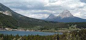
 Crowsnest Lake, looking east toward Crowsnest Mountain. | |
| Location | Municipality of Crowsnest Pass, Alberta |
| Coordinates | 49°37′58″N 114°38′16″W / 49.63278°N 114.63778°WCoordinates: 49°37′58″N 114°38′16″W / 49.63278°N 114.63778°W |
| Basin countries | Canada |
| Max. length | 0.9 km (0.56 mi) |
| Max. width | 3 km (1.9 mi) |
| Surface area | 1.19 km2 (0.46 sq mi) |
| Average depth | 13.5 m (44 ft) |
| Max. depth | 27.4 m (90 ft) |
| Surface elevation | 1,357 m (4,452 ft) |
| References | Crowsnest Lake |
Crowsnest Lake is a lake in southwestern Alberta, Canada. It lies near the summit of the Crowsnest Pass in the southern Canadian Rockies and gives rise to the Crowsnest River.[1]
References
- ↑ Canada NTS Map 82G/10 Crowsnest, 1:50,000.
This article is issued from Wikipedia - version of the 9/4/2015. The text is available under the Creative Commons Attribution/Share Alike but additional terms may apply for the media files.

