Denio, Nevada
| Denio, Nevada | |
|---|---|
| Census-designated place | |
_a_half_mile_north_of_the_Oregon_border.JPG) | |
  Denio, Nevada Location within the state of Nevada | |
| Coordinates: 41°59′24″N 118°37′59″W / 41.99000°N 118.63306°WCoordinates: 41°59′24″N 118°37′59″W / 41.99000°N 118.63306°W | |
| Country | United States |
| State | Nevada and Oregon |
| County | Humboldt and Harney |
| Area | |
| • Total | 16.1 sq mi (41.7 km2) |
| • Land | 16.1 sq mi (41.7 km2) |
| • Water | 0 sq mi (0 km2) |
| Elevation | 4,207 ft (1,282 m) |
| Population (2010) | |
| • Total | 47 |
| • Density | 2.9/sq mi (1.1/km2) |
| Time zone | Pacific (PST) (UTC-8) |
| • Summer (DST) | PDT (UTC-7) |
| ZIP code | 89404 |
| FIPS code | 32-18500 |
| GNIS feature ID | 845425 |
Denio is a census-designated place (CDP) that lies on the Nevada-Oregon state line in Humboldt County, Nevada, in the United States.[1] There was formerly a Denio post office north of the state line in Harney County, Oregon.[2] The population of the CDP, which is entirely in Nevada, was 47 at the 2010 census;[3] additional development considered to be Denio extends into Oregon. The CDP includes a post office, a community center, a library, and the Diamond Inn Bar, the center of the town's social life.[4] Recreational activities available in the Denio area include fishing, opal mining, rockhounding, hunting, and visiting the hot springs.[4] The Humboldt County School District operates the Denio School, a kindergarten-eighth grade (K-8) school, on the Nevada side of the state line.[4]
Denio Junction is about two miles (3 km) south of Denio, at the junction of State Route 140 and State Route 292.[5] Denio Junction's motel provides food, groceries, and lodging, and historically provided gasoline but hasn't since at least mid 2013.[4] Air transportation is available via the Denio Junction Airport, a two-runway graded airstrip.[6] There is no scheduled air or ground transportation serving this field, which is a short walk from any part of Denio Junction.[6]
History
Denio was named for Aaron Denio, who settled in the area in 1885.[7] Aaron Denio was born in 1824 in Illinois and traveled to California in 1860.[7] He worked in milling, mining, and farming in Nevada and California for 25 years before settling near the Oregon-Nevada border.[7] He died at Denio in 1907.[7] Denio post office was established in Oregon in 1888.[7] After World War II a number of businesses relocated south of the state line to take advantage of Nevada's more liberal liquor and gambling laws.[7] The post office moved and reopened in Nevada in 1950.[7]
See also
References
- ↑ "Denio". Geographic Names Information System. United States Geological Survey. December 12, 1980. Retrieved March 27, 2012.
- ↑ "Denio Post Office (historical)". Geographic Names Information System. United States Geological Survey. August 1, 1994. Retrieved March 27, 2012.
- ↑ "Geographic Identifiers: 2010 Demographic Profile Data (G001): Denio CDP, Nevada". U.S. Census Bureau, American Factfinder. Retrieved January 24, 2013.
- 1 2 3 4 "Denio, Nevada". travelNevada.com. Nevada Commission on Tourism. Retrieved March 27, 2012.
- ↑ "Denio Junction". Geographic Names Information System. United States Geological Survey. December 12, 1980. Retrieved March 27, 2012.
- 1 2 3 4 5 6 7 McArthur, Lewis A.; McArthur, Lewis L. (2003) [1928]. Oregon Geographic Names (7th ed.). Portland, Oregon: Oregon Historical Society Press. p. 278. ISBN 978-0875952772.
Further reading
- Kirchmeier, Mark (June 16, 1979). "Denio never scared Reno, Vegas". The Oregonian.
External links
- "Denio, Nevada". Archived from the original on July 24, 2008.
- Images of Denio from Panoramio
- Images of Denio from Flickr
Municipalities and communities of Humboldt County, Nevada, United States | ||
|---|---|---|
| City | 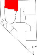 | |
| CDPs | ||
| Unincorporated community | ||
| Indian Colony | ||
| Indian Reservation | ||
| Ghost towns |
| |
Municipalities and communities of Harney County, Oregon, United States | ||
|---|---|---|
| Cities | 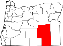 | |
| CDP | ||
| Other unincorporated communities | ||
| Indian reservation | ||
| Ghost town | ||