Ebony Wall
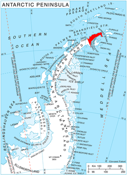
Location of Trinity Peninsula.
Ebony Wall (63°55′S 59°9′W / 63.917°S 59.150°WCoordinates: 63°55′S 59°9′W / 63.917°S 59.150°W) is a dark, nearly vertical rock wall in Antarctica, which rises about 400 metres (1,300 ft) at the head of Pettus Glacier. The wall is about 2 nautical miles (4 km) long and forms a part of the western escarpment of Detroit Plateau near the base of Trinity Peninsula. It was charted in 1948 by the Falkland Islands Dependencies Survey who applied the descriptive name.[1]
Map
- Trinity Peninsula. Scale 1:250000 topographic map No. 5697. Institut für Angewandte Geodäsie and British Antarctic Survey, 1996.
References
- ↑ "Ebony Wall". Geographic Names Information System. United States Geological Survey. Retrieved 2012-02-23.
![]() This article incorporates public domain material from the United States Geological Survey document "Ebony Wall" (content from the Geographic Names Information System).
This article incorporates public domain material from the United States Geological Survey document "Ebony Wall" (content from the Geographic Names Information System).
This article is issued from Wikipedia - version of the 11/21/2015. The text is available under the Creative Commons Attribution/Share Alike but additional terms may apply for the media files.