Pettus Glacier
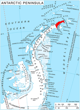
Location of Trinity Peninsula.
Pettus Glacier (63°48′S 59°4′W / 63.800°S 59.067°WCoordinates: 63°48′S 59°4′W / 63.800°S 59.067°W) is a narrow deeply entrenched glacier 9 nautical miles (17 km) long, which flows north from Ebony Wall into Gavin Ice Piedmont between Poynter Hill and Tinsel Dome, Trinity Peninsula. Named by United Kingdom Antarctic Place-Names Committee (UK-APC) for Robert N. Pettus, aircraft pilot with Falkland Islands and Dependencies Aerial Survey Expedition (FIDASE), 1956-57.
Map
- Trinity Peninsula. Scale 1:250000 topographic map No. 5697. Institut für Angewandte Geodäsie and British Antarctic Survey, 1996.
References
![]() This article incorporates public domain material from the United States Geological Survey document "Pettus Glacier" (content from the Geographic Names Information System).
This article incorporates public domain material from the United States Geological Survey document "Pettus Glacier" (content from the Geographic Names Information System).
This article is issued from Wikipedia - version of the 11/21/2015. The text is available under the Creative Commons Attribution/Share Alike but additional terms may apply for the media files.