Freeburn, Kentucky
| Freeburn | |
|---|---|
| Unincorporated community & census-designated place | |
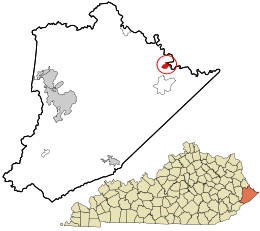 Location in Pike County and the state of Kentucky. | |
| Coordinates: 37°33′52″N 82°8′30″W / 37.56444°N 82.14167°WCoordinates: 37°33′52″N 82°8′30″W / 37.56444°N 82.14167°W | |
| Country | United States |
| State | Kentucky |
| County | Pike |
| Elevation | 725 ft (221 m) |
| Population (2010) | |
| • Total | 399 |
| Time zone | Eastern (EST) |
| • Summer (DST) | EST (UTC) |
| ZIP codes | 41528 |
| GNIS feature ID | 492497[1] |
Freeburn is a census-designated place, unincorporated community and coal town in Pike County, Kentucky, United States.
A post office called Liss was established in the community in 1911. In 1932, it was renamed Freeburn supposedly for a freeburning coal seam fire.[2]
Climate
The climate in this area is characterized by hot, humid summers and generally mild to cool winters. According to the Köppen Climate Classification system, Freeburn has a humid subtropical climate, abbreviated "Cfa" on climate maps.[3]
References
- ↑ U.S. Geological Survey Geographic Names Information System: Freeburn, Kentucky
- ↑ Rennick, Robert M. (1987). Kentucky Place Names. University Press of Kentucky. p. 110. Retrieved 2013-04-28.
- ↑ Climate Summary for Freeburn, Kentucky
This article is issued from Wikipedia - version of the 10/11/2016. The text is available under the Creative Commons Attribution/Share Alike but additional terms may apply for the media files.