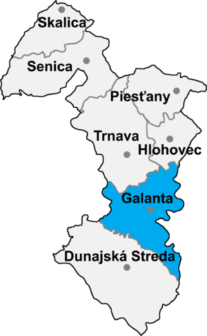
Galanta District
| Galanta District | |
|---|---|
| District | |
 | |
| Country | Slovakia |
| Region (kraj) | Trnava Region |
| Area | |
| • Total | 641 km2 (247 sq mi) |
| Population (2001) | |
| • Total | 94,533 |
| • Density | 150/km2 (380/sq mi) |
| Time zone | CET (UTC+1) |
| • Summer (DST) | CEST (UTC+2) |
Galanta District (okres Galanta) is a district in the Trnava Region of western Slovakia.[1] The district lies on the lowland area. Through the district area flows River Váh and its level is regulated by dam in Kráľová nad Váhom. Historically the economy of the district area had relied on agriculture, now the production of white goods is of utmost importance. The district center is its largest town Galanta and there are 36 municipalities, in three of them are towns.
Municipalities
- Abrahám
- Čierna Voda
- Čierny Brod
- Dolná Streda
- Dolné Saliby
- Dolný Chotár
- Galanta
- Gáň
- Horné Saliby
- Hoste
- Jánovce
- Jelka
- Kajal
- Košúty
- Kráľov Brod
- Malá Mača
- Matúškovo
- Mostová
- Pata
- Pusté Sady
- Pusté Úľany
- Sereď
- Sládkovičovo
- Šalgočka
- Šintava
- Šoporňa
- Tomášikovo
- Topoľnica
- Trstice
- Váhovce
- Veľká Mača
- Veľké Úľany
- Veľký Grob
- Vinohrady nad Váhom
- Vozokany
- Zemianske Sady
References
- ↑ Ústredný portál verejnej správy Slovenskej republiky. "Okres Galanta". Ministry of Finance of the Slovak Republic. Retrieved 2012-08-16.
External links
Coordinates: 48°11′22″N 17°43′36″E / 48.18944°N 17.72667°E
This article is issued from Wikipedia - version of the 5/6/2016. The text is available under the Creative Commons Attribution/Share Alike but additional terms may apply for the media files.
