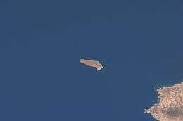
Gavdopoula
| Native name: Γαυδοπούλα | |
|---|---|
 The islet of Gavdopoula | |
|
| |
| Geography | |
| Coordinates | 34°53′N 24°01′E / 34.883°N 24.017°E |
| Archipelago | Cretan Islands |
| Area | 2 km2 (0.77 sq mi) |
| Administration | |
|
Greece | |
| Region | Crete |
| Regional unit | Chania |
| Demographics | |
| Population | 3 (2001) |
| Pop. density | 2 /km2 (5 /sq mi) |
| Vehicle registration | ΧΝ |
Gavdopoula (Greek: Γαυδοπούλα, [ɣavðoˈpula]) is an islet located north-west of its larger neighbour, Gavdos, in the Libyan Sea. It is located to the south of Crete, of which it is administratively a part, in the regional unit of Chania. It is part of the municipality of Gavdos, and it was part of the former Selino Province.
Nature
Gavdopoula is covered with phrygana (φρύγανα) low-lying shrubs. It is an important stop for migrating birds.[1]
Proposed Container Shipping Development
In 1998 the islet was the proposed site of an enormous container shipping storage facility. Environmentalists campaigned successfully to block the development and Gavdopoula is now a protected nature reserve and notably for migrating birds.[2]
See also
References
- ↑ European populations of migratory birds, Natural History Museum of Crete of the University of Crete, Flora and Fauna on Gavdos, Gavdos Online Service, March 1, 2008.
- ↑ Going to Gavdos by DeTraci Regula, About.com
This article is issued from Wikipedia - version of the 11/30/2016. The text is available under the Creative Commons Attribution/Share Alike but additional terms may apply for the media files.
