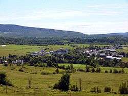
Ham-Nord, Quebec
| Ham-Nord | |
|---|---|
| Township municipality | |
 | |
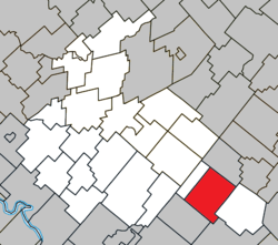 Location within Arthabaska RCM. | |
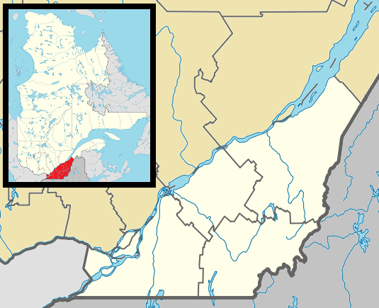 Ham-Nord Location in southern Quebec. | |
| Coordinates: 45°54′N 71°39′W / 45.900°N 71.650°WCoordinates: 45°54′N 71°39′W / 45.900°N 71.650°W[1] | |
| Country |
|
| Province |
|
| Region | Centre-du-Québec |
| RCM | Arthabaska |
| Constituted | January 1, 1864 |
| Named for | Ham, Essex[1] |
| Government[2] | |
| • Mayor | François Marcotte |
| • Federal riding | Richmond—Arthabaska |
| • Prov. riding | Drummond–Bois-Francs |
| Area[2][3] | |
| • Total | 103.50 km2 (39.96 sq mi) |
| • Land | 102.89 km2 (39.73 sq mi) |
| Population (2011)[3] | |
| • Total | 832 |
| • Density | 8.1/km2 (21/sq mi) |
| • Pop 2006-2011 |
|
| Time zone | EST (UTC−5) |
| • Summer (DST) | EDT (UTC−4) |
| Postal code(s) | G0P 1A0 |
| Area code(s) | 819 |
| Highways |
|
| Website |
www |
Ham-Nord, Quebec is a township municipality in the Centre-du-Québec region of Quebec, Canada.
References
External links
 Media related to Ham-Nord at Wikimedia Commons
 |
Saint-Fortunat | | ||
| Notre-Dame-de-Ham Saint-Adrien |
|
Saints-Martyrs-Canadiens | ||
| ||||
| | ||||
| Ham-Sud |
| Cities | |
|---|---|
| Municipalities | |
| Parishes | |
| Townships | |
| |
This article is issued from Wikipedia - version of the 11/8/2016. The text is available under the Creative Commons Attribution/Share Alike but additional terms may apply for the media files.