Howard, Georgia
| Howard, Georgia | |
|---|---|
| Census-designated place | |
 Howard, Georgia | |
| Coordinates: 32°35′46″N 84°23′04″W / 32.59611°N 84.38444°WCoordinates: 32°35′46″N 84°23′04″W / 32.59611°N 84.38444°W | |
| Country | United States |
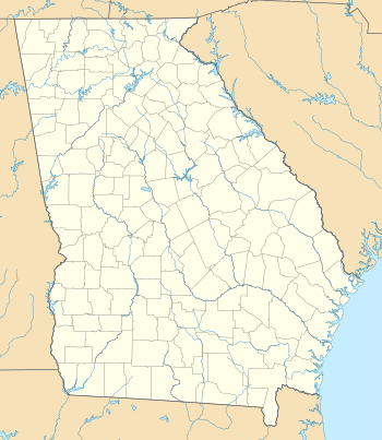
| State | Georgia |
| County | Taylor |
| Area[1] | |
| • Total | 2.916 sq mi (7.55 km2) |
| • Land | 2.897 sq mi (7.50 km2) |
| • Water | 0.019 sq mi (0.05 km2) |
| Elevation | 643 ft (196 m) |
| Population (2010) | |
| • Total | 110 |
| • Density | 38/sq mi (15/km2) |
| Time zone | Eastern (EST) (UTC-5) |
| • Summer (DST) | EDT (UTC-4) |
| ZIP code | 31039 |
| Area code(s) | 478 |
| GNIS feature ID | 315749[2] |
Howard is a census-designated place and unincorporated community in Taylor County, Georgia, United States. Its population was 110 as of the 2010 census.[1] Howard has a post office with ZIP code 31039.[3] Georgia State Route 96 passes through the community.
References
- 1 2 "2010 Census Gazetteer Files - Places: Georgia". U.S. Census Bureau. Retrieved January 3, 2015.
- ↑ "Howard". Geographic Names Information System. United States Geological Survey.
- ↑ United States Postal Service. "USPS - Look Up a ZIP Code". Retrieved January 3, 2015.
Municipalities and communities of Taylor County, Georgia, United States | ||
|---|---|---|
| City | 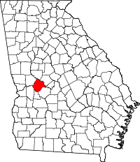 | |
| Town | ||
| CDP | ||
| Unincorporated communities | ||
This article is issued from Wikipedia - version of the 1/4/2015. The text is available under the Creative Commons Attribution/Share Alike but additional terms may apply for the media files.