Indiana State Road 32
| ||||
|---|---|---|---|---|
| Route information | ||||
| Maintained by INDOT | ||||
| Length: | 156.79 mi[1] (252.33 km) | |||
| Existed: | October 1, 1926[2] – present | |||
| Major junctions | ||||
| West end: |
 CR 4 at the Illinois state line CR 4 at the Illinois state line | |||
| ||||
| East end: |
 SR 47 in Union City SR 47 in Union City | |||
| Location | ||||
| Counties: | Vermillion, Fountain, Montgomery, Boone, Hamilton, Madison, Delaware, Randolph | |||
| Highway system | ||||
| ||||


State Road 32 (SR 32) in the U.S. state of Indiana is an east–west state highway in central Indiana that crosses the entire state, covering a distance of about 157 miles (253 km). The western terminus of SR 32 is at the Illinois state line, southeast of Danville, Illinois, where the state highway becomes a county road. The eastern terminus is at Union City, Indiana, and Union City, Ohio, at the Ohio state border where the highway becomes Ohio State Route 47.
Route description
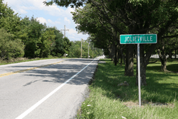
Between the Illinois state line and Crawfordsville, the highway runs somewhat parallel to Interstate 74. East of Crawfordsville, the highway is a popular alternate route for traffic from parts north and northeast of Indianapolis heading for westbound I-74.
Between I-65 and I-69, SR 32 travels through one of the highest-growth areas in the entire United States: Hamilton County, Indiana. Continuing east from I-69, SR 32 serves the towns of Anderson, Muncie, and Winchester.
The vast majority of SR 32 is rural and undivided. Portions of SR 32 between Muncie and Selma are divided.
Major intersections
| County | Location | mi[1] | km | Destinations | Notes |
|---|---|---|---|---|---|
| Vermillion | Highland Township | 0.00 | 0.00 | Vermilion CR 4 | Western terminus of SR 32 at the Illinois state line |
| Perrysville | 4.46 | 7.18 |  SR 63 – Terre Haute SR 63 – Terre Haute | ||
| Fountain | Millcreek Township | 17.73 | 28.53 |  US 41 – Terre Haute, Hammond US 41 – Terre Haute, Hammond | |
| Jackson Township | 22.30 | 35.89 |  SR 341 north – Hillsboro SR 341 north – Hillsboro | Northern end of SR 341 concurrency | |
| 22.40 | 36.05 | SR 341 south – Wallace | Southern end of SR 341 concurrency | ||
| Montgomery | Ripley Township | 27.77 | 44.69 |  SR 25 north – Waynetown, Lafayette SR 25 north – Waynetown, Lafayette | Southern terminus of SR 25 |
| Crawfordsville | 35.81 | 57.63 |  SR 47 south – Waveland SR 47 south – Waveland | Western end of SR 47 concurrency | |
| 36.04 | 58.00 |  US 231 south – Greencastle US 231 south – Greencastle | Southern end of US 231 concurrency | ||
| 37.23 | 59.92 |  US 136 west / US 231 north – Lafayette, Danville US 136 west / US 231 north – Lafayette, Danville | Western end of US 136 and northern end of US 231 concurrencies | ||
| 37.89 | 60.98 | US 136 east – Speedway | Eastern end of US 136 concurrency | ||
| 38.65 | 62.20 | SR 47 north | Eastern end of SR 47 concurrency | ||
| Union Township | 42.03 | 67.64 |  I-74 – Indianapolis, Danville I-74 – Indianapolis, Danville | Exit 39 on I-74 | |
| Boone | Jefferson Township | 52.43 | 84.38 |  SR 75 – Jamestown, Thorntown SR 75 – Jamestown, Thorntown | |
| Lebanon | 59.51 | 95.77 |   I-65 / US 52 – Indianapolis, Gary I-65 / US 52 – Indianapolis, Gary | Exit 140 on I-65 | |
| 60.57 | 97.48 |  SR 39 – Danville, Frankfort SR 39 – Danville, Frankfort | |||
| 70.55 | 113.54 |  US 421 – Indianapolis, Frankfort US 421 – Indianapolis, Frankfort | |||
| Hamilton | Westfield | 78.51 | 126.35 |  US 31 – Indianapolis, Kokomo, South Bend US 31 – Indianapolis, Kokomo, South Bend | |
| Noblesville | 84.45 | 135.91 |  SR 38 west – Frankfort, Lafayette SR 38 west – Frankfort, Lafayette | Western end of SR 38 concurrency | |
| 84.77 | 136.42 |  SR 19 north – Peru SR 19 north – Peru | Southern terminus of SR 19 | ||
| 86.10 | 138.56 |  SR 37 – Indianapolis, Elwood, Marion SR 37 – Indianapolis, Elwood, Marion | |||
| 87.55 | 140.90 | SR 38 east – Pendleton | Eastern end of SR 38 concurrency | ||
| Madison | Lapel | 93.75 | 150.88 |  SR 13 – Fortville, Elwood, Wabash SR 13 – Fortville, Elwood, Wabash | |
| Anderson | 105.56 | 169.88 |   SR 9 south / SR 232 east – Pendleton SR 9 south / SR 232 east – Pendleton | Southern end of SR 9 concurrency; western terminus of SR 232 | |
| 107.01 | 172.22 | SR 9 north – Marion | Northern end of SR 9 concurrency | ||
| Delaware | Chesterfield | 111.50 | 179.44 |  I-69 – Indianapolis, Fort Wayne I-69 – Indianapolis, Fort Wayne | Exit 234 on I-69 |
| Muncie |    US 35 / SR 3 / SR 67 – Indianapolis, Hartford City US 35 / SR 3 / SR 67 – Indianapolis, Hartford City | ||||
| Randolph | Farmland | 137.25 | 220.88 |  SR 1 north – Bluffton SR 1 north – Bluffton | Northern end of SR 1 concurrency |
| 138.41 | 222.75 | SR 1 south – Cambridge City | Southern end of SR 1 concurrency | ||
| Winchester | 147.10 | 236.73 |  US 27 – Richmond, Fort Wayne US 27 – Richmond, Fort Wayne | ||
| Union City | 156.57 | 251.97 |  SR 28 east SR 28 east To SR 571 east – Union City, Greenville To SR 571 east – Union City, Greenville | Southern end of SR 28 concurrency | |
| 156.68 | 252.15 | SR 28 west – Albany | Northern end of SR 28 concurrency | ||
| 156.79 | 252.33 | SR 47 east – Union City, Ansonia | Eastern terminus of SR 32 Ohio state line | ||
1.000 mi = 1.609 km; 1.000 km = 0.621 mi
| |||||
References
- 1 2 "INDOT Roadway Referencing System" (PDF).
- ↑ "Road Numbers to Be Changed". The Hancock-Democrat. The Indianapolis News. September 30, 1926. Retrieved June 9, 2016 – via Newspapers.com.
