Interstate 75 in Georgia
| |||||||
|---|---|---|---|---|---|---|---|
_map.svg.png) | |||||||
| Route information | |||||||
| Maintained by GDOT | |||||||
| Length: | 355.11 mi[1] (571.49 km) | ||||||
| Existed: | 1960[2] – present | ||||||
| Major junctions | |||||||
| South end: |
 I-75 at Florida state line I-75 at Florida state line | ||||||
| North end: |
I-75 at Tennessee state line | ||||||
| Location | |||||||
| Counties: | Lowndes, Cook, Tift, Turner, Crisp, Dooly, Houston, Peach, Crawford, Bibb, Monroe, Lamar, Butts, Spalding, Henry, Clayton, Fulton, Cobb, Cherokee, Bartow, Gordon, Whitfield, Catoosa | ||||||
| Highway system | |||||||
| |||||||


Interstate 75 (I-75) in the U.S. state of Georgia runs north–south along the U.S. Route 41 (US 41) corridor on the western side of the state, passing through the cities of Valdosta, Macon, and Atlanta. It is also designated—but not signed—as State Route 401 (SR 401). In downtown Atlanta, I-75 joins with I-85 as the Downtown Connector.
Route description
I-75 enters Georgia near Valdosta, and it continues northward through the towns of Tifton and Cordele until it reaches the Macon area, where it intersects with I-16 eastbound towards Savannah. For northbound traffic wishing to avoid potential congestion in Macon, I-475 provides a relatively straight bypass west of that city and I-75's route.
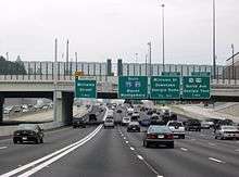
After Macon it passes the small town of Forsyth. The freeway reaches no major junctions again until in the Atlanta metropolitan area. The first metropolitan freeway met is I-675, then followed by the Atlanta "Perimeter" bypass, I-285. It crosses inside the Perimeter and heads northeast several miles towards the Atlanta city center. I-75 then runs concurrently with I-85 due north over the Downtown Connector through the central business district of Atlanta. After the two Interstates split, I-75 makes a beeline northwest, crossing outside the I-285 Perimeter and heading towards the major suburban city of Marietta. This section of I-75 just north of I-285 has 15 through lanes, making it the widest roadway anywhere in the Interstate Highway System.[3] North of Marietta, the final major junction in the Atlanta metropolitan area is the I-575 spur. I-75 then traverses the hilly northern Georgia terrain as it travels towards Chattanooga, Tennessee.
The 180-mile-long (290 km) section of I-75 from I-475 to I-24 in Chattanooga is one of the longest continuous six-lane freeways in the United States (some segments along this corridor have as many as 16 lanes).
Due to recent widening in south Georgia, the only four-lane section of I-75 in Georgia is bypassed by six-lane I-475; along this route there are at least six lanes from Florida's Turnpike in Wildwood, Florida to I-24 in Chattanooga.
History
In 1998, the portion of I-75 that runs from the Chattahoochee River northward to the Tennessee state line was named the Larry McDonald Memorial Highway. Larry McDonald, a conservative Democratic representative to Congress was aboard Korean Air Lines Flight 007 when it was shot down by the Soviets on September 1, 1983. He was the only sitting Congressman to be reportedly killed by the Soviets during the Cold War.
I-75 was also designated as Horace E. Tate Freeway between I-85 to I-285 north of Downtown Atlanta, in honor Horace E. Tate who was a Georgia State Senate in 1974.
Until 2000, the state of Georgia used the sequential interchange numbering system on all of its Interstate Highways. The first exit on each highway would begin with the number "1" and increase numerically with each exit. In 2000, the Georgia Department of Transportation switched to a mileage-based exit system, in which the exit number corresponded to the nearest milepost.[4]
In March 2007, I-75 in Atlanta (the HOV ramp serving Northside Drive) was the site of the Bluffton University bus crash.
Exit list
| County | Location | mi[5] | km | Old exit | New exit | Destinations | Notes | |
|---|---|---|---|---|---|---|---|---|
| Florida–Georgia state line | 0.00 | 0.00 | I-75 continues into Florida | |||||
| Lowndes | | 1.55 | 2.49 | 1 | 2 | Bellville, Lake Park | ||
| Lake Park | 4.78 | 7.69 | 2 | 5 |  SR 376 (Lakes Boulevard) – Lake Park SR 376 (Lakes Boulevard) – Lake Park | |||
| | 10.60 | 17.06 | 3 | 11 |  SR 31 – Clyattville, Valdosta, Madison, Florida SR 31 – Clyattville, Valdosta, Madison, Florida | |||
| | 12.81 | 20.62 | 4 | 13 | Old Clyattville Road – Valdosta | |||
| Valdosta | 15.93 | 25.64 | 5 | 16 |     I‑75 Bus. north / US 84 / US 221 / SR 38 I‑75 Bus. north / US 84 / US 221 / SR 38 | |||
| 17.95 | 28.89 | 6 | 18 |  SR 133 – Valdosta, Moultrie SR 133 – Valdosta, Moultrie | ||||
| | 21.74 | 34.99 | 7 | 22 |  I‑75 Bus. south / US 41 south (North Valdosta Road) I‑75 Bus. south / US 41 south (North Valdosta Road) | Southern end of US 41 concurrency | ||
| Hahira | 28.71 | 46.20 | 8 | 29 |  US 41 north / SR 122 – Hahira, Barney, Lakeland US 41 north / SR 122 – Hahira, Barney, Lakeland | Northern end of US 41 concurrency | ||
| Cook | Cecil | 32.43 | 52.19 | 9 | 32 | Old Coffee Road – Cecil | ||
| Adel | 37.50 | 60.35 | 10 | 37 | Adel | |||
| 38.92 | 62.64 | 11 | 39 |  SR 37 – Adel, Moultrie, Nashville SR 37 – Adel, Moultrie, Nashville | ||||
| Sparks | 41.46 | 66.72 | 12 | 41 | Rountree Bridge Road – Sparks | |||
| | 44.92 | 72.29 | 13 | 45 | Barneyville Road | |||
| Lenox | 48.71 | 78.39 | 14 | 49 | Kinard Bridge Road – Lenox | |||
| Tift | | 55.00 | 88.51 | 15 | 55 | Eldorado, Omega | ||
| | 59.09 | 95.10 | 16 | 59 | I‑75 Bus. (Southwell Boulevard) – Tifton | |||
| | 60.34 | 97.11 | 17 | 60 | South Central Avenue | |||
| Tifton | 61.30 | 98.65 | 18 | 61 | Omega Road | |||
| 61.94 | 99.68 | 19 | 62 |    US 82 / SR 520 to US 319 – Tifton, Sylvester US 82 / SR 520 to US 319 – Tifton, Sylvester | ||||
| 62.49 | 100.57 | 20 | 63A | 2nd Street | ||||
| 62.88 | 101.20 | 21 | 63B | 8th Street | ||||
| 64.10 | 103.16 | 22 | 64 | US 41 – Tifton | ||||
| | 66.08 | 106.35 | 23 | 66 | Brighton Road | |||
| | 69.35 | 111.61 | 24 | 69 | Chula Brookfield Road | |||
| | 70.95 | 114.18 | 25 | 71 | Willis Still Road – Sunsweet | |||
| Turner | | 75.24 | 121.09 | 26 | 75 |  SR 232 (Inaha Road) SR 232 (Inaha Road) | ||
| | 78.52 | 126.37 | 27 | 78 |  SR 32 – Sycamore, Ocilla SR 32 – Sycamore, Ocilla | |||
| | 79.78 | 128.39 | 28 | 80 | Bussey Road – Sycamore | |||
| Ashburn | 82.15 | 132.21 | 29 | 82 |   SR 107 / SR 112 – Ashburn, Fitzgerald SR 107 / SR 112 – Ashburn, Fitzgerald | |||
| | 84.04 | 135.25 | 30 | 84 |  SR 159 – Ashburn, Amboy SR 159 – Ashburn, Amboy | |||
| Crisp | Arabi | 91.96 | 148.00 | 31 | 92 | Arabi | ||
| | 97.08 | 156.24 | 32 | 97 |  SR 33 Conn. – Wenona, Sylvester SR 33 Conn. – Wenona, Sylvester | |||
| Cordele | 99.09 | 159.47 | 33 | 99 |  SR 300 (Georgia–Florida Parkway) SR 300 (Georgia–Florida Parkway) | |||
| 100.86 | 162.32 | 34 | 101 |    US 280 (16th Avenue East) / SR 30 / SR 90 – Cordele, Abbeville US 280 (16th Avenue East) / SR 30 / SR 90 – Cordele, Abbeville | ||||
| 101.91 | 164.01 | 35 | 102 |  SR 257 (8th Avenue East) – Cordele, Hawkinsville SR 257 (8th Avenue East) – Cordele, Hawkinsville | ||||
| | 103.98 | 167.34 | 36 | 104 | Farmers Market Road | |||
| Dooly | | 109.68 | 176.51 | 37 | 109 |  SR 215 (East Union Street) – Vienna, Pitts SR 215 (East Union Street) – Vienna, Pitts | ||
| | 112.22 | 180.60 | 38 | 112 |  SR 27 SR 27 | |||
| | 117.02 | 188.33 | 39 | 117 | Pinehurst | |||
| Unadilla | 120.96 | 194.67 | 40 | 121 | US 41 – Unadilla | |||
| 121.94 | 196.24 | 41 | 122 |  SR 230 – Unadilla, Byromville SR 230 – Unadilla, Byromville | ||||
| Houston | | 127 | 204 | 42 | 127 |  SR 26 – Montezuma, Hawkinsville SR 26 – Montezuma, Hawkinsville | ||
| Perry | 134 | 216 | 43 | 134 | South Perry Parkway | |||
| 135 | 217 | 44 | 135 |   US 41 / SR 127 / SR 224 (Larry Walker Highway) – Perry US 41 / SR 127 / SR 224 (Larry Walker Highway) – Perry | ||||
| 136 | 219 | 45 | 136 |   US 341 / SR 7 – Perry, Fort Valley US 341 / SR 7 – Perry, Fort Valley | ||||
| 138 | 222 | 46 | 138 | Perry Parkway, Thompson Road | Unsigned as US 341 BYP | |||
| Peach | | 142 | 229 | 47 | 142 |  SR 96 (Housers Mill Road) SR 96 (Housers Mill Road) | ||
| | 144 | 232 | — | 144 | Richard B. Russell Parkway | |||
| | 146 | 235 | 48 | 146 |  SR 247 Conn. – Centerville, Warner Robins SR 247 Conn. – Centerville, Warner Robins | |||
| Byron | 149 | 240 | 49 | 149 |  SR 49 – Byron, Fort Valley SR 49 – Byron, Fort Valley | |||
| Crawford |
No major junctions | |||||||
| Bibb | | 153 | 246 | — | 153 | Sardis Church Road | ||
| | 155 | 249 | 50 | 155 | Hartley Bridge Road | Collector-distributor lanes on southbound exit and northbound entrance | ||
| | 156 | 251 | 51 | 156 |  I‑475 north to I‑75 – Atlanta I‑475 north to I‑75 – Atlanta | Northbound exit and southbound entrance | ||
| Macon | 160 | 260 | 52 | 160A |  US 41 / SR 247 (Pio Nono Avenue) US 41 / SR 247 (Pio Nono Avenue) | Signed as exit 160 northbound | ||
| 160 | 260 | 53 | 160B | Rocky Creek Road | Northbound exit is via exit 160 | |||
| 162 | 261 | 54 | 162 |   US 80 / SR 22 (Eisenhower Parkway) US 80 / SR 22 (Eisenhower Parkway) | ||||
| 163 | 262 | 55 | 163 |  SR 74 west (Mercer University Drive) / Little Richard Penniman Boulevard SR 74 west (Mercer University Drive) / Little Richard Penniman Boulevard | ||||
| 164 | 264 | 56 | 164 |    US 41 Bus. / SR 19 (Forsyth Street) / Hardman Avenue – Downtown Macon US 41 Bus. / SR 19 (Forsyth Street) / Hardman Avenue – Downtown Macon | ||||
| 165 | 266 | 57 | 165 |  I‑16 east – Savannah I‑16 east – Savannah | Exit 0 on I-16 | |||
| 167 | 269 | 58 | 167 | SR 247 (Pierce Avenue) | ||||
| 169 | 272 | 59 | 169 |  To US 23 / Arkwright Road / Riverside Drive To US 23 / Arkwright Road / Riverside Drive | ||||
| | 171 | 275 | 60 | 171 |  US 23 / SR 87 / Riverside Drive US 23 / SR 87 / Riverside Drive | |||
| | 172 | 277 | 61 | 172 | Bass Road | |||
| Monroe | | 175 | 282 | 62 | 175 | Pate Road – Bolingbroke | Northbound exit and southbound entrance | |
| | 177 | 285 | 63 | 177 | I‑475 south – Valdosta | Southbound exit and northbound entrance | ||
| | 181 | 291 | 64 | 181 | Rumble Road – Smarr | |||
| | 185 | 298 | 65 | 185 |  SR 18 – Forsyth, Gray SR 18 – Forsyth, Gray | |||
| Forsyth | 186 | 299 | 66 | 186 | Tift College Drive | |||
| 187 | 301 | 67 | 187 |  SR 83 – Forsyth, Monticello SR 83 – Forsyth, Monticello | ||||
| 188 | 303 | 68 | 188 |  SR 42 – Forsyth SR 42 – Forsyth | ||||
| | 193 | 311 | 69 | 193 | Johnstonville Road | |||
| | 198 | 319 | 70 | 198 | High Falls Road | |||
| Lamar |
No major junctions | |||||||
| Butts | | 201 | 323 | 71 | 201 |  SR 36 – Jackson, Barnesville SR 36 – Jackson, Barnesville | ||
| | 205 | 330 | 72 | 205 |  SR 16 – Griffin, Jackson SR 16 – Griffin, Jackson | |||
| Spalding |
No major junctions | |||||||
| Henry | Locust Grove | 212 | 341 | 73 | 212 | Bill Gardner Parkway – Jenkinsburg, Locust Grove, Hampton, Jackson | ||
| | 216 | 348 | 74 | 216 |  SR 155 – McDonough SR 155 – McDonough | |||
| | 218 | 351 | 75 | 218 |   SR 20 / SR 81 – McDonough, Hampton SR 20 / SR 81 – McDonough, Hampton | |||
| | 221 | 356 | 76 | 221 | Jonesboro Road – Lovejoy | |||
| | 222 | 357 | 77 | 222 | Jodeco Road – Flippen | Former SR 351 | ||
| | 224 | 360 | 78 | 224 | Hudson Bridge Road, Eagles Landing Parkway | |||
| | 227 | 365 | 79 | 227 |   I‑675 north to I‑285 – Augusta, Greenville I‑675 north to I‑285 – Augusta, Greenville | Northbound exit and southbound entrance | ||
| | 228 | 367 | 80 | 228 |  SR 138 – Jonesboro, Stockbridge SR 138 – Jonesboro, Stockbridge | |||
| Clayton | | 231 | 372 | 81 | 231 | Mount Zion Boulevard | ||
| Morrow | 233 | 375 | 82 | 233 |  SR 54 – Morrow, Lake City SR 54 – Morrow, Lake City | |||
| | 235 | 378 | 83 | 235 |  US 19 / US 41 (Old Dixie Highway) – Griffin, Jonesboro US 19 / US 41 (Old Dixie Highway) – Griffin, Jonesboro | |||
| | 237 | 381 | 84 | 237 |  SR 331 – Forest Park SR 331 – Forest Park | |||
| | 237 | 381 | 85 | 237A |  SR 85 south – Riverdale SR 85 south – Riverdale | Southbound exit only | ||
| | 238 | 383 | 85A | 238A | I‑285 east – Augusta, Greenville | |||
| | 238 | 383 | 85B | 238B |  I‑285 west – Birmingham, Chattanooga, Domestic Terminals, Columbus, Montgomery I‑285 west – Birmingham, Chattanooga, Domestic Terminals, Columbus, Montgomery | |||
| Fulton | Hapeville | 239 | 385 | 86 | 239 | US 19 / US 41 (SR 3 / Central Avenue) / C.W. Grant Parkway / Porsche Avenue – International Terminal | Additional ramps for direct HOV lane access to/from C.W. Grant Parkway | |
| Atlanta | 241 | 388 | 87 | 241 | Cleveland Avenue | |||
| 242 | 389 | 87A | 242 |  I‑85 south – Domestic Terminals, Columbus, Montgomery I‑85 south – Domestic Terminals, Columbus, Montgomery | Southern end of I-85 concurrency; southbound exit and northbound entrance | |||
| 243 | 391 | 88 | 243 |  SR 166 (Langford Parkway) – East Point SR 166 (Langford Parkway) – East Point | ||||
| 244 | 393 | 89 | 244 | University Avenue, Pryor Street | ||||
| 245 | 394 | 90 | 245 | Abernathy Boulevard, Capitol Avenue – Turner Field | Northbound exit and southbound entrance | |||
| 246 | 396 | 91 | 246 | Fulton Street, Central Avenue – Downtown Atlanta | ||||
| 247 | 398 | 92 | 247 |  I‑20 (Ralph D. Abernathy Freeway) – Augusta, Birmingham I‑20 (Ralph D. Abernathy Freeway) – Augusta, Birmingham | Eastbound exit and westbound exit | |||
| 248 | 399 | 93 | 248A | Martin Luther King Jr. Drive – State Capitol | Southbound exit and northbound entrance | |||
| 248 | 399 | 94 | 248B | Edgewood Avenue, Auburn Avenue, J.W. Dobbs Avenue | Northbound exit and southbound entrance | |||
| 248 | 399 | 96 | 248C |  SR 10 east (Freedom Parkway) / Andrew Young International Boulevard – Carter Center SR 10 east (Freedom Parkway) / Andrew Young International Boulevard – Carter Center | ||||
| 248 | 399 | 95 | 248D | J.W. Dobbs Avenue, Edgewood Avenue | Southbound exit and northbound entrance | |||
| 249 | 401 | 97 | 249A | Courtland Street – Georgia State University | Southbound exit only | |||
| 249 | 401 | 98 | 249B | Pine Street, Peachtree Street – Civic Center | Northbound exit only | |||
| 249 | 401 | 99 | 249C | Williams Street – Georgia World Congress Center, Georgia Dome | No northbound exit (only northbound entrance, southbound entrance, southbound exit); additional ramps for direct HOV access: southbound exit and northbound entrance | |||
| 249 | 401 | 100 | 249D | Spring Street, West Peachtree Street | Northbound exit and southbound entrance | |||
| 249 | 401 | 100 | 249D |     US 29 / US 78 / US 278 / SR 8 (North Avenue) – Georgia Tech US 29 / US 78 / US 278 / SR 8 (North Avenue) – Georgia Tech | Southbound exit and northbound entrance | |||
| 250 | 400 | 101 | 250 | 10th Street, 14th Street – Georgia Tech | Northbound exit and southbound entrance; no northbound entrance to I-85 north | |||
| 250 | 400 | 102 | 250 | 16th Street, 14th Street, 10th Street | Southbound exit and northbound entrance | |||
| 251 | 404 | 102 | 251A | 17th Street – Midtown | Northbound exit only | |||
| 251 | 404 | 103 | 251B |  I‑85 north to SR 400 north – Greenville, Charlotte I‑85 north to SR 400 north – Greenville, Charlotte | Northern end of I-85 concurrency | |||
| 252 | 406 | 104 | 252A | US 41 (Northside Drive) | Additional ramps for direct HOV lane access: southbound exit and northbound entrance | |||
| 252 | 406 | 105 | 252B | Howell Mill Road | ||||
| 254 | 409 | 106 | 254 | Moores Mill Road | ||||
| 255 | 410 | 107 | 255 | US 41 (Northside Parkway) / West Paces Ferry Road | ||||
| 256 | 412 | 108 | 256 | Mount Paran Road | ||||
| Chattahoochee River | 257 | 414 | Lester and Virginia Maddox Bridge | |||||
| Cobb | | 258 | 415 | 108A | 258 | Cumberland Boulevard | ||
| | 259 | 417 | 109 | 259 | Akers Mill Road | HOV-only ramps for northbound exit and southbound entrance | ||
| | 259 | 417 | 109A | 259A | I‑285 east – Augusta, Greenville | Exit 20 on I-285 | ||
| | 259 | 417 | 109B | 259B | I‑285 west – Birmingham, Montgomery, Tampa | Exit 20 on I-285 | ||
| | 260 | 420 | 110 | 260 | Windy Hill Road – Smyrna | |||
| Marietta | 261 | 420 | 111 | 261 |  SR 280 west (Delk Road) – Lockheed, Dobbins AFB SR 280 west (Delk Road) – Lockheed, Dobbins AFB | |||
| 263 | 423 | 112 | 263 |  SR 120 – Marietta, Roswell SR 120 – Marietta, Roswell | Former SR 120 Loop | |||
| 265 | 426 | 113 | 265 |  SR 120 Alt. – Marietta, Roswell SR 120 Alt. – Marietta, Roswell | Former SR 120 Loop | |||
| 267 | 430 | 114A | 267A |  SR 5 Spur north (Canton Road) SR 5 Spur north (Canton Road) | ||||
| | 267 | 430 | 114B | 267B |  SR 5 south to US 41 – Marietta SR 5 south to US 41 – Marietta | Southern end of SR 5 concurrency | ||
| | 268 | 431 | 115 | 268 |  I‑575 north / SR 5 north – Ball Ground, Canton I‑575 north / SR 5 north – Ball Ground, Canton | Northern end of SR 5 concurrency; southbound exit is via exit 269 | ||
| | 269 | 433 | 116 | 269 |  SR 5 Conn. / Barrett Parkway – Kennesaw SR 5 Conn. / Barrett Parkway – Kennesaw | |||
| | 271 | 436 | 117 | 271 | Chastain Road | |||
| Kennesaw | 273 | 439 | 118 | 273 | Wade Green Road – Kennesaw | |||
| Cherokee | | 277 | 446 | 120 | 277 |  SR 92 – Acworth SR 92 – Acworth | ||
| Bartow | | 278 | 447 | 121 | 278 | Glade Road – Acworth | ||
| Emerson | 283 | 455 | 122 | 283 | Allatoona Road – Emerson | |||
| | 285 | 459 | 123 | 285 | Red Top Mountain Road | |||
| Cartersville | 288 | 463 | 124 | 288 |  SR 113 – Cartersville SR 113 – Cartersville | |||
| | 290 | 470 | 125 | 290 | SR 20 – Rome, Canton | |||
| Cartersville | 293 | 472 | 126 | 293 |  US 411 – Chatsworth, White, Cartersville US 411 – Chatsworth, White, Cartersville | |||
| | 296 | 476 | 127 | 296 | Cassville–White Road | |||
| Adairsville | 306 | 492 | 128 | 306 |  SR 140 – Adairsville SR 140 – Adairsville | |||
| Gordon | | 310 | 500 | — | 310 | Union Grove Road | ||
| Calhoun | 312 | 502 | 129 | 312 |  SR 53 – Calhoun, Fairmount, Rome SR 53 – Calhoun, Fairmount, Rome | |||
| 315 | 507 | 130 | 315 |  SR 156 (Redbud Road) – Calhoun SR 156 (Redbud Road) – Calhoun | ||||
| | 317 | 510 | 131 | 317 |  SR 225 – Chatsworth, Calhoun SR 225 – Chatsworth, Calhoun | |||
| Resaca | 318 | 512 | 132 | 318 | US 41 – Resaca, Calhoun | |||
| 320 | 510 | 133 | 320 |  SR 136 – Resaca, LaFayette SR 136 – Resaca, LaFayette | ||||
| Whitfield | | 326 | 525 | 134 | 326 | Carbondale Road | ||
| | 328 | 528 | 135 | 328 |  SR 3 Conn. – Dalton SR 3 Conn. – Dalton | |||
| Dalton | 333 | 536 | 136 | 333 |   SR 52 / SR 71 (Walnut Avenue) – Dalton SR 52 / SR 71 (Walnut Avenue) – Dalton | |||
| 336 | 541 | 137 | 336 |  US 41 / US 76 – Dalton, Rocky Face US 41 / US 76 – Dalton, Rocky Face | ||||
| | 341 | 549 | 138 | 341 |  SR 201 – Tunnel Hill, Varnell SR 201 – Tunnel Hill, Varnell | |||
| Catoosa | | 345 | 555 | 139 | 345 | US 41 / US 76 – Ringgold, LaFayette | ||
| | 348 | 560 | 140 | 348 |  SR 151 – Ringgold, LaFayette SR 151 – Ringgold, LaFayette | |||
| | 350 | 560 | 141 | 350 |  SR 2 (Battlefield Parkway) – Fort Oglethorpe SR 2 (Battlefield Parkway) – Fort Oglethorpe | |||
| | 353 | 568 | 142 | 353 |  SR 146 – Rossville, Fort Oglethorpe SR 146 – Rossville, Fort Oglethorpe | |||
| Georgia–Tennessee state line | 355 | 571 | I-75 continues into Tennessee | |||||
1.000 mi = 1.609 km; 1.000 km = 0.621 mi
| ||||||||
Auxiliary routes
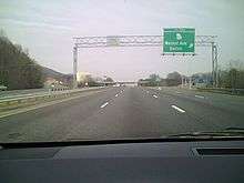
- Interstate 175 was a proposed spur from Albany northeast to Cordele. The road was built, but not as a freeway; it is SR 300, the Florida–Georgia Parkway.
- Interstate 475 is a western bypass of Macon, shortening the trip for through I-75 traffic.
- Interstate 575 is a spur from near Marietta north to Canton and Nelson.
- Interstate 675 is a cutoff from I-75 south of Atlanta north to Interstate 285 (Atlanta's perimeter) - east of I-75.
See also
-
 U.S. Roads portal
 -
.svg.png) Georgia (U.S. state) portal
Georgia (U.S. state) portal
References
- ↑ Adderly, Kevin (December 31, 2014). "Table 1: Main Routes of the Dwight D. Eisenhower National System of Interstate and Defense Highways as of December 31, 2014". Route Log and Finder List. Federal Highway Administration. Retrieved August 4, 2015.
- ↑ State Highway Department of Georgia (1960). State Highway System and Other Principal Connection Roads (PDF) (Map) (1960–61 ed.). Scale not given. Atlanta: State Highway Department of Georgia. OCLC 5673161. Retrieved July 12, 2016. (Corrected to June 1, 1960.)
- ↑ Federal Highway Administration (January 2004). "Interstate System Facts". Highway Information Quarterly Newsletter. Federal Highway Administration. Archived from the original on September 17, 2008. Retrieved November 26, 2008.
- ↑ "Interstate Exit Numbers". Georgia Department of Transportation. Retrieved September 2, 2015.
- ↑ MapQuest (2009). "Map of Interstate 75 in Georgia" (Map). MapQuest. MapQuest. Retrieved July 23, 2011.
External links
 |
Wikimedia Commons has media related to Interstate 75 in Georgia. |
- I-75 at the Interstate Guide
| Interstate 75 | ||
|---|---|---|
| Previous state: Florida |
Georgia | Next state: Tennessee |
| ||
1Cancelled | ||