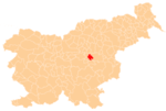
Kal, Hrastnik
| Kal | |
|---|---|
 Kal Location in Slovenia | |
| Coordinates: 46°10′19.1″N 15°6′44.69″E / 46.171972°N 15.1124139°ECoordinates: 46°10′19.1″N 15°6′44.69″E / 46.171972°N 15.1124139°E | |
| Country |
|
| Traditional region | Styria |
| Statistical region | Central Sava |
| Municipality | Hrastnik |
| Area | |
| • Total | 3.48 km2 (1.34 sq mi) |
| Elevation | 880.6 m (2,889.1 ft) |
| Population (2002) | |
| • Total | 41 |
| [1] | |
Kal (pronounced [ˈkaːu̯]) is a settlement in the Municipality of Hrastnik in central Slovenia. It lies in the hills north of Dol pri Hrastniku. Traditionally the area was part of the Styria region. It is now included with the rest of the municipality in the Central Sava Statistical Region.[2]
History
The Kal area settled relatively late. It was still uninhabited in the 13th century, but farms were attested in the area in the 16th century. A school was established in the settlement in 1908. Classes were initially held in a private home; after that building burned down, a school building was built in 1927.[3]
Mass grave
Kal is the site of a mass grave associated with the Second World War. The Paradise Valley Mass Grave (Slovene: Grobišče Rajska dolina) is located under a log cabin at the beginning of the Paradise Valley (Rajska dolina) ski lift. It contains the remains of 40 Slovenian families from Lower Carniola that were transported to the valley and murdered.[4]
References
- ↑ Statistical Office of the Republic of Slovenia
- ↑ Hrastnik municipal site
- ↑ Savnik, Roman, ed. 1976. Krajevni leksikon Slovenije, vol. 3. Ljubljana: Državna založba Slovenije. p. 112.
- ↑ Paradise Valley Mass Grave on Geopedia (Slovene)
