Kangersuatsiaq
| Kangersuatsiaq Prøven | |
|---|---|
|
Kangersuatsiaq | |
 Kangersuatsiaq Location within Greenland | |
| Coordinates: 72°22′47″N 55°33′00″W / 72.37972°N 55.55000°WCoordinates: 72°22′47″N 55°33′00″W / 72.37972°N 55.55000°W | |
| State |
|
| Constituent country |
|
| Municipality |
|
| Population (2010) | |
| • Total | 186 |
| Time zone | UTC-03 |
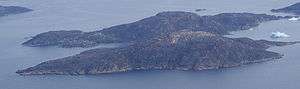
Kangersuatsiaq (old spelling: Kangerssuatsiaq) (IATA: KGQ), formerly Prøven, is an island settlement in the Qaasuitsup municipality in northwestern Greenland. It had 186 inhabitants in 2010.[1]
Upernavik Archipelago
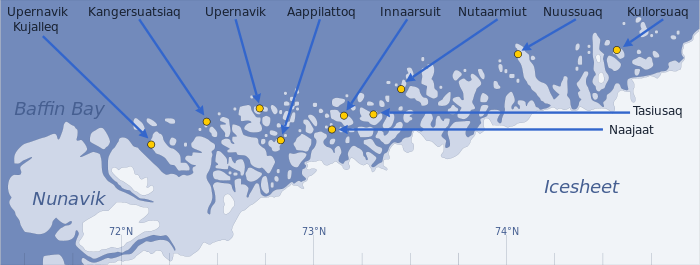
Kangersuatsiaq is located within Upernavik Archipelago, a vast archipelago of small islands on the coast of northeastern Baffin Bay. The archipelago extends from the northwestern coast of Sigguup Nunaa peninsula in the south at approximately 71°50′N 56°00′W / 71.833°N 56.000°W[2] to the southern end of Melville Bay (Greenlandic: Qimusseriarsuaq) in the north at approximately 74°50′N 57°30′W / 74.833°N 57.500°W.[3]
Transport
Air Greenland serves the village as part of government contract, with flights between Kangersuatsiaq Heliport and Upernavik Airport.[4]
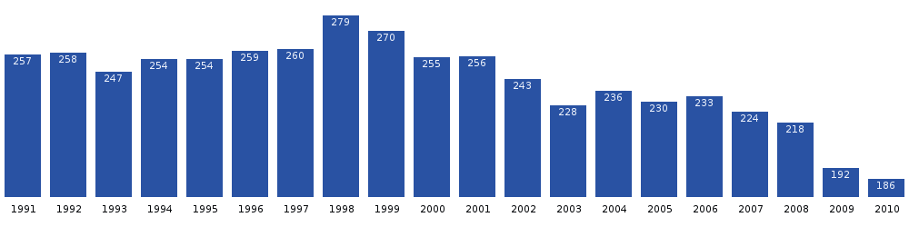
Population
The population of Kangersuatsiaq has decreased by over a quarter relative to the 2000 levels, and is still decreasing.[5]
References
| Wikimedia Commons has media related to Kangersuatsiaq. |
- ↑ Statistics Greenland (Danish)
- ↑ Nunavik, Saga Map, 1:250.000, Tage Schjøtt, 1992
- ↑ Upernavik Avannarleq, Saga Map, 1:250.000, Tage Schjøtt, 1992
- ↑ Air Greenland, Departures and Arrivals
- 1 2 Statistics Greenland

