Keenaght (townland)
| Keenaght | |
|---|---|
| Irish transcription(s) | |
| • Derivation: | Caonach |
| • Meaning: | "Mossy place" |
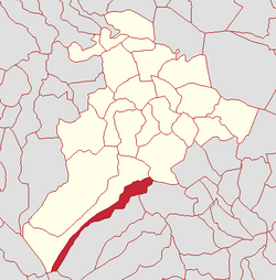 | |
 Keenaght Keenaght shown within Northern Ireland | |
| Coordinates: 54°45′54″N 6°44′06″W / 54.765°N 6.735°WCoordinates: 54°45′54″N 6°44′06″W / 54.765°N 6.735°W | |
| Country | Northern Ireland |
| County | County Londonderry |
| Barony | Loughinsholin |
| Civil parish | Kilcronaghan |
| Plantation grant | Drapers Company |
| First recorded | 1609 |
| Government | |
| • Council | Magherafelt District Council |
| • Ward | Tobermore |
| Area[1] | |
| • Total | 124.87 ha (308.56 acres) |
| Irish grid ref | H8191 |
Keenaght (locally [ˌkʲiːnəx], from Irish Caonach, meaning "mossy place"[2]) is a townland lying within the civil parish of Kilcronaghan, County Londonderry, Northern Ireland. It lies in the south of the parish on the boundary with the civil parish of Desertmartin, and it is bounded by the townlands of: Coolsaragh, Cullion, Gortahurk, Longfield, and Tintagh. It was apportioned to the Drapers company.[3]
The townland currently lies within Tobermore electoral ward of Magherafelt District Council, however in 1901 and 1926 it was part of Iniscarn District Electoral Division as part of the Draperstown dispensery (registrar's) district of Magherafelt Rural District.[4][5] As part of Kilcronaghan civil parish, Keenaght also lies in the historic barony of Loughinsholin.
Etymology
The present name of this townland, Keenaght, is very likely a reformed analogy of the neighbouring barony of Keenaght, with scribal errors adding a t to the end of anglicisations of its name such as with Tonaght in the neighbouring parish of Ballynascreen, which actually derives from Tonach.[2] It is more reasonably suggested that Keenaght derives from the synonym Coanna with the adjectival suffix -ach added to it.[2] This derivation is supported by the majority of earlier recorded forms.[2]
History
|
|
| ||||||||||||||||||||||||||||||||||||||||||||||||||||
See also
References
- ↑ Northern Ireland Environment Agency. "NIEA Map Viewer". Retrieved 27 January 2012.
- 1 2 3 4 5 Toner, Gregory: Place-Names of Northern Ireland, page 126-7. Queen's University of Belfast, 1996, ISBN 0-85389-613-5
- ↑ Notes on the Place Names of the Parishes and Townlands of the County of Londonderry, 1925, Alfred Moore Munn, Clerk of the Crown and Peace of the City and County of Londonderry
- 1 2 3 4 HistPop; Area, houses, and population, Vol. III [Part 2], Ireland, 1901 Page 34
- 1 2 3 4 HistPop; County and County Borough of Londonderry, 1926, page 24
- 1 2 3 4 5 6 HistPop; Area, population and number of houses, Vol. III, Ireland, 1881, page 698
- ↑ HistPop; County of Londonderry, 1851, page 241
- ↑ Place Names NI - Keenaght
