Lac-Huron, Quebec
| Lac-Huron | |
|---|---|
| Unorganized Territory | |
|
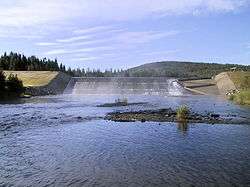
Fish ladder at the outlet of Lake Rimouski | |
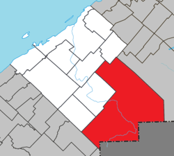 Location within Rimouski-Neigette RCM | |
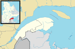 Lac-Huron Location in eastern Quebec | |
| Coordinates: 48°12′N 68°14′W / 48.2°N 68.23°WCoordinates: 48°12′N 68°14′W / 48.2°N 68.23°W[1] | |
| Country |
|
| Province |
|
| Region | Bas-Saint-Laurent |
| RCM | Rimouski-Neigette |
| Established | January 1, 1986 |
| Government[2] | |
| • Federal riding | Rimouski-Neigette—Témiscouata—Les Basques |
| • Prov. riding | Rimouski |
| Area[2][3] | |
| • Total | 965.30 km2 (372.70 sq mi) |
| • Land | 964.15 km2 (372.26 sq mi) |
| Population (2011)[3] | |
| • Total | 5 |
| • Density | 0.0/km2 (0/sq mi) |
| • Pop 2006-2011 |
|
| • Dwellings | 64 |
| Time zone | EST (UTC−5) |
| • Summer (DST) | EDT (UTC−4) |
| Area code(s) | 418 and 581 |
| Highways | No major routes |
Lac-Huron is an unorganized territory in the Canadian province of Quebec, located in the Rimouski-Neigette Regional County Municipality.
See also
References
External links
-
 Media related to Lac-Huron, Quebec at Wikimedia Commons
 |
Saint-Narcisse-de-Rimouski | Saint-Marcellin | | |
| La Trinité-des-Monts Esprit-Saint |
|
Lac-des-Eaux-Mortes | ||
| ||||
| | ||||
| Biencourt Lejeune |
|
| Cities & Towns | |
|---|---|
| Municipalities | |
| Parishes | |
| Unorganized territories | |
| |
This article is issued from Wikipedia - version of the 12/1/2016. The text is available under the Creative Commons Attribution/Share Alike but additional terms may apply for the media files.