Lair, Kentucky
| Lair, Kentucky | |
|---|---|
| Unincorporated community | |
  Lair, Kentucky | |
| Coordinates: 38°20′31″N 84°18′28″W / 38.34194°N 84.30778°WCoordinates: 38°20′31″N 84°18′28″W / 38.34194°N 84.30778°W | |
| Country | United States |
| State | Kentucky |
| County | Harrison |
| Elevation | 738 ft (225 m) |
| Time zone | Eastern (EST) (UTC-5) |
| • Summer (DST) | EDT (UTC-4) |
| Area code(s) | 859 |
| GNIS feature ID | 495908[1] |
Lair is an unincorporated community in Harrison County, Kentucky, United States. Lair is located on U.S. Route 27, 3.4 miles (5.5 km) south of Cynthiana.[2]
History
A post office was established as Lair's Station in 1860, was renamed Lair in 1882, and remained in operation until it was discontinued in 1920.[3] In the 1870s, the community contained a store, two gristmills, and two distilleries.[4]
References
- ↑ "Lair". Geographic Names Information System. United States Geological Survey.
- ↑ State Primary Road System: Harrison County (PDF) (Map). Kentucky Transportation Cabinet. 2013. Retrieved April 30, 2013.
- ↑ "Harrison County". Jim Forte Postal History. Retrieved 10 January 2015.
- ↑ Collins, Lewis (1877). History of Kentucky. p. 322.
Municipalities and communities of Harrison County, Kentucky, United States | ||
|---|---|---|
| Cities | 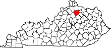 | |
| Unincorporated communities | ||
| Footnotes | ‡This populated place also has portions in an adjacent county or counties | |
This article is issued from Wikipedia - version of the 10/18/2016. The text is available under the Creative Commons Attribution/Share Alike but additional terms may apply for the media files.