Leopolis, Wisconsin
| Leopolis | |
|---|---|
| Census-designated place | |
  Leopolis Location within the state of Wisconsin | |
| Coordinates: 44°46′05″N 88°50′41″W / 44.76806°N 88.84472°WCoordinates: 44°46′05″N 88°50′41″W / 44.76806°N 88.84472°W | |
| Country | United States |
| State | Wisconsin |
| County | Shawano |
| Area | |
| • Total | 0.373 sq mi (0.97 km2) |
| • Land | 0.373 sq mi (0.97 km2) |
| Population (2010) | |
| • Total | 87 |
| • Density | 230/sq mi (90/km2) |
| Time zone | Central (CST) (UTC-6) |
| • Summer (DST) | CDT (UTC-5) |
| ZIP codes | 54948 |
Leopolis is an unincorporated census-designated place in Shawano County, Wisconsin, United States.[1][2] The community is located on County Highway D, between the towns of Herman, and Pella, Wisconsin. As of the 2010 census, its population is 87.[3]
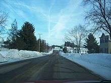 Looking east at Leopolis |
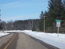 Looking west at Leopolis |
Notes
Municipalities and communities of Shawano County, Wisconsin, United States | ||
|---|---|---|
| Cities | 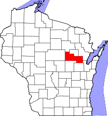 | |
| Villages | ||
| Towns | ||
| CDPs | ||
| Unincorporated communities | ||
| Indian reservations | ||
| Footnotes | ‡This populated place also has portions in an adjacent county or counties | |
This article is issued from Wikipedia - version of the 9/5/2016. The text is available under the Creative Commons Attribution/Share Alike but additional terms may apply for the media files.