| Property | Type | Access | Unitary Authority | Community | Historic County | Map link, Grid Reference and Coordinates | Ref. |
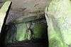
Barclodiad y Gawres
| Burial Chamber | Free | Isle of Anglesey | Aberffraw | Anglesey | map SH329707 53°12′26″N 4°30′13″W / 53.2072°N 4.5036°W / 53.2072; -4.5036 (Barclodiad y Gawres Burial Chamber) | [1] |
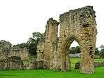
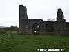
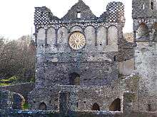
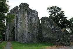
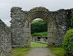
Basingwerk Abbey
| Religious | Free | Flintshire | Holywell | Flintshire | map SJ196774 53°17′17″N 3°12′27″W / 53.288°N 3.2074°W / 53.288; -3.2074 (Basingwerk Abbey) | [2] |
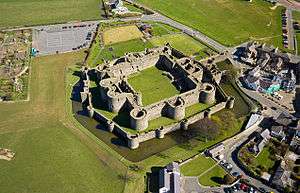
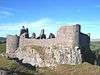
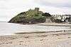
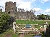
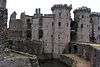
Beaumaris Castle
| Castle
 World Heritage Site.[3] World Heritage Site.[3] | Pay | Isle of Anglesey | Beaumaris | Anglesey | map SH607762 53°15′54″N 4°05′23″W / 53.2649°N 4.0897°W / 53.2649; -4.0897 (Beaumaris Castle)
postcode LL58 8AP | [4] |
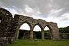
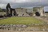
Blaenavon Ironworks
 | Industrial
World Heritage Site.[5] | Free | Torfaen | Blaenavon | Monmouthshire | map SO249092 51°46′37″N 3°05′21″W / 51.777°N 3.0892°W / 51.777; -3.0892 (Blaenavon Ironworks)
postcode NP4 9RN | [6] |
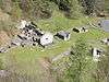
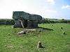
Bodowyr
_-_geograph.org.uk_-_937080.jpg) | Burial Chamber | Free | Isle of Anglesey | Llanidan | Anglesey | map SH462681 53°11′18″N 4°18′10″W / 53.1882°N 4.3029°W / 53.1882; -4.3029 (Bodowyr Burial Chamber) | [7] |
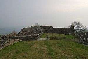
Brecon Gaer
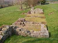 | Roman Fort | Free | Powys | Yscir | Brecknockshire | map SO003296 51°57′23″N 3°27′06″W / 51.9565°N 3.4517°W / 51.9565; -3.4517 (Brecon Gaer Roman Fort) | [8] |
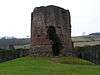
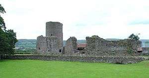
Bronllys Castle
 | Castle | Free | Powys | Bronllys | Brecknockshire | map SO149347 52°00′16″N 3°14′27″W / 52.0044°N 3.2407°W / 52.0044; -3.2407 (Bronllys Castle) | [9] |
Bryn Celli Ddu
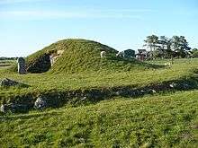 | Burial Chamber | Free | Isle of Anglesey | Llanddaniel Fab | Anglesey | map SH507701 53°12′28″N 4°14′10″W / 53.2077°N 4.2361°W / 53.2077; -4.2361 (Bryn Celli Ddu Burial Chamber) | [10] |
Bryntail
 | Industrial | Free | Powys | Llanidloes Without | Montgomeryshire | map SN913868 52°28′08″N 3°36′03″W / 52.4688°N 3.6008°W / 52.4688; -3.6008 (Bryntail Lead Mine Buildings) | [11] |
Caer Gybi
 | Roman Fort | Free | Isle of Anglesey | Holyhead | Anglesey | map SH247826 53°18′42″N 4°37′55″W / 53.3116°N 4.632°W / 53.3116; -4.632 (Caer Gybi Roman Fortlet) | [12] |
Caer Lêb
 | Enclosure | Free | Isle of Anglesey | Llanidan | Anglesey | map SH472674 53°10′55″N 4°17′12″W / 53.1819°N 4.2866°W / 53.1819; -4.2866 (Caer Lêb) | [13] |
Caer y Tŵr
 | Hill Fort | Free | Isle of Anglesey | Trearddur | Anglesey | map SH219829 53°18′47″N 4°40′29″W / 53.3131°N 4.6747°W / 53.3131; -4.6747 (Caer y Tŵr) | [14] |
Caerleon Roman Fortress
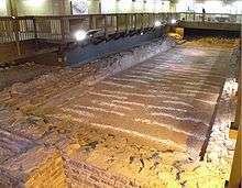 | Roman Fort | Free | Newport | Caerleon | Monmouthshire | map ST337906 51°36′37″N 2°57′32″W / 51.6103°N 2.9588°W / 51.6103; -2.9588 (Caerleon Roman Fortress and Baths) | [15] |
Caernarfon Castle
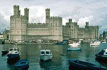 | Castle
World Heritage Site.[3] | Pay | Gwynedd | Caernarfon | Caernarvonshire | map SH477626 53°08′22″N 4°16′37″W / 53.1394°N 4.277°W / 53.1394; -4.277 (Caernarfon Castle)
postcode LL55 2AY | [16] |
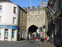
Caernarfon town walls
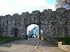 | Town Walls
World Heritage Site.[3] | Free | Gwynedd | Caernarfon | Caernarvonshire | map SH479626 53°08′28″N 4°16′31″W / 53.141°N 4.2754°W / 53.141; -4.2754 (Caernarfon Town Walls) | [17] |
Caerphilly Castle
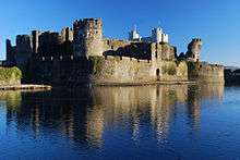 | Castle | Pay | Caerphilly | Caerphilly | Glamorganshire | map ST155870 51°34′35″N 3°13′14″W / 51.5763°N 3.2206°W / 51.5763; -3.2206 (Caerphilly Castle) | [18] |
Caerwent
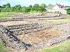 | Roman Town | Free | Monmouthshire | Caerwent | Monmouthshire | map ST469907 51°36′45″N 2°46′06″W / 51.6126°N 2.7683°W / 51.6126; -2.7683 (Caerwent Roman Town) | [19] |
Capel Garmon
 | Burial Chamber | Free | Conwy | Bro Garmon | Denbighshire | map SH817543 53°04′23″N 3°45′57″W / 53.073°N 3.7658°W / 53.073; -3.7658 (Capel Garmon Burial Chamber) | [20] |
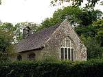
Capel Lligwy
 | Religious | Free | Isle of Anglesey | Moelfre | Anglesey | map SH499863 53°21′08″N 4°15′23″W / 53.3523°N 4.2564°W / 53.3523; -4.2564 (Capel Lligwy) | [21] |
Carew Cross
 | Religious | Free | Pembrokeshire | Carew | Pembrokeshire | map SN047037 51°41′53″N 4°49′40″W / 51.698°N 4.8278°W / 51.698; -4.8278 (Carew Cross) | [22] |
Carreg Cennen Castle
 | Castle | Pay | Carmarthenshire | Dyffryn Cennen | Carmarthenshire | map SN668190 51°51′16″N 3°56′07″W / 51.8545°N 3.9352°W / 51.8545; -3.9352 (Carreg Cennen Castle) | [23] |
Carreg Coetan
 | Burial Chamber | Free | Pembrokeshire | Newport | Pembrokeshire | map SN060394 52°01′07″N 4°49′42″W / 52.0186°N 4.8282°W / 52.0186; -4.8282 (Carreg Coetan Arthur Burial Chamber) | [24] |
| Carswell Medieval House | Domestic | Free (Ext.) | Pembrokeshire | Penally | Pembrokeshire | map SN098010 51°40′34″N 4°45′08″W / 51.676°N 4.7523°W / 51.676; -4.7523 (Carswell Medieval House) | [25] |
Castell Bryn Gwyn
 | Prehistoric | Free | Isle of Anglesey | Llanidan | Anglesey | map SH465670 53°10′42″N 4°17′52″W / 53.1784°N 4.2979°W / 53.1784; -4.2979 (Castell Bryn Gwyn) | [26] |
Castell Coch
 | Castle | Pay | Cardiff | Tongwynlais | Glamorganshire | map ST130826 51°32′10″N 3°15′18″W / 51.536°N 3.2549°W / 51.536; -3.2549 (Castell Coch) | [27] |
Castell y Bere
 | Castle | Free | Gwynedd | Llanfihangel-y-Pennant | Merionethshire | map SH667085 52°39′30″N 3°58′16″W / 52.6583°N 3.9711°W / 52.6583; -3.9711 (Castell y Bere) | [28] |
Chepstow, Bulwark Camp
 | Prehistoric enclosure | Free | Monmouthshire | Chepstow | Monmouthshire | map ST538927 51°37′52″N 2°40′08″W / 51.6312°N 2.6689°W / 51.6312; -2.6689 (Chepstow Bulwarks Camp) | [29] |
Chepstow Castle
 | Castle | Pay | Monmouthshire | Chepstow | Monmouthshire | map ST533940 51°38′37″N 2°40′32″W / 51.6437°N 2.6755°W / 51.6437; -2.6755 (Chepstow Castle) | [30] |
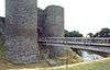
Chepstow Port Wall
 | Town Walls | Free | Monmouthshire | Chepstow | Monmouthshire | map ST533937 51°38′25″N 2°40′34″W / 51.6404°N 2.6762°W / 51.6404; -2.6762 (Chepstow Port Wall) | [31] |
Cilgerran Castle
 | Castle | Pay | Pembrokeshire | Cilgerran | Pembrokeshire | map SN194431 52°03′25″N 4°38′03″W / 52.0569°N 4.6342°W / 52.0569; -4.6342 (Cilgerran Castle) | [32] |
Coity Castle
 | Castle | Free | Bridgend | Coity Higher | Glamorganshire | map SS923814 51°31′20″N 3°33′12″W / 51.5221°N 3.5534°W / 51.5221; -3.5534 (Coity Castle) | [33] |
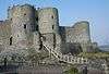
Conwy Castle
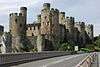 | Castle
World Heritage Site.[3] | Pay | Conwy | Conwy | Caernarvonshire | map SH783774 53°16′48″N 3°49′32″W / 53.2801°N 3.8256°W / 53.2801; -3.8256 (Conwy Castle)
postcode LL32 8AY | [34] |
Conwy town walls
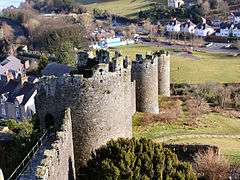 | Town Walls
World Heritage Site.[3] | Free | Conwy | Conwy | Caernarvonshire | map SH780776 53°16′54″N 3°49′52″W / 53.2817°N 3.8312°W / 53.2817; -3.8312 (Conwy Town Walls) | [35] |
Criccieth Castle
 | Castle | Pay | Gwynedd | Criccieth | Caernarvonshire | map SH499377 52°54′58″N 4°13′57″W / 52.916°N 4.2324°W / 52.916; -4.2324 (Criccieth Castle) | [36] |
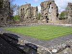
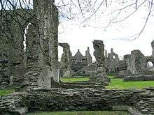
Cymer Abbey
 | Religious | Free | Gwynedd | Llanelltyd | Merionethshire | map SH721195 52°45′29″N 3°53′46″W / 52.7581°N 3.8962°W / 52.7581; -3.8962 (Cymer Abbey) | [37] |
Denbigh Castle
 | Castle | Pay | Denbighshire | Denbigh | Denbighshire | map SJ051657 53°10′50″N 3°25′14″W / 53.1806°N 3.4206°W / 53.1806; -3.4206 (Denbigh Castle) | [38] |
Denbigh Friary
 | Religious | Free | Denbighshire | Denbigh | Denbighshire | map SJ059665 53°11′16″N 3°24′33″W / 53.1878°N 3.4091°W / 53.1878; -3.4091 (Denbigh Friary) | [39] |
Denbigh Town Walls
 | Town Walls | Free | Denbighshire | Denbigh | Denbighshire | map SJ052657 53°10′51″N 3°25′09″W / 53.1808°N 3.4191°W / 53.1808; -3.4191 (Denbigh Town Walls) | [40] |
Leicester's Church, Denbigh
 | Religious | Free | Denbighshire | Denbigh | Denbighshire | map SJ053659 53°10′56″N 3°25′08″W / 53.1822°N 3.419°W / 53.1822; -3.419 (Denbigh, Leicester's Church) | [41] |
Denbigh St Hilary's Chapel
 | Religious | Free | Denbighshire | Denbigh | Denbighshire | map SJ052659 53°10′54″N 3°25′11″W / 53.1818°N 3.4198°W / 53.1818; -3.4198 (Denbigh, St Hilary's Chapel) | [42] |
Derwen Churchyard Cross
 | Religious | Free | Denbighshire | Derwen | Denbighshire | map SJ070507 53°02′45″N 3°23′18″W / 53.0457°N 3.3882°W / 53.0457; -3.3882 (Derwen Churchyard Cross) | [43] |
Din Dryfol
 | Burial Chamber | Free | Isle of Anglesey | Aberffraw | Anglesey | map SH395724 53°13′30″N 4°24′17″W / 53.225°N 4.4048°W / 53.225; -4.4048 (Din Dryfol Burial Chamber) | [44] |
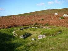
Din Lligwy
 | Hut Group | Free | Isle of Anglesey | Moelfre | Anglesey | map SH497861 53°21′03″N 4°15′33″W / 53.3508°N 4.2592°W / 53.3508; -4.2592 (Din Lligwy Hut Group) | [45] |
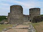
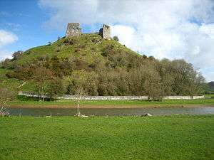
Dinefwr Castle
 | Castle | Free | Carmarthenshire | Llandeilo | Carmarthenshire | map SN622224 51°52′36″N 4°01′07″W / 51.876776°N 4.018562°W / 51.876776; -4.018562 (Dinefwr Castle) | [46] |
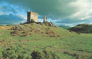
Dolbadarn Castle
 | Castle | Free | Gwynedd | Llanberis | Caernarvonshire | map SH586598 53°07′00″N 4°06′51″W / 53.1166°N 4.1143°W / 53.1166; -4.1143 (Dolbadarn Castle) | [47] |
Dolforwyn Castle
 | Castle | Free | Powys | Llandyssil | Montgomeryshire | map SO151950 52°32′47″N 3°15′09″W / 52.5464°N 3.2525°W / 52.5464; -3.2525 (Dolforwyn Castle) | [48] |
Dolwyddelan Castle
 | Castle | Pay | Conwy | Dolwyddelan | Caernarvonshire | map SH721523 53°03′11″N 3°54′30″W / 53.0531°N 3.9084°W / 53.0531; -3.9084 (Dolwyddelan Castle) | [49] |
Dryslwyn Castle
 | Castle | Free | Carmarthenshire | Llangathen | Carmarthenshire | map SN554203 51°51′48″N 4°06′03″W / 51.8632°N 4.1007°W / 51.8632; -4.1007 (Dryslwyn Castle) | [50] |
Dyffryn Ardudwy
 | Burial Chamber | Free | Gwynedd | Dyffryn Ardudwy | Merionethshire | map SH588228 52°47′05″N 4°05′37″W / 52.7846°N 4.0937°W / 52.7846; -4.0937 (Dyffryn Ardudwy Burial Chamber) | [51] |
Dyfi Furnace
 | Industrial | Free | Ceredigion | Ysgubor-y-coed | Cardiganshire | map SN684950 52°32′16″N 3°56′25″W / 52.5378°N 3.9404°W / 52.5378; -3.9404 (Dyfi Furnace) | [52] |
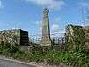
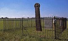
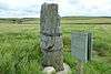
Eliseg's Pillar
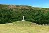 | Religious | Free | Denbighshire | Llantysilio | Denbighshire | map SJ202445 52°59′32″N 3°11′21″W / 52.9921°N 3.1893°W / 52.9921; -3.1893 (Eliseg's Pillar) | [53] |
Ewenny Priory
 | Religious | Free | The Vale of Glamorgan | Ewenny | Glamorganshire | map SS912778 51°29′20″N 3°34′03″W / 51.4888°N 3.5676°W / 51.4888; -3.5676 (Ewenny Priory) | [54] |
Ewloe Castle
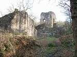 | Castle | Free | Flintshire | Hawarden | Flintshire | map SJ288675 53°12′00″N 3°04′02″W / 53.2°N 3.0672°W / 53.2; -3.0672 (Ewloe Castle) | [55] |
Flint Castle
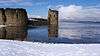 | Castle | Free | Flintshire | Flint | Flintshire | map SJ246732 53°15′04″N 3°07′48″W / 53.2511°N 3.1301°W / 53.2511; -3.1301 (Flint Castle) | [56] |
Grosmont Castle
 | Castle | Free | Monmouthshire | Grosmont | Monmouthshire | map SO405244 51°54′55″N 2°51′57″W / 51.9154°N 2.8657°W / 51.9154; -2.8657 (Grosmont Castle) | [57] |
Gwydir Uchaf Chapel
 | Religious | Free | Conwy | Trefriw | Caernarvonshire | map SH794609 53°07′55″N 3°48′10″W / 53.1319°N 3.8028°W / 53.1319; -3.8028 (Gwydir Uchaf Chapel) | [58] |
Hafoty Medieval House
 | Domestic | Free (Ext.) | Isle of Anglesey | Cwm Cadnant | Anglesey | map SH562781 53°16′51″N 4°09′28″W / 53.2809°N 4.1579°W / 53.2809; -4.1579 (Hafoty Medieval House) | [59] |
Harlech Castle
 | Castle
World Heritage Site.[3] | Pay | Gwynedd | Harlech | Merionethshire | map SH581312 52°51′37″N 4°06′33″W / 52.8602°N 4.1091°W / 52.8602; -4.1091 (Harlech Castle)
postcode LL46 2YH | [60] |
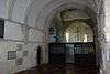
Haverfordwest Priory
 | Religious | Free | Pembrokeshire | Haverfordwest | Pembrokeshire | map SM956151 51°47′51″N 4°57′51″W / 51.7976°N 4.9643°W / 51.7976; -4.9643 (Haverfordwest Priory) | [61] |
Hen Gwrt Moated Site
 | Domestic | Free | Monmouthshire | Llantilio Crossenny | Monmouthshire | map SO395151 51°49′53″N 2°52′42″W / 51.8315°N 2.8782°W / 51.8315; -2.8782 (Hen Gwrt Moated Site) | [62] |
Holyhead Mountain Hut Circles
 | Hut Group | Free | Isle of Anglesey | Trearddur | Anglesey | map SH212820 53°18′19″N 4°41′02″W / 53.3054°N 4.6838°W / 53.3054; -4.6838 (Holyhead Mountain Hut Circles) | [63] |
Kidwelly Castle
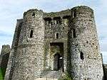 | Castle | Pay | Carmarthenshire | Kidwelly | Carmarthenshire | map SN409070 51°44′23″N 4°18′20″W / 51.7398°N 4.3055°W / 51.7398; -4.3055 (Kidwelly Castle) | [64] |
Lamphey Bishop's Palace
 | Religious | Pay | Pembrokeshire | Lamphey | Pembrokeshire | map SN018009 51°40′19″N 4°52′00″W / 51.672°N 4.8668°W / 51.672; -4.8668 (Lamphey Bishop's Palace) | [65] |
Laugharne Castle
 | Castle | Pay | Carmarthenshire | Laugharne Township | Carmarthenshire | map SN302107 51°46′11″N 4°27′44″W / 51.7696°N 4.4621°W / 51.7696; -4.4621 (Laugharne Castle) | [66] |
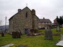
Llangar Church
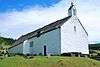 | Religious | Pay | Denbighshire | Cynwyd | Merionethshire | map SJ063424 52°58′16″N 3°23′45″W / 52.9712°N 3.3959°W / 52.9712; -3.3959 (Llangar Old Parish Church) | [67] |
Llanmelin Wood Hill Fort
 | Hill Fort | Free | Monmouthshire | Caerwent | Monmouthshire | map ST461925 51°37′45″N 2°46′46″W / 51.6291°N 2.7794°W / 51.6291; -2.7794 (Llanmelin Wood Hill Fort) | [68] |
Llansteffan Castle
 | Castle | Free | Carmarthenshire | Llansteffan | Carmarthenshire | map SN351101 51°45′56″N 4°23′27″W / 51.7655°N 4.3908°W / 51.7655; -4.3908 (Llansteffan Castle) | [69] |
Llanthony Priory
 | Religious | Free | Monmouthshire | Crucorney | Monmouthshire | map SO289278 51°56′41″N 3°02′11″W / 51.9448°N 3.0364°W / 51.9448; -3.0364 (Llanthony Priory) | [70] |
Llawhaden Castle
 | Castle | | Pembrokeshire | Llawhaden | Pembrokeshire | map SN073175 51°49′20″N 4°47′51″W / 51.8223°N 4.7976°W / 51.8223; -4.7976 (Llawhaden Castle) | [71] |
Lligwy Burial Chamber
 | Burial Chamber | Free | Isle of Anglesey | Moelfre | Anglesey | map SH501860 53°21′00″N 4°15′10″W / 53.3499°N 4.2529°W / 53.3499; -4.2529 (Lligwy Burial Chamber) | [72] |
Loughor Castle
 | Castle | Free | Swansea | Llwchwr | Glamorganshire | map SS564979 51°39′44″N 4°04′38″W / 51.6622°N 4.0771°W / 51.6622; -4.0771 (Loughor Castle) | [73] |
Maen Achwyfan Cross
 | Religious | Free | Flintshire | Whitford | Flintshire | map SJ128787 53°17′55″N 3°18′31″W / 53.2987°N 3.3085°W / 53.2987; -3.3085 (Maen Achwyfan Cross) | [74] |
Margam Stones Museum
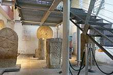 | Religious | Pay | Neath Port Talbot | Margam | Glamorganshire | map SS801864 51°33′49″N 3°43′52″W / 51.5637°N 3.7312°W / 51.5637; -3.7312 (Margam Stones Museum) | [75] |
Monmouth Castle
 | Castle | Free | Monmouthshire | Monmouth | Monmouthshire | map SO506128 51°48′45″N 2°43′00″W / 51.8125°N 2.7167°W / 51.8125; -2.7167 (Monmouth Castle) | [76] |
Montgomery Castle
 | Castle | Free | Powys | Montgomery | Montgomeryshire | map SO221967 52°33′48″N 3°09′00″W / 52.5632°N 3.1501°W / 52.5632; -3.1501 (Montgomery Castle) | [77] |
Neath Abbey
 | Religious | Free | Neath Port Talbot | Dyffryn Clydach | Glamorganshire | map SS738974 51°39′40″N 3°49′34″W / 51.6612°N 3.826°W / 51.6612; -3.826 (Neath Abbey and Gatehouse) | [78] |
Newcastle Castle
 | Castle | Free | Bridgend | Bridgend | Glamorganshire | map SS902800 51°30′32″N 3°34′59″W / 51.5089°N 3.583°W / 51.5089; -3.583 (Newcastle, Bridgend) | [79] |
Newport Castle
 | Castle | Free | Newport | Stow Hill | Monmouthshire | map ST311884 51°35′27″N 2°59′42″W / 51.5908°N 2.9951°W / 51.5908; -2.9951 (Newport Castle) | [80] |
Ogmore Castle
 | Castle | Free | The Vale of Glamorgan | St Bride's Major | Glamorganshire | map SS881769 51°28′50″N 3°36′41″W / 51.4805°N 3.6115°W / 51.4805; -3.6115 (Ogmore Castle) | [81] |
Old Beaupre Castle
 | Castle | Free | The Vale of Glamorgan | Llanfair | Glamorganshire | map ST008720 51°26′19″N 3°25′39″W / 51.4385°N 3.4274°W / 51.4385; -3.4274 (Old Beaupre Castle) | [82] |
Oxwich Castle
 | Castle | Pay | Swansea | Penrice | Glamorganshire | map SS497862 51°33′20″N 4°10′06″W / 51.5555°N 4.1683°W / 51.5555; -4.1683 (Oxwich Castle) | [83] |
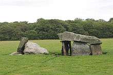
Parc le Breos
 | Burial Chamber} | Free | Swansea | Ilston | Glamorganshire | map SS537898 51°35′18″N 4°06′46″W / 51.5883°N 4.1128°W / 51.5883; -4.1128 (Parc le Breos Burial Chamber) | [84] |
Penarth Fawr
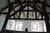 | Medieval House | ? | Gwynedd | Llanystumdwy | Caernarvonshire | map SH419376 52°54′48″N 4°21′09″W / 52.9132°N 4.3524°W / 52.9132; -4.3524 (Penarth Fawr Medieval House) | [85] |
Penmon Cross
 | Religious | Free | Isle of Anglesey | Llangoed | Anglesey | map SH630807 53°18′21″N 4°03′24″W / 53.3058°N 4.0568°W / 53.3058; -4.0568 (Penmon Cross) | [86] |
Penmon Dovecote
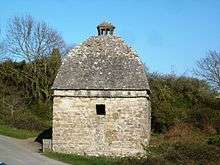 | Domestic | Free | Isle of Anglesey | Llangoed | Anglesey | map SH631807 53°18′20″N 4°03′21″W / 53.3056°N 4.0557°W / 53.3056; -4.0557 (Penmon Dovecote) | [87] |
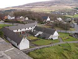
Penmon Priory
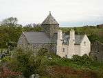 | Religious | Free | Isle of Anglesey | Llangoed | Anglesey | map SH630807 53°18′20″N 4°03′24″W / 53.3055°N 4.0568°W / 53.3055; -4.0568 (Penmon Priory) | [88] |
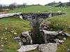
Penmon - St Seiriol's Well
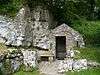 | Religious | Free | Isle of Anglesey | Llangoed | Anglesey | map SH630808 53°18′23″N 4°03′24″W / 53.3064°N 4.0566°W / 53.3064; -4.0566 (Penmon, St Seiriol's Well) | [89] |
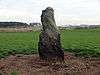
Penrhos Feilw Standing Stones
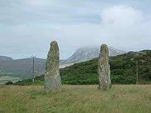 | Prehistoric | Free | Isle of Anglesey | Trearddur | Anglesey | map SH227809 53°17′45″N 4°39′42″W / 53.2957°N 4.6618°W / 53.2957; -4.6618 (Penrhos Feliw Standing Stones) | [90] |
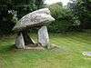
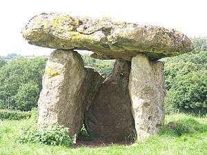
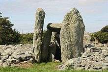
Pentre Ifan
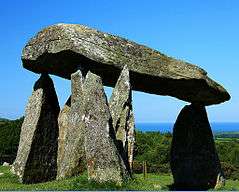 | Burial Chamber | Free | Pembrokeshire | Nevern | Pembrokeshire | map SN099370 51°59′57″N 4°46′12″W / 51.9991°N 4.7701°W / 51.9991; -4.7701 (Pentre Ifan Burial Chamber) | [91] |
Plas Mawr, Conwy
 | Domestic | Pay | Conwy | Conwy | Caernarvonshire | map SH780775 53°16′52″N 3°49′48″W / 53.2812°N 3.83°W / 53.2812; -3.83 (Plas Mawr) | [92] |
Pont Minllyn
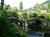 | Bridge | Free | Gwynedd | Mawddwy | Merionethshire | map SH859138 52°42′38″N 3°41′21″W / 52.7106°N 3.6891°W / 52.7106; -3.6891 (Pont Minllyn) | [93] |
| Pontypandy Priory | Religious | Free | Ceredigion | Pontypandy | Dyfed |
Presaddfed
 | Burial Chamber | Free | Isle of Anglesey | Bodedern | Anglesey | map SH347808 53°17′57″N 4°28′51″W / 53.2992°N 4.4809°W / 53.2992; -4.4809 (Presaddfed Burial Chamber) | [94] |
Raglan Castle
 | Castle | Pay | Monmouthshire | Raglan | Monmouthshire | map SO417085 51°46′13″N 2°50′59″W / 51.7702°N 2.8498°W / 51.7702; -2.8498 (Raglan Castle) | [95] |
Rhuddlan Castle
 | Castle | Pay | Denbighshire | Rhuddlan | Flintshire | map SJ024779 53°17′21″N 3°27′54″W / 53.2891°N 3.465°W / 53.2891; -3.465 (Rhuddlan Castle) | [96] |
Rug Chapel
 | Religious | Pay | Denbighshire | Corwen | Merionethshire | map SJ064438 52°59′03″N 3°23′39″W / 52.9842°N 3.3942°W / 52.9842; -3.3942 (Rug Chapel / Llangar Old Parish Church) | [97] |
Runston Chapel
 | Religious | | Monmouthshire | Mathern | Monmouthshire | map ST496915 51°37′13″N 2°43′45″W / 51.6204°N 2.7293°W / 51.6204; -2.7293 (Runston Chapel) | [98] |
Segontium Roman Fort
 | Roman Fort | Free | Gwynedd | Caernarfon | Caernarvonshire | map SH485624 53°08′14″N 4°15′58″W / 53.1372°N 4.2662°W / 53.1372; -4.2662 (Segontium Roman Fort) | [99] |
Skenfrith Castle
 | Castle | Free | Monmouthshire | Llangattock-Vibon-Avel | Monmouthshire | map SO456203 51°52′43″N 2°47′25″W / 51.8786°N 2.7904°W / 51.8786; -2.7904 (Skenfrith Castle) | [100] |
St Cybi's Well
 | Religious | Free | Gwynedd | Llangybi | Gwynedd | map SH427413 52°56′45″N 4°20′32″W / 52.945735°N 4.342090°W / 52.945735; -4.342090 (St Cybi's Well) | [101] |
St Davids Bishop's Palace
 | Religious | Pay | Pembrokeshire | St Davids | Pembrokeshire | map SM750254 51°52′56″N 5°16′15″W / 51.8821°N 5.2708°W / 51.8821; -5.2708 (St Davids Bishop's Palace) | [102] |
St Dogmaels Abbey
 | Religious | Free | Pembrokeshire | St Dogmaels | Pembrokeshire | map SN164458 52°04′50″N 4°40′50″W / 52.0806°N 4.6806°W / 52.0806; -4.6806 (St Dogmaels Abbey and Coach House) | [103] |
St Lythans burial chamber
 | Burial Chamber | Free | The Vale of Glamorgan | Wenvoe | Glamorganshire | map ST100723 51°26′33″N 3°17′42″W / 51.4426°N 3.2951°W / 51.4426; -3.2951 (St Lythans Burial Chamber) | [104] |
St Non's Chapel
 | Religious | Free | Pembrokeshire | St Davids | Pembrokeshire | map SM750243 51°52′20″N 5°16′08″W / 51.8722°N 5.2689°W / 51.8722; -5.2689 (St Non's Chapel) | [105] |
St Quentin's Castle, Llanblethian
 | Castle | Free | The Vale of Glamorgan | Cowbridge with Llanblethian | Glamorganshire | map SS989741 51°27′27″N 3°27′23″W / 51.4576°N 3.4564°W / 51.4576; -3.4564 (St Quentin's Castle, Llanblethian) | [106] |
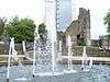
St Winefride's Chapel and Holywell
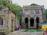 | Religious | Free | Flintshire | Holywell | Flintshire | map SJ185762 53°16′38″N 3°13′25″W / 53.2771°N 3.2236°W / 53.2771; -3.2236 (St Winifred's Chapel and Holy Well) | [107] |
Strata Florida Abbey
 | Religious | Pay | Ceredigion | Ystrad Fflur | Cardiganshire | map SN746657 52°16′31″N 3°50′18″W / 52.2752°N 3.8383°W / 52.2752; -3.8383 (Strata Florida Abbey) | [108] |
Swansea Castle
 | Castle | Free (External only) | Swansea | Swansea | Glamorganshire | map SS657930 51°37′14″N 3°56′28″W / 51.6205°N 3.9411°W / 51.6205; -3.9411 (Swansea Castle) | [109] |
Talley Abbey
 | Religious | Free | Carmarthenshire | Talley | Carmarthenshire | map SN632327 51°58′35″N 3°59′32″W / 51.9765°N 3.9922°W / 51.9765; -3.9922 (Talley Abbey) | [110] |
Tinkinswood
 | Burial Chamber | Free | The Vale of Glamorgan | St Nicholas and Bonvilston | Glamorganshire | map ST092732 51°27′05″N 3°18′26″W / 51.4513°N 3.3072°W / 51.4513; -3.3072 (Tinkinswood Burial Chamber) | [111] |
Tintern Abbey
 | Religious | Pay | Monmouthshire | Tintern | Monmouthshire | map SO533000 51°41′49″N 2°40′36″W / 51.6969°N 2.6768°W / 51.6969; -2.6768 (Tintern Abbey) | [112] |
Trefignath
 | Burial Chamber | Free | Isle of Anglesey | Trearddur | Anglesey | map SH258805 53°17′36″N 4°36′51″W / 53.2932°N 4.6142°W / 53.2932; -4.6142 (Trefignath Burial Chamber) | [113] |
Tregwehelydd Standing Stone
 | Prehistoric | Free | Isle of Anglesey | Tref Alaw | Anglesey | map SH340831 53°19′10″N 4°29′33″W / 53.3195°N 4.4926°W / 53.3195; -4.4926 (Tregwehelydd Standing Stone) | [114] |
Tretower Castle
 | Castle | Pay | Powys | Llanfihangel Cwmdu | Brecknockshire | map SO184212 51°53′02″N 3°11′10″W / 51.8839°N 3.1862°W / 51.8839; -3.1862 (Tretower Castle) | [115] |
Tretower Court
 | Castle | Pay | Powys | Llanfihangel Cwmdu | Brecknockshire | map SO185211 51°53′00″N 3°11′05″W / 51.8832°N 3.1846°W / 51.8832; -3.1846 (Tretower Court) | [116] |
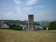
Twthill, Rhuddlan
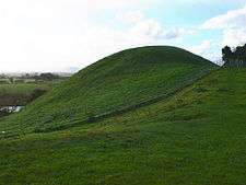 | Castle Mound | Free | Denbighshire | Rhuddlan | Flintshire | map SJ026776 53°17′14″N 3°27′43″W / 53.2871°N 3.4619°W / 53.2871; -3.4619 (Twthill, Rhuddlan) | [117] |
Tŷ Mawr Standing Stone
 | Prehistoric | Free | Isle of Anglesey | Holyhead | Anglesey | map SH253809 53°17′48″N 4°37′17″W / 53.2967°N 4.6214°W / 53.2967; -4.6214 (Ty Mawr Standing Stone) | [118] |
Tŷ Newydd Burial Chamber
 | Burial Chamber | Free | Isle of Anglesey | Llanfaelog | Anglesey | map SH344738 53°14′09″N 4°28′57″W / 53.2359°N 4.4824°W / 53.2359; -4.4824 (Tŷ Newydd Burial Chamber) | [119] |
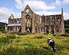
Valle Crucis Abbey
 | Religious | Pay | Denbighshire | Llantysilio | Denbighshire | map SJ204441 52°59′20″N 3°11′12″W / 52.9888°N 3.1867°W / 52.9888; -3.1867 (Valle Crucis Abbey) | [120] |
Weobley Castle
 | Castle | Pay | Swansea | Llanrhidian Lower | Glamorganshire | map SS478927 51°36′46″N 4°11′57″W / 51.6128°N 4.1993°W / 51.6128; -4.1993 (Weobley Castle) | [121] |
White Castle
 | Castle | Pay | Monmouthshire | Llantilio Crossenny | Monmouthshire | map SO379167 51°50′46″N 2°54′08″W / 51.8461°N 2.9022°W / 51.8461; -2.9022 (White Castle) | [122] |
Wiston Castle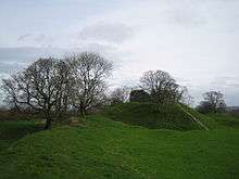 | Castle | Free | Pembrokeshire | Wiston | Pembrokeshire | map SN022181 51°49′36″N 4°52′16″W / 51.8268°N 4.8711°W / 51.8268; -4.8711 (Wiston Castle) | [123] |