| [4] |
Name on the Register[5] |
Image |
Date listed[6] |
Location |
Description |
|---|
| 1 |
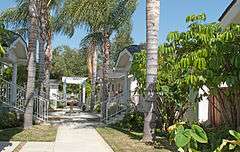
Arroyo Seco Parkway Historic District |
|
000000002011-02-04-0000February 4, 2011
(#10001198) |
CA 110 from Four Level Interchange in Los Angeles to East Glenarm St. in Pasadena
34°07′39″N 118°08′50″W / 34.1275°N 118.147222°W / 34.1275; -118.147222 (Arroyo Seco Parkway Historic District) |
Runs from Downtown Los Angeles to Pasadena
|
| 2 |
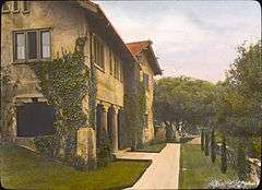
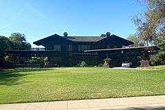
Batchelder House |
|
000000001978-12-14-0000December 14, 1978
(#78000695) |
626 S. Arroyo Blvd.
34°08′06″N 118°09′54″W / 34.135°N 118.165°W / 34.135; -118.165 (Batchelder House) |
|
| 3 |
Bekins Storage Co. Roof Sign |
|
000000001997-10-15-0000October 15, 1997
(#97001212) |
511 S. Fair Oaks Ave.
34°08′14″N 118°09′00″W / 34.137222°N 118.15°W / 34.137222; -118.15 (Bekins Storage Co. Roof Sign) |
The sign now promotes Public Storage Co.
|
| 4 |
Louise C. Bentz House |
|
000000001977-12-02-0000December 2, 1977
(#77000299) |
657 Prospect Blvd.
34°09′21″N 118°09′38″W / 34.155833°N 118.160556°W / 34.155833; -118.160556 (Louise C. Bentz House) |
|
| 5 |
Robert R. Blacker House |
|
000000001986-02-06-0000February 6, 1986
(#86000147) |
1177 Hillcrest Ave.
34°07′37″N 118°07′58″W / 34.126944°N 118.132778°W / 34.126944; -118.132778 (Robert R. Blacker House) |
|
| 6 |
Edmund Blinn House |
|
000000002001-04-05-0000April 5, 2001
(#01000329) |
160 N. Oakland Ave.
34°08′55″N 118°08′19″W / 34.148611°N 118.138611°W / 34.148611; -118.138611 (Edmund Blinn House) |
|
| 7 |
Dr. W. T. Bolton House |
|
000000001980-07-09-0000July 9, 1980
(#80004491) |
370 W. Del Mar Blvd.
34°08′26″N 118°09′27″W / 34.140556°N 118.1575°W / 34.140556; -118.1575 (Dr. W. T. Bolton House) |
|
| 8 |
Bonnie Court |
|
000000001994-11-15-0000November 15, 1994
(#94001325) |
140 S. Bonnie Ave.
34°08′35″N 118°06′52″W / 34.143056°N 118.114444°W / 34.143056; -118.114444 (Bonnie Court) |
|
| 9 |
Bowen Court |
|
000000001982-06-17-0000June 17, 1982
(#82002194) |
539 E. Villa St.
34°09′20″N 118°08′18″W / 34.155556°N 118.138333°W / 34.155556; -118.138333 (Bowen Court) |
|
| 10 |
Bristol-Cypress Historic District |
|
000000002011-08-09-0000August 9, 2011
(#11000489) |
438-516 Cypress Ave.
34°09′13″N 118°09′15″W / 34.153611°N 118.154167°W / 34.153611; -118.154167 (Bristol-Cypress Historic District) |
|
| 11 |
Bryan Court |
|
000000001986-04-16-0000April 16, 1986
(#86000790) |
427 S. Marengo Ave.
34°08′18″N 118°08′46″W / 34.138333°N 118.146111°W / 34.138333; -118.146111 (Bryan Court) |
|
| 12 |
Bullock's Pasadena |
|
000000001996-07-12-0000July 12, 1996
(#96000776) |
401 S. Lake Ave.
34°08′15″N 118°07′58″W / 34.1375°N 118.132778°W / 34.1375; -118.132778 (Bullock's Pasadena) |
|
| 13 |
Bungalow Heaven Historic District |
|
000000002008-04-10-0000April 10, 2008
(#08000260) |
Roughly bounded by N. Mentor Ave., E. Orange Grove Blvd., E. Washington Blvd., N. Michigan & N. Chester Aves.
34°09′48″N 118°07′39″W / 34.163403°N 118.127469°W / 34.163403; -118.127469 (Bungalow Heaven Historic District) |
|
| 14 |
Case Study House No. 10 |
|
000000002013-07-24-0000July 24, 2013
(#13000514) |
711 S. San Rafael Ave.
34°07′52″N 118°10′13″W / 34.13122°N 118.17032°W / 34.13122; -118.17032 (Case Study House No. 10) |
One of the Case Study Houses. While the NPS listing for the property gives its address as in Los Angeles, its nomination form places the property in Pasadena.[7]
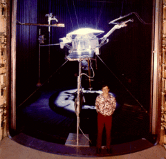
|
| 15 |
Civic Center Financial District |
|
000000001982-10-29-0000October 29, 1982
(#82000967) |
E. Colorado Blvd. and Marengo Ave.
34°08′46″N 118°08′41″W / 34.146111°N 118.144722°W / 34.146111; -118.144722 (Civic Center Financial District) |
|
| 16 |
Colonial Court |
|
000000001983-07-11-0000July 11, 1983
(#83001185) |
291-301 N. Garfield Ave.
34°09′04″N 118°08′39″W / 34.151111°N 118.144167°W / 34.151111; -118.144167 (Colonial Court) |
|
| 17 |
Colorado Street Bridge |
|
000000001981-02-12-0000February 12, 1981
(#81000156) |
Colorado Blvd.
34°08′41″N 118°09′49″W / 34.144722°N 118.163611°W / 34.144722; -118.163611 (Colorado Street Bridge) |
|
| 18 |
James Fielding Cosby House |
|
000000002011-08-09-0000August 9, 2011
(#11000490) |
510 Locke Haven St.
34°08′17″N 118°09′41″W / 34.138056°N 118.161389°W / 34.138056; -118.161389 (James Fielding Cosby House) |
|
| 19 |
Cottage Court |
|
000000001983-07-11-0000July 11, 1983
(#83001186) |
642-654 S. Marengo Ave.
34°08′04″N 118°08′41″W / 34.134444°N 118.144722°W / 34.134444; -118.144722 (Cottage Court) |
|
| 20 |
Court |
|
000000001983-07-11-0000July 11, 1983
(#83001188) |
744-756½ S. Marengo Ave.
34°07′58″N 118°08′40″W / 34.132778°N 118.144444°W / 34.132778; -118.144444 (Court) |
|
| 21 |
Court |
|
000000001983-07-11-0000July 11, 1983
(#83001187) |
497-503½ N. Madison Ave.
34°09′17″N 118°08′15″W / 34.154722°N 118.1375°W / 34.154722; -118.1375 (Court) |
|
| 22 |
Court |
|
000000001983-07-11-0000July 11, 1983
(#83001189) |
732-744 Santa Barbara St.
34°09′19″N 118°08′03″W / 34.155278°N 118.134167°W / 34.155278; -118.134167 (Court) |
|
| 23 |
Court at 1274-1282 North Raymond Avenue |
|
000000001994-11-15-0000November 15, 1994
(#94001315) |
1274-1282 N. Raymond Ave.
34°10′04″N 118°08′56″W / 34.167821°N 118.14875°W / 34.167821; -118.14875 (Court at 1274-1282 North Raymond Avenue) |
|
| 24 |
Court at 275 North Chester Avenue |
|
000000001994-11-15-0000November 15, 1994
(#94001324) |
275 N. Chester Ave.
34°09′03″N 118°07′29″W / 34.150951°N 118.124615°W / 34.150951; -118.124615 (Court at 275 North Chester Avenue) |
|
| 25 |
Court at 533-549 North Lincoln Avenue |
|
000000001994-11-15-0000November 15, 1994
(#94001320) |
533-549 N. Lincoln Ave.
34°09′15″N 118°09′14″W / 34.154231°N 118.153963°W / 34.154231; -118.153963 (Court at 533-549 North Lincoln Avenue) |
|
| 26 |
Court at 638-650 North Mar Vista Avenue |
|
000000001994-11-15-0000November 15, 1994
(#94001319) |
638-650 N. Mar Vista Ave.
34°09′26″N 118°07′35″W / 34.157131°N 118.126482°W / 34.157131; -118.126482 (Court at 638-650 North Mar Vista Avenue) |
|
| 27 |
Court at 940-948 North Raymond Avenue |
|
000000001994-11-15-0000November 15, 1994
(#94001317) |
940-948 N. Raymond Ave.
34°09′43″N 118°08′55″W / 34.162058°N 118.148689°W / 34.162058; -118.148689 (Court at 940-948 North Raymond Avenue) |
|
| 28 |
Cordelia A. Culbertson House |
|
000000001985-09-12-0000September 12, 1985
(#85002198) |
1188 Hillcrest Ave.
34°07′40″N 118°07′56″W / 34.127778°N 118.132222°W / 34.127778; -118.132222 (Cordelia A. Culbertson House) |
|
| 29 |
Cypress Court |
|
000000001983-07-11-0000July 11, 1983
(#83001190) |
623-641 N. Madison Ave.
34°09′25″N 118°08′16″W / 34.156944°N 118.137778°W / 34.156944; -118.137778 (Cypress Court) |
|
| 30 |
Mary E. Denham House |
|
000000002011-08-09-0000August 9, 2011
(#11000491) |
297 S. Orange Grove Blvd.
34°08′26″N 118°09′35″W / 34.140556°N 118.159722°W / 34.140556; -118.159722 (Mary E. Denham House) |
|
| 31 |
Don Carlos Court |
|
000000001983-07-11-0000July 11, 1983
(#83001191) |
374-386 S. Marengo Ave.
34°08′23″N 118°08′40″W / 34.139722°N 118.144444°W / 34.139722; -118.144444 (Don Carlos Court) |
|
| 32 |
Euclid Court |
|
000000001983-07-11-0000July 11, 1983
(#83001193) |
545 S. Euclid Ave.
34°08′11″N 118°08′32″W / 34.136389°N 118.142222°W / 34.136389; -118.142222 (Euclid Court) |
|
| 33 |
Evanston Inn |
|
000000001984-09-13-0000September 13, 1984
(#84000787) |
385-395 S. Marengo Ave.
34°08′19″N 118°08′43″W / 34.138611°N 118.145278°W / 34.138611; -118.145278 (Evanston Inn) |
|
| 34 |
Fenyes Estate |
|
000000001985-09-05-0000September 5, 1985
(#85001983) |
470 W. Walnut St. & 160 N. Orange Grove Blvd.
34°08′56″N 118°09′37″W / 34.148889°N 118.160278°W / 34.148889; -118.160278 (Fenyes Estate) |
|
| 35 |
First Trust Building and Garage |
|
000000001987-06-12-0000June 12, 1987
(#87000941) |
587-611 E. Colorado Blvd. and 30-44 N. Madison Ave.
34°08′46″N 118°08′17″W / 34.14613°N 118.13808°W / 34.14613; -118.13808 (First Trust Building and Garage) |
|
| 36 |
Foothill Boulevard Milestone (Mile 11) |
|
000000001996-04-19-0000April 19, 1996
(#96000421) |
South side of E. Colorado Blvd., west of the junction with Holliston Ave.
34°08′45″N 118°07′23″W / 34.145864°N 118.123156°W / 34.145864; -118.123156 (Foothill Boulevard Milestone (Mile 11)) |
|
| 37 |
Ford Place Historic District |
|
000000002010-07-22-0000July 22, 2010
(#10000496) |
110-175 N. Oakland Ave.; 450-465 Ford Place; 144 N. Los Robles Ave.
34°08′55″N 118°08′26″W / 34.148611°N 118.140556°W / 34.148611; -118.140556 (Ford Place Historic District) |
|
| 38 |
Richard and Mary Alice Frank House |
|
000000002009-04-10-0000April 10, 2009
(#09000175) |
919 La Loma Road
34°08′05″N 118°10′10″W / 34.134722°N 118.169444°W / 34.134722; -118.169444 (Richard and Mary Alice Frank House) |
|
| 39 |
Rose Graham and James Allen Freeman House |
|
000000002011-09-15-0000September 15, 2011
(#11000654) |
1330 Hillcrest Ave.
34°07′28″N 118°07′53″W / 34.124577°N 118.131510°W / 34.124577; -118.131510 (Rose Graham and James Allen Freeman House) |
|
| 40 |
Friendship Baptist Church |
|
000000001978-11-20-0000November 20, 1978
(#78000696) |
80 W. Dayton St.
34°08′36″N 118°09′04″W / 34.143333°N 118.151111°W / 34.143333; -118.151111 (Friendship Baptist Church) |
|
| 41 |
Gamble House |
|
000000001971-09-03-0000September 3, 1971
(#71000155) |
4 Westmoreland Pl.
34°09′05″N 118°09′36″W / 34.151389°N 118.16°W / 34.151389; -118.16 (Gamble House) |
|
| 42 |
Gartz Court |
|
000000001983-08-25-0000August 25, 1983
(#83001195) |
745 N. Pasadena Ave.
34°09′26″N 118°09′36″W / 34.157095°N 118.160128°W / 34.157095; -118.160128 (Gartz Court) |
|
| 43 |
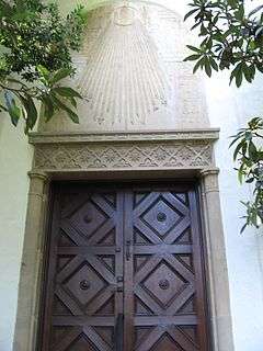
Merwyn C. Gill House |
|
000000002009-12-23-0000December 23, 2009
(#09000176) |
1385 El Mirador Dr.
34°09′56″N 118°10′44″W / 34.165604°N 118.178942°W / 34.165604; -118.178942 (Merwyn C. Gill House) |
|
| 44 |
Hale Solar Laboratory |
|
000000001986-01-23-0000January 23, 1986
(#86000103) |
740 Holladay Rd.
34°07′59″N 118°07′14″W / 34.133056°N 118.120556°W / 34.133056; -118.120556 (Hale Solar Laboratory) |
|
| 45 |
Harnetiaux Court |
|
000000001994-11-15-0000November 15, 1994
(#94001321) |
48 N. Catalina Ave.
34°08′49″N 118°07′45″W / 34.146902°N 118.129131°W / 34.146902; -118.129131 (Harnetiaux Court) |
|
| 46 |
John S. Hartwell House |
|
000000002011-08-09-0000August 9, 2011
(#11000492) |
423 Lincoln Ave.
34°09′09″N 118°09′10″W / 34.1525°N 118.152778°W / 34.1525; -118.152778 (John S. Hartwell House) |
|
| 47 |
Haskett Court |
|
000000001982-02-25-0000February 25, 1982
(#82002195) |
824-834 E. California Blvd.
34°08′09″N 118°07′56″W / 34.135833°N 118.132222°W / 34.135833; -118.132222 (Haskett Court) |
|
| 48 |
Hermitage |
|
000000002001-04-05-0000April 5, 2001
(#01000328) |
2121 Monte Vista St.
34°09′20″N 118°06′25″W / 34.15563°N 118.106816°W / 34.15563; -118.106816 (Hermitage) |
|
| 49 |
Hillmont |
|
000000002011-08-09-0000August 9, 2011
(#11000493) |
1375 E. Mountain St.
34°09′43″N 118°07′19″W / 34.161944°N 118.121944°W / 34.161944; -118.121944 (Hillmont) |
|
| 50 |
Holly Street Livery Stable |
|
000000001979-10-25-0000October 25, 1979
(#79000491) |
110 E. Holly St
34°08′49″N 118°08′51″W / 34.146944°N 118.1475°W / 34.146944; -118.1475 (Holly Street Livery Stable) |
|
| 51 |
Home Laundry |
|
000000001987-06-18-0000June 18, 1987
(#87000980) |
432 S. Arroyo Pkwy.
34°08′18″N 118°08′49″W / 34.138462°N 118.147045°W / 34.138462; -118.147045 (Home Laundry) |
|
| 52 |
Mrs. J.H. Hood House |
|
000000002011-08-09-0000August 9, 2011
(#11000494) |
494 Ellis St.
34°08′27″N 118°09′39″W / 34.140833°N 118.160833°W / 34.140833; -118.160833 (Mrs. J.H. Hood House) |
|
| 53 |
Hotel Green |
|
000000001982-03-23-0000March 23, 1982
(#82002196) |
99 S. Raymond Ave.
34°08′39″N 118°08′55″W / 34.144167°N 118.148611°W / 34.144167; -118.148611 (Hotel Green) |
|
| 54 |
House at 1011 S. Madison Ave. |
|
000000001998-08-06-0000August 6, 1998
(#98000959) |
1011 S. Madison Ave.
34°07′43″N 118°08′19″W / 34.128476°N 118.13856°W / 34.128476; -118.13856 (House at 1011 S. Madison Ave.) |
|
| 55 |
House at 1015 Prospect Boulevard |
|
000000002004-08-20-0000August 20, 2004
(#04000322) |
1015 Prospect Blvd.
34°09′37″N 118°09′46″W / 34.160403°N 118.162777°W / 34.160403; -118.162777 (House at 1015 Prospect Boulevard) |
|
| 56 |
House at 1050 S. Madison Ave. |
|
000000001998-08-06-0000August 6, 1998
(#98000960) |
1050 S. Madison Ave.
34°07′40″N 118°08′17″W / 34.127867°N 118.137961°W / 34.127867; -118.137961 (House at 1050 S. Madison Ave.) |
|
| 57 |
House at 1111 North Los Robles Avenue |
|
000000002013-12-03-0000December 3, 2013
(#13000868) |
1111 N. Los Robles Ave.
34°09′54″N 118°08′31″W / 34.165023°N 118.1419°W / 34.165023; -118.1419 (House at 1111 North Los Robles Avenue) |
|
| 58 |
House at 1121 North Los Robles Avenue |
|
000000002013-12-03-0000December 3, 2013
(#13000869) |
1121-1123 N. Los Robles Ave.
34°09′55″N 118°08′31″W / 34.165192°N 118.141921°W / 34.165192; -118.141921 (House at 1121 North Los Robles Avenue) |
|
| 59 |
House at 1141 North Chester Avenue |
|
000000002004-08-20-0000August 20, 2004
(#04000326) |
1141 N. Chester Ave.
34°09′57″N 118°07′29″W / 34.165742°N 118.124798°W / 34.165742; -118.124798 (House at 1141 North Chester Avenue) |
|
| 60 |
House at 1233 Wentworth Ave. |
|
000000001998-08-06-0000August 6, 1998
(#98000962) |
1233 Wentworth Ave.
34°07′32″N 118°08′03″W / 34.125492°N 118.13425°W / 34.125492; -118.13425 (House at 1233 Wentworth Ave.) |
|
| 61 |
House at 1240 North Los Robles |
|
000000002004-08-20-0000August 20, 2004
(#04000329) |
1240 N. Los Robles Ave.
34°10′02″N 118°08′29″W / 34.167216°N 118.141265°W / 34.167216; -118.141265 (House at 1240 North Los Robles) |
|
| 62 |
House at 1360 Lida Street |
|
000000002011-08-09-0000August 9, 2011
(#11000495) |
1360 Lida St.
34°10′17″N 118°10′46″W / 34.171319°N 118.17932°W / 34.171319; -118.17932 (House at 1360 Lida Street) |
|
| 63 |
House at 1487 Loma Vista Street |
|
000000002004-08-20-0000August 20, 2004
(#04000323) |
1487 Loma Vista St.
34°09′38″N 118°07′11″W / 34.160602°N 118.119809°W / 34.160602; -118.119809 (House at 1487 Loma Vista Street) |
|
| 64 |
House at 380 W. Del Mar Blvd. |
|
000000001998-08-06-0000August 6, 1998
(#98000961) |
380 W. Del Mar Blvd.
34°08′26″N 118°09′30″W / 34.140554°N 118.158463°W / 34.140554; -118.158463 (House at 380 W. Del Mar Blvd.) |
|
| 65 |
House at 530 S. Marengo Avenue |
|
000000001979-09-13-0000September 13, 1979
(#79000492) |
530 S. Marengo Ave.
34°08′12″N 118°08′44″W / 34.136667°N 118.145503°W / 34.136667; -118.145503 (House at 530 S. Marengo Avenue) |
|
| 66 |
House at 574 Bellefontaine St. |
|
000000001998-08-06-0000August 6, 1998
(#98000958) |
574 Bellefontaine St.
34°07′53″N 118°09′45″W / 34.131469°N 118.16252°W / 34.131469; -118.16252 (House at 574 Bellefontaine St.) |
|
| 67 |
House at 674 Elliot Drive |
|
000000002004-08-20-0000August 20, 2004
(#04000325) |
674 Elliot Dr.
34°07′31″N 118°08′10″W / 34.125278°N 118.136111°W / 34.125278; -118.136111 (House at 674 Elliot Drive) |
|
| 68 |
Howard Motor Company Building |
|
000000001996-04-18-0000April 18, 1996
(#96000422) |
1285 E. Colorado Blvd.
34°08′47″N 118°07′26″W / 34.146269°N 118.123828°W / 34.146269; -118.123828 (Howard Motor Company Building) |
|
| 69 |
Benjamin Jarvis House |
|
000000002011-08-09-0000August 9, 2011
(#11000496) |
531 N. Raymond Ave.
34°09′18″N 118°08′58″W / 34.155°N 118.149444°W / 34.155; -118.149444 (Benjamin Jarvis House) |
|
| 70 |
Kindel Building |
|
000000001996-04-18-0000April 18, 1996
(#96000423) |
1095 E. Colorado Blvd.
34°08′47″N 118°07′40″W / 34.146292°N 118.127769°W / 34.146292; -118.127769 (Kindel Building) |
|
| 71 |
Kosy Knook Court |
|
000000001994-11-15-0000November 15, 1994
(#94001322) |
830 Brooks Ave.
34°09′35″N 118°09′19″W / 34.159679°N 118.15532°W / 34.159679; -118.15532 (Kosy Knook Court) |
|
| 72 |
La Loma Bridge |
|
000000002004-07-14-0000July 14, 2004
(#04000680) |
Crossing the Arroyo Seco at La Loma Road
34°08′03″N 118°10′01″W / 34.134178°N 118.166919°W / 34.134178; -118.166919 (La Loma Bridge) |
|
| 73 |
Friend Lacey House |
|
000000002011-08-09-0000August 9, 2011
(#11000497) |
679 E. Villa St.
34°09′16″N 118°08′11″W / 34.154444°N 118.136389°W / 34.154444; -118.136389 (Friend Lacey House) |
|
| 74 |
Las Casitas Court |
|
000000001983-07-11-0000July 11, 1983
(#83001196) |
656 N. Summit Ave.
34°09′26″N 118°08′51″W / 34.157102°N 118.147563°W / 34.157102; -118.147563 (Las Casitas Court) |
|
| 75 |
Longfellow-Hastings House |
|
000000001982-03-02-0000March 2, 1982
(#82002197) |
85 S. Allen Ave.
34°08′40″N 118°06′45″W / 34.144444°N 118.1125°W / 34.144444; -118.1125 (Longfellow-Hastings House) |
|
| 76 |
Lower Arroyo Seco Historic District |
|
000000002005-07-12-0000July 12, 2005
(#04000331) |
Roughly Arroyo Blvd., W. California Blvd., La Loma Blvd.
34°08′06″N 118°09′59″W / 34.135114°N 118.166281°W / 34.135114; -118.166281 (Lower Arroyo Seco Historic District) |
|
| 77 |
Theodore Parker Lukens House |
|
000000001984-03-29-0000March 29, 1984
(#84000879) |
267 N. El Molino Ave.
34°09′02″N 118°08′15″W / 34.150498°N 118.137436°W / 34.150498; -118.137436 (Theodore Parker Lukens House) |
|
| 78 |
Marengo Gardens |
|
000000001983-07-11-0000July 11, 1983
(#83001197) |
982, 986, 990 S. Marengo Ave. and 221-241 Ohio St.
34°07′58″N 118°08′40″W / 34.132778°N 118.144444°W / 34.132778; -118.144444 (Marengo Gardens) |
|
| 79 |
Marguerita Lane Historic District |
|
000000002009-04-10-0000April 10, 2009
(#09000177) |
Marguerita Lane off South Marengo Avenue
34°07′26″N 118°08′41″W / 34.123889°N 118.144722°W / 34.123889; -118.144722 (Marguerita Lane Historic District) |
|
| 80 |
Markham Place Historic District |
|
000000002013-03-27-0000March 27, 2013
(#13000106) |
Roughly bounded by California St., Pasadena Ave., Bellefontaine St. & Orange Grove Blvd.
34°08′02″N 118°09′22″W / 34.133885°N 118.156246°W / 34.133885; -118.156246 (Markham Place Historic District) |
|
| 81 |
Mary Louise Court |
|
000000001994-11-15-0000November 15, 1994
(#94001318) |
583-599 N. Mentor Ave.
34°09′22″N 118°07′53″W / 34.15619°N 118.131321°W / 34.15619; -118.131321 (Mary Louise Court) |
|
| 82 |
Clarence and Mary Mello House |
|
000000002009-04-10-0000April 10, 2009
(#09000178) |
541 Fremont Dr.
34°09′16″N 118°09′45″W / 34.154381°N 118.162439°W / 34.154381; -118.162439 (Clarence and Mary Mello House) |
|
| 83 |
Mentor Court |
|
000000001994-11-15-0000November 15, 1994
(#94001323) |
937 E. California Blvd.
34°08′10″N 118°07′49″W / 34.136111°N 118.130278°W / 34.136111; -118.130278 (Mentor Court) |
|
| 84 |
Samuel Merrill House |
|
000000002001-04-05-0000April 5, 2001
(#01000330) |
1285 N. Summit Ave.
34°10′05″N 118°08′53″W / 34.167987°N 118.147992°W / 34.167987; -118.147992 (Samuel Merrill House) |
|
| 85 |
Merwin House |
|
000000002013-01-14-0000January 14, 2013
(#12001164) |
267 W. State St.
34°07′34″N 118°09′21″W / 34.126123°N 118.155946°W / 34.126123; -118.155946 (Merwin House) |
|
| 86 |
Millard House |
|
000000001976-12-12-0000December 12, 1976
(#76000493) |
645 Prospect Crescent
34°09′19″N 118°09′39″W / 34.155278°N 118.160833°W / 34.155278; -118.160833 (Millard House) |
Textile block house designed by Frank Lloyd Wright
|
| 87 |
Miss Orton's Classical School for Girls (Dormitory) |
|
000000001995-08-04-0000August 4, 1995
(#95000998) |
154 S. Euclid Ave.
34°08′36″N 118°08′33″W / 34.143253°N 118.142618°W / 34.143253; -118.142618 (Miss Orton's Classical School for Girls (Dormitory)) |
|
| 88 |
Mission Court |
|
000000001983-07-11-0000July 11, 1983
(#83001198) |
567 N. Oakland Ave.
34°09′21″N 118°08′22″W / 34.155833°N 118.139444°W / 34.155833; -118.139444 (Mission Court) |
|
| 89 |
New Fair Oaks Historic District |
|
000000002011-08-09-0000August 9, 2011
(#11000498) |
480-512 Lincoln Av. & 57-103 W. Villa St.
34°09′13″N 118°09′11″W / 34.153611°N 118.153056°W / 34.153611; -118.153056 (New Fair Oaks Historic District) |
|
| 90 |
Newcomb House |
|
000000001982-09-02-0000September 2, 1982
(#82002198) |
675-677 N. El Molino Ave.
34°09′27″N 118°08′10″W / 34.1575°N 118.136111°W / 34.1575; -118.136111 (Newcomb House) |
|
| 91 |
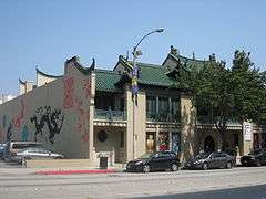
Grace Nicholson Building |
|
000000001977-07-21-0000July 21, 1977
(#77000300) |
46 N. Los Robles Ave.
34°08′47″N 118°08′25″W / 34.146389°N 118.140278°W / 34.146389; -118.140278 (Grace Nicholson Building) |
Home of Pacific Asia Museum
|
| 92 |
John Norton House |
|
000000002009-04-10-0000April 10, 2009
(#09000179) |
820 Burleigh Dr.
34°07′46″N 118°10′24″W / 34.129356°N 118.1733°W / 34.129356; -118.1733 (John Norton House) |
|
| 93 |
Odd Fellows Temple |
|
000000001985-08-01-0000August 1, 1985
(#85001682) |
120 N. El Molino Ave., Pasadena, California
34°08′53″N 118°08′12″W / 34.148056°N 118.136667°W / 34.148056; -118.136667 (Odd Fellows Temple) |
Odd Fellows building, moved after NRHP listing from 175 N. Los Robles Ave.
|
| 94 |
Old Pasadena Historic District |
|
000000001983-09-15-0000September 15, 1983
(#83001200) |
Roughly bounded by Pasadena, Fair Oaks, Raymond Aves., Arroyo Pkwy., Del Mar Blvd., and Corson St.
34°08′45″N 118°09′00″W / 34.145833°N 118.15°W / 34.145833; -118.15 (Old Pasadena Historic District) |
Boundary increase and decrease (listed March 25, 2008): Fair Oaks & Raymond Aves., Colorado Blvd., Green St.
|
| 95 |
Orange Grove Court |
|
000000001983-07-11-0000July 11, 1983
(#83001199) |
745 E. Orange Grove Blvd.
34°09′28″N 118°08′03″W / 34.157778°N 118.134167°W / 34.157778; -118.134167 (Orange Grove Court) |
|
| 96 |
Orange Heights-Barnhart Tracts Historic District |
|
000000001995-09-29-0000September 29, 1995
(#95001128) |
Roughly bounded by N. Los Robles Ave. W, N. El Molino Ave. E., Jackson St. N., and E. Mountain St. S.
34°09′47″N 118°08′18″W / 34.163056°N 118.138333°W / 34.163056; -118.138333 (Orange Heights-Barnhart Tracts Historic District) |
|
| 97 |
Palmetto Court |
|
000000001983-07-11-0000July 11, 1983
(#83001201) |
100 Palmetto Dr.
34°08′14″N 118°09′09″W / 34.13712°N 118.152541°W / 34.13712; -118.152541 (Palmetto Court) |
|
| 98 |
Park Place-Arroyo Terrace Historic District |
|
000000002007-06-29-0000June 29, 2007
(#04000324) |
368-440 Arroyo Terrace, 200-240 N. Grand Ave., 201-239 N. Orange Grove Blvd.
34°08′58″N 118°09′44″W / 34.149481°N 118.162175°W / 34.149481; -118.162175 (Park Place-Arroyo Terrace Historic District) |
|
| 99 |
Pasadena Arroyo Parks and Recreation District |
|
000000002008-11-11-0000November 11, 2008
(#08000579) |
Roughly bounded by the Foothill Freeway on the north, the city limits on the south, Arroyo Blvd on east, San Rafael Ave on the west
34°09′17″N 118°10′02″W / 34.154716°N 118.167257°W / 34.154716; -118.167257 (Pasadena Arroyo Parks and Recreation District) |
|
| 100 |
Pasadena Civic Center District |
|
000000001980-07-28-0000July 28, 1980
(#80000813) |
Roughly bounded by Walnut and Green Sts., Raymond and Euclid Aves.
34°08′48″N 118°08′40″W / 34.146667°N 118.144444°W / 34.146667; -118.144444 (Pasadena Civic Center District) |
|
| 101 |
Pasadena Playhouse |
|
000000001975-11-11-0000November 11, 1975
(#75000435) |
39 S. El Molino Ave.
34°08′42″N 118°08′11″W / 34.145°N 118.136389°W / 34.145; -118.136389 (Pasadena Playhouse) |
|
| 102 |
Pasadena Playhouse Historic District |
|
000000001994-05-19-0000May 19, 1994
(#94000462) |
464-611 E. Colorado Blvd., 550-655 E. Green St., 21-127 S. El Molino Ave., and 150 N.-101 S. Madison Ave..
34°08′43″N 118°08′19″W / 34.145278°N 118.138611°W / 34.145278; -118.138611 (Pasadena Playhouse Historic District) |
|
| 103 |
Pegfair Estates Historic District |
|
000000002010-01-18-0000January 18, 2010
(#09001223) |
1525-1645 Pegfair Estates Dr.; 1335-1345 Carnarvon Dr.
34°10′19″N 118°11′04″W / 34.172009°N 118.184315°W / 34.172009; -118.184315 (Pegfair Estates Historic District) |
|
| 104 |
Robert and Barbara Pike House |
|
000000002009-04-10-0000April 10, 2009
(#09000181) |
512 Glen Ct.
34°09′14″N 118°10′31″W / 34.153758°N 118.175328°W / 34.153758; -118.175328 (Robert and Barbara Pike House) |
|
| 105 |
Poppy Peak Historic District |
|
000000002009-12-23-0000December 23, 2009
(#09000182) |
Bounded by Ave. 64 on the east, La Loma Rd. on the north including Poppy Peak Dr., Kaweah Dr. and Cresthaven Dr.
34°07′53″N 118°10′52″W / 34.1313°N 118.1812°W / 34.1313; -118.1812 (Poppy Peak Historic District) |
|
| 106 |
George B. Post House |
|
000000002011-08-09-0000August 9, 2011
(#11000499) |
360 S. Grand Ave.
34°08′21″N 118°09′41″W / 34.139167°N 118.161389°W / 34.139167; -118.161389 (George B. Post House) |
|
| 107 |
Prospect Historic District |
|
000000001983-04-07-0000April 7, 1983
(#83001202) |
Prospect Blvd., Prospect Square, Prospect Crescent and Prospect Terrace, Rosemont Ave., Armada and Fremont Drs., and La Mesa Pl.
34°09′29″N 118°09′42″W / 34.158039°N 118.1618°W / 34.158039; -118.1618 (Prospect Historic District) |
|
| 108 |
Raymond-Summit Historic District |
|
000000002011-08-09-0000August 9, 2011
(#11000500) |
Roughly bounded by N. Raymond Ave., E. Villa St., Summit Ave. & E. Maple St.
34°09′12″N 118°08′54″W / 34.153333°N 118.148333°W / 34.153333; -118.148333 (Raymond-Summit Historic District) |
|
| 109 |
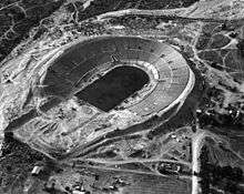
The Rose Bowl |
|
000000001987-02-27-0000February 27, 1987
(#87000755) |
991 Rosemont Ave., Brookside Park
34°09′41″N 118°10′00″W / 34.161389°N 118.166667°W / 34.161389; -118.166667 (The Rose Bowl) |
|
| 110 |
Rose Court |
|
000000001983-07-11-0000July 11, 1983
(#83001203) |
449-457 S. Hudson Ave.
34°08′15″N 118°07′59″W / 34.1375°N 118.133056°W / 34.1375; -118.133056 (Rose Court) |
|
| 111 |
Royal Laundry Complex |
|
000000002007-09-27-0000September 27, 2007
(#07000996) |
443 S. Raymond Ave.
34°08′17″N 118°08′57″W / 34.137934°N 118.149226°W / 34.137934; -118.149226 (Royal Laundry Complex) |
|
| 112 |
Sara-Thel Court |
|
000000001983-07-11-0000July 11, 1983
(#83001192) |
618-630 S. Marengo Ave.
34°08′06″N 118°08′41″W / 34.135°N 118.144722°W / 34.135; -118.144722 (Sara-Thel Court) |
|
| 113 |
Singer Building |
|
000000001985-05-16-0000May 16, 1985
(#85001066) |
16 S. Oakland Ave. and 520 E. Colorado Blvd.
34°08′44″N 118°08′22″W / 34.14565°N 118.139518°W / 34.14565; -118.139518 (Singer Building) |
|
| 114 |
Ernest W. Smith House |
|
000000001988-01-14-0000January 14, 1988
(#87002397) |
272 S. Los Robles Ave.
34°08′28″N 118°08′27″W / 34.141108°N 118.140906°W / 34.141108; -118.140906 (Ernest W. Smith House) |
|
| 115 |
Southern California Sanitarium Historic District |
|
000000002013-04-17-0000April 17, 2013
(#13000160) |
2900 E. Del Mar Blvd.
34°08′30″N 118°05′27″W / 34.141732°N 118.090955°W / 34.141732; -118.090955 (Southern California Sanitarium Historic District) |
|
| 116 |
South Marengo Historic District |
|
000000001982-06-02-0000June 2, 1982
(#82002199) |
S. Marengo Ave.
34°08′12″N 118°08′42″W / 34.136667°N 118.145°W / 34.136667; -118.145 (South Marengo Historic District) |
|
| 117 |
Space Flight Operations Facility |
|
000000001985-10-03-0000October 3, 1985
(#85002814) |
Jet Propulsion Laboratory
34°12′04″N 118°10′25″W / 34.201111°N 118.173611°W / 34.201111; -118.173611 (Space Flight Operations Facility) |
|
| 118 |
Storrier-Stearns Japanese Garden |
|
000000002005-02-15-0000February 15, 2005
(#05000050) |
270 Arlington Dr.
34°07′41″N 118°09′21″W / 34.127979°N 118.155718°W / 34.127979; -118.155718 (Storrier-Stearns Japanese Garden) |
|
| 119 |
Stoutenburgh House |
|
000000001980-11-25-0000November 25, 1980
(#80000814) |
255 S. Marengo Ave.
34°08′28″N 118°08′42″W / 34.141111°N 118.145°W / 34.141111; -118.145 (Stoutenburgh House) |
|
| 120 |
Stuart Company Plant and Office Building |
|
000000001998-10-20-0000October 20, 1998
(#94001326) |
3360 E. Foothill Blvd.
34°08′57″N 118°04′49″W / 34.149167°N 118.080278°W / 34.149167; -118.080278 (Stuart Company Plant and Office Building) |
Currently a condominium
|
| 121 |
Twenty-Five-Foot Space Simulator |
|
000000001985-10-03-0000October 3, 1985
(#85002812) |
Jet Propulsion Laboratory
34°12′10″N 118°10′22″W / 34.202778°N 118.172778°W / 34.202778; -118.172778 (Twenty-Five-Foot Space Simulator) |
|
| 122 |
Villa Verde |
|
000000001984-09-13-0000September 13, 1984
(#84000896) |
800 S. San Rafael
34°07′52″N 118°10′06″W / 34.131149°N 118.168389°W / 34.131149; -118.168389 (Villa Verde) |
|
| 123 |
Vista del Arroyo Hotel and Bungalows |
|
000000001981-04-02-0000April 2, 1981
(#81000157) |
125 S. Grand Ave.
34°08′38″N 118°09′43″W / 34.143866°N 118.161864°W / 34.143866; -118.161864 (Vista del Arroyo Hotel and Bungalows) |
Currently the Richard H. Chambers Courthouse, U.S. Court of Appeals for the 9th Circuit
|
| 124 |
Henry A. Ware House |
|
000000002004-06-15-0000June 15, 2004
(#04000015) |
460 Bellefontaine St.
34°07′53″N 118°09′36″W / 34.131336°N 118.160085°W / 34.131336; -118.160085 (Henry A. Ware House) |
|
| 125 |
Washington Court |
|
000000001994-11-15-0000November 15, 1994
(#94001316) |
475 E. Washington Blvd.
34°10′09″N 118°08′27″W / 34.169179°N 118.140796°W / 34.169179; -118.140796 (Washington Court) |
|


.jpg)

